Mt. Rainier's Last Eruption: What the Geologic Record Actually Shows
Mt. Rainier's last eruption was around 1450 CE, though disputed 19th-century reports suggest later activity. Here's what the evidence shows.

When Did Mt. Rainier Last Erupt?
Mt. Rainier's last eruption depends on how you define the term. The Smithsonian Global Volcanism Program records the most recent confirmed eruption as approximately 1450 CE, a relatively small event involving explosions and lahars. Newspaper accounts from the 1800s describe what observers believed were eruptions in 1820, 1854, 1873, and 1894, but geologists have found no deposits confirming magmatic activity during those years. The last major eruptive sequence ended roughly 1,000 years ago. Check our real-time Mt. Rainier visibility forecast to see the mountain today.
The question "when was Mt. Rainier's last eruption?" sounds like it should have a simple answer. It does not. The geologic record gives one date, 19th-century eyewitnesses give several others, and the scientific community has spent decades sorting out which accounts hold up under scrutiny. That ambiguity is the real story, and understanding it matters more than memorizing a single number.
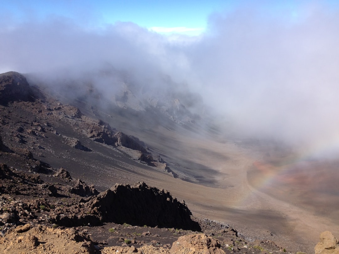
Mt. Rainier stands at 14,411 feet, the tallest volcano in the Cascade Range, carrying more glacial ice than any other peak in the contiguous United States. It is classified as an active volcano by the U.S. Geological Survey, which monitors it continuously as a "very high threat" to surrounding communities.
Table of Contents
- The Confirmed Mt. Rainier Last Eruption: Around 1450 CE
- Did Mt. Rainier Erupt in the 1800s?
- The Summerland Period: Mt. Rainier's Last Major Eruption Sequence
- A Complete Timeline of Holocene Eruptions
- The July 2025 Earthquake Swarm
- How Often Does Mt. Rainier Erupt?
- Frequently Asked Questions
The Confirmed Mt. Rainier Last Eruption: Around 1450 CE
The most recent eruption confirmed by geologic evidence occurred around 1450 CE, give or take about 100 years. The Smithsonian Global Volcanism Program records this event as involving explosions and lahar activity, though it was small by Rainier's historical standards.
This eruption did not produce lava flows or massive ash columns. It was a modest event, significant mainly because it is the last for which scientists have found physical deposits they can date. Thin tephra layers and lahar deposits in the river valleys downstream provide the evidence.
Before this event, a slightly larger eruption occurred around 910 CE (plus or minus 500 years), producing pyroclastic flows, ash, and lahars. This is what most sources refer to when they say Mt. Rainier "last erupted about 1,000 years ago." The two events are close enough in geologic time that popular accounts often merge them.
The distinction matters because it changes what we mean by "last eruption." If you mean the most recent confirmed volcanic activity of any kind, the answer is approximately 1450 CE. If you mean the last eruption that produced recognizable tephra deposits visible across the landscape, the answer shifts to roughly 1,000 years ago. Both are correct. Neither tells the full story.
Did Mt. Rainier Erupt in the 1800s?
Between 1820 and 1894, observers in Seattle and Tacoma reported what appeared to be volcanic eruptions from Mt. Rainier's summit on at least fourteen separate occasions. These reports are some of the most debated entries in Pacific Northwest geological history.
The earliest account comes from around 1820, when Indigenous peoples near the mountain reported fire, loud noises, and an earthquake. Later settlers described seeing dark smoke rising from the summit in 1854, 1858, 1870, 1873, 1879, 1882, and 1894.
The 1873 report is particularly vivid. On October 19 of that year, observers saw clouds of smoke pouring from the summit around 4 p.m., preceded by a slight earthquake earlier that afternoon. Cloud cover rolled in before darkness, preventing further observation the following day.
The 1894 Newspaper Battle
The most famous episode played out in competing Seattle newspapers during the winter of 1894. The Seattle Post-Intelligencer and Seattle Press-Times printed dramatic accounts of "black smoke" rising from Rainier's summit. The Seattle Telegraph, their rival, dismissed the reports entirely.
The Post-Intelligencer went further and funded an expedition to the mountain in late December 1894. On December 24, expedition members reached the northern base and reported seeing small plumes of white steam and a single darker plume rising from the distant summit. But five days later, on December 29, a clear photograph of the volcano taken from Tacoma showed no eruptive activity whatsoever.
What Scientists Conclude
The USGS assessment is direct: evidence of 19th-century eruptions from Mt. Rainier is "scanty and tenuous." No tephra deposits, no lava, no ash layers in the geologic record correspond to any of these reported dates.
Some of the supposed sightings can be explained. Geologists have found that deposits early researchers labeled as 19th-century tephra were actually redeposited material from the much older Layer C eruption (about 2,200 years ago), carried downslope by snow avalanches. Others may have been large steam plumes from the mountain's active hydrothermal system, which vents heat through fumaroles near the summit crater to this day.
The 19th-century accounts probably describe real observations of steam, rockfall dust, or small phreatic (steam-driven) explosions. But none qualify as magmatic eruptions where fresh molten rock reached the surface. The distinction is important. Mt. Rainier vents steam regularly. That is not the same as erupting.
The Summerland Period: Mt. Rainier's Last Major Eruption Sequence
Mt. Rainier's last truly significant eruption sequence occurred during the Summerland eruptive period, roughly 2,600 to 2,200 years ago. This was the mountain's final act of serious volcanic construction.
The largest single eruption of the entire Holocene (the last 11,700 years) happened about 2,200 years ago. Known as the Layer C tephra event, it ejected between 0.1 and 0.2 cubic kilometers of volcanic material. To put that in perspective, this is smaller than the 1980 Mt. St. Helens eruption but still substantial enough to blanket the eastern portion of Mt. Rainier National Park in ash and pumice.
After Layer C, lava flows filled parts of the east summit crater and built Columbia Crest, the highest point on the mountain today. This is a detail competitors rarely mention: the summit you see when you check Mt. Rainier's visibility from Seattle was literally constructed during these eruptions. The mountain's current profile is a product of the Summerland period.
Following the Summerland sequence, eruptions continued but became progressively smaller. The Twin Creek episode about 1,500 years ago involved new magma but no lava flows. The eruptions around 1,000 years ago produced only thin, fine-grained tephra. Each successive event was weaker than the last, until activity tapered into the quiet period we are still in today.
A Complete Timeline of Holocene Eruptions
Mt. Rainier's post-glacial eruption record spans roughly 11,000 years. The USGS Holocene eruption timeline documents at least a dozen significant events, clustered into named periods.
| Period | Approximate Date | Key Events |
|---|---|---|
| Sunrise | ~11,000 years ago | Ash and pumice across eastern park; lahar down Nisqually River |
| Cowlitz Park | 7,400-6,700 years ago | At least 4 moderately explosive eruptions; Reflection Lakes lahar |
| Osceola | ~5,600 years ago | Edifice collapse; 4 km³ Osceola Mudflow reached Puget Sound |
| Summerland | 2,600-2,200 years ago | Largest Holocene tephra (Layer C); lava flows built Columbia Crest |
| Twin Creek | ~1,500 years ago | Small eruptions with new magma; no lava flows |
| Fryingpan Creek | 1,100-1,000 years ago | Thin tephra; lahars down White River to Auburn |
| Last confirmed | ~1450 CE | Small explosions and lahars |
The Osceola Mudflow deserves special attention. Roughly 5,600 years ago, an eruption triggered a massive collapse of the volcano's northeast flank, releasing an estimated 4 cubic kilometers of debris. The resulting lahar traveled all the way to Puget Sound, inundating areas now occupied by the cities of Auburn, Enumclaw, and parts of the Kent Valley. Our Mt. Rainier eruption guide covers the lahar hazard zones and which communities remain at risk today.
The July 2025 Earthquake Swarm
Mt. Rainier produced its largest recorded earthquake swarm beginning on July 8, 2025, a reminder that the volcano's internal systems remain very much alive.
Over 1,350 locatable earthquakes struck beneath the summit over the following weeks, with thousands more too small to pinpoint. The largest event reached magnitude 2.42 on July 11. At the swarm's peak, seismometers recorded over 30 earthquakes per hour. The average depth was about 2.8 miles (4.5 kilometers) beneath the summit.
The Pacific Northwest Seismic Network confirmed this swarm surpassed the previous record holder from 2009 in total events, event rate, and energy release.
The USGS kept the volcano alert level at GREEN/NORMAL throughout. Scientists attributed the swarm to hydrothermal processes, essentially hot fluids moving through fractures in the rock beneath the summit, rather than magma migration. The earthquake depths and waveform characteristics showed no pattern consistent with rising molten rock.
But the swarm illustrates exactly why continuous monitoring matters. Without decades of baseline seismic data, a sudden burst of 1,350 earthquakes beneath an active volcano would be terrifying and uninterpretable. With that baseline, scientists could confidently distinguish between a hydrothermal pressure adjustment and the precursor signals of an actual eruption.
The Mt. Rainier weather patterns that shape daily visibility have nothing to do with volcanic seismicity. But the monitoring infrastructure that tracks earthquakes beneath the summit operates on the same principle as our visibility scoring methodology: continuous measurement produces useful predictions. Without the data, you are guessing.
How Often Does Mt. Rainier Erupt?
Mt. Rainier has produced roughly a dozen significant eruptions over the past 2,600 years, giving an average recurrence interval of roughly 200 to 250 years. But averages are misleading when applied to volcanoes.
Eruptions cluster. The Summerland period packed multiple events into a 400-year window. Then 700 years passed with minimal activity before the Twin Creek episode. Another 500 quiet years followed before the Fryingpan Creek eruptions. The intervals between events vary from decades to centuries with no predictable rhythm.
The USGS states plainly that Mt. Rainier "will continue to erupt, grow, and collapse" based on its 500,000-year behavioral record. They also note that large lahars have reached the Puget Sound lowland roughly once every 500 to 1,000 years over the past several millennia. By that measure, there is approximately a 1-in-10 chance of a major lahar reaching lowland communities during an average human lifespan.
A future eruption would not arrive without warning. The USGS expects days to months of detectable precursor signals, including increased earthquake frequency, measurable ground deformation, and elevated volcanic gas emissions. That warning window is the foundation of the entire monitoring and alert system protecting communities downstream.
The word "overdue" does not apply. Volcanoes do not operate on schedules. What the record shows is a mountain that has been consistently active over geologic time and that has no reason to stop.
Frequently Asked Questions
Is Mt. Rainier going to erupt soon?
No imminent eruption is expected. The USGS maintains the volcano alert level at NORMAL/GREEN. While the July 2025 earthquake swarm was the largest on record, scientists determined it was caused by hydrothermal activity, not rising magma. Any future eruption would likely be preceded by days to months of measurable warning signs.
Is Mt. Rainier more dangerous than Mt. St. Helens?
Many volcanologists consider Mt. Rainier more dangerous in terms of potential casualties, though not necessarily more likely to erupt soon. The 1980 Mt. St. Helens eruption killed 57 people in a sparsely populated area. Mt. Rainier has over 90,000 people living in its lahar hazard zones, with arrival times as short as 30 minutes for communities like Orting.
What would happen if Mt. Rainier erupted today?
The primary threat would be lahars, volcanic mudflows generated when eruption heat rapidly melts the mountain's glacial ice. These flows would travel down river valleys toward Orting, Puyallup, Sumner, and Auburn. Seattle itself is not in a lahar path, but prevailing westerly winds would carry volcanic ash eastward across the state. Sea-Tac Airport would likely close for days. The National Park Service Mt. Rainier page details the hazard zones and evacuation routes.
How does Mt. Rainier compare to Mt. Fuji's eruption history?
Both are active stratovolcanoes with long dormant periods. Mt. Fuji last erupted in 1707, making its quiet stretch about 318 years compared to Mt. Rainier's roughly 575 years since the 1450 CE event. Both are monitored continuously, both sit near major population centers, and both are classified as high-threat volcanoes by their respective geological agencies. You can check current conditions for Mt. Fuji on our visibility page.
The geologic record is clear on two points. Mt. Rainier has erupted repeatedly over the past half-million years, and nothing about its current state suggests that pattern has ended. The quiet since 1450 CE is not unusual by the mountain's own standards. Several comparable gaps appear in the Holocene timeline.
What has changed is the audience. When Mt. Rainier last erupted, the Puget Sound lowlands were home to small Indigenous communities with deep generational knowledge of the mountain's behavior. Today, millions of people live within sight of the volcano. The view from Seattle is the same one those earlier inhabitants knew. The stakes are different.
Check whether the mountain is visible right now on our Mt. Rainier visibility page, updated every 15 minutes with real-time atmospheric data.
More Articles
Mt. Rainier Eruption: History, Hazards, and What Scientists Watch For
Mt. Rainier eruption history spans 500,000 years. Learn about the last eruption, lahar hazards, at-risk cities, and what scientists monitor today.
Mt. Rainier Weather: Complete Guide to Conditions and Visibility
Plan your visit with our complete Mt. Rainier weather guide covering monthly conditions, precipitation, snowfall records, and how weather affects mountain visibility.
Mt. Rainier Height: How Tall Is Washington's Highest Peak?
Mt. Rainier height is 14,411 feet (4,392 m), making it the tallest mountain in Washington and the most topographically prominent peak in the contiguous US.