Mt. Rainier Height: How Tall Is Washington's Highest Peak?
Mt. Rainier height is 14,411 feet (4,392 m), making it the tallest mountain in Washington and the most topographically prominent peak in the contiguous US.
How Tall Is Mt. Rainier?
Mt. Rainier height is 14,411 feet (4,392 meters) above sea level, making it the tallest mountain in Washington State and the highest peak in the Cascade Range. Its topographic prominence of 13,210 feet is the largest of any mountain in the contiguous United States, meaning it rises almost entirely from its own base. That is why it dominates the horizon from Seattle, roughly 60 miles away. Check our real-time Mt. Rainier visibility forecast to see if the summit is visible right now.
Table of Contents
- How Tall Is Mt. Rainier? The Official Measurement
- Mt. Rainier Height vs. Other Mountains
- The Summit Is Changing: What Recent Surveys Found
- Elevation Zones: What the Height Means on the Ground
- How Mt. Rainier's Height Makes It Visible from Seattle
- Climbing Mt. Rainier: The Height Challenge
- Frequently Asked Questions
How Tall Is Mt. Rainier? The Official Measurement
Mt. Rainier height is 14,411 feet (4,392 meters) above sea level. This figure comes from a 1956 survey conducted jointly by the National Park Service and the United States Geological Survey, referenced to the National Geodetic Vertical Datum of 1929. It remains the official elevation on federal maps and is the number found on trail signs, guidebooks, and park literature.
The mountain is an active stratovolcano built from alternating layers of hardened lava, ash, and volcanic debris deposited over hundreds of thousands of years. The USGS Cascades Volcano Observatory ranks Rainier among the most hazardous volcanoes in the United States, largely because its combination of extreme height and massive glacial ice creates serious lahar risk for the valleys and communities below.
At its summit sits a pair of craters connected by a crater rim. Columbia Crest, the ice-capped high point, traditionally marked the top of the mountain. Recent surveys in 2024 and 2025 complicated that picture, as covered in the section below. What has not changed is the official federal elevation: 14,411 feet.
Mt. Rainier Height vs. Other Mountains
Mt. Rainier is the tallest mountain in Washington State by a wide margin. The gap between Rainier and the second-highest Washington peak, Mt. Adams, is nearly 2,200 feet. That difference is large enough to swallow the entire relief of Seattle's Beacon Hill several times over.
Washington's Five Tallest Peaks
| Mountain | Elevation | Range |
|---|---|---|
| Mt. Rainier | 14,411 ft (4,392 m) | Cascade Range |
| Mt. Adams | 12,281 ft (3,743 m) | Cascade Range |
| Mt. Baker | 10,781 ft (3,286 m) | Cascade Range |
| Glacier Peak | 10,525 ft (3,207 m) | Cascade Range |
| Mt. Olympus | 7,965 ft (2,428 m) | Olympic Range |
Within the entire Cascade Range, Rainier is the tallest peak, surpassing Mt. Shasta in northern California (14,179 ft) and Mt. Hood in Oregon (11,250 ft). It is the tallest volcanic peak in the Cascade Volcanic Arc, which stretches from British Columbia to northern California.
The Prominence Distinction
Height and topographic prominence are different measurements, and for Rainier, the distinction matters enormously. Height is distance above sea level. Prominence measures how much a summit rises above the highest terrain connecting it to any taller peak.
Rainier's topographic prominence is 13,210 feet (4,026 meters), the highest figure of any summit in the contiguous United States. That number exceeds even K2's prominence (13,189 feet), the second-tallest mountain on Earth. In practical terms, it means Mt. Rainier rises almost entirely from relatively flat lowland terrain, with no significant mountain ridge connecting it to any higher point. The surrounding Puget Sound lowlands sit at roughly 1,000 to 1,200 feet in most directions, which is why Rainier looks enormous and solitary from Seattle rather than embedded in a larger range.
How Rainier Compares to Mountains on This Site
| Mountain | Elevation | Location |
|---|---|---|
| Mt. Rainier | 14,411 ft (4,392 m) | Washington, US |
| Mt. Fuji | 12,389 ft (3,776 m) | Japan |
| Denali | 20,310 ft (6,190 m) | Alaska, US |
Rainier is taller than Mt. Fuji by about 2,022 feet. Our Mt. Fuji height guide covers Japan's iconic peak in detail, including similar comparisons to neighboring summits. Denali in Alaska stands in a different category at 20,310 feet, nearly 6,000 feet above Rainier and the tallest mountain in North America. Each peak's altitude directly shapes how weather and atmospheric conditions affect its visibility, which is why dedicated forecasting tools exist for each.
The Summit Is Changing: What Recent Surveys Found
The official elevation of 14,411 feet has not been updated since 1956, but surveys in 2024 and 2025 revealed that the mountain's actual highest point has shifted due to glacial melting.
The 2024 Survey
In August and September 2024, mountaineer and mechanical engineer Eric Gilbertson climbed Rainier with precision GPS equipment and measured both Columbia Crest and the southwest crater rim. His findings, reported by The Seattle Times and published on arXiv, showed that Columbia Crest had melted down approximately 21.8 feet since its last professional measurement in 1998. The ice cap that once made it the undisputed high point has receded to the point where a rocky spot on the southwest crater rim now sits higher.
The measured elevation of the new high point came in at approximately 14,399.6 feet, roughly 11 feet below the official figure. Officials at Mt. Rainier National Park acknowledged receiving the measurements and indicated the findings are under review.
The 2025 Follow-Up
A second survey in summer 2025 confirmed the trend is continuing. Columbia Crest lost an additional 1.2 feet of elevation between 2024 and 2025. Liberty Cap, a prominent satellite summit on Rainier's north side, lost 2.2 feet in the same period and has melted 26.3 feet since 2007. If melting continues at recent rates, Liberty Cap is projected to lose its ice cap by 2041 and melt entirely to bedrock by 2047.
This is not unique to Rainier. Washington's glaciers have lost roughly 40 percent of their volume since 1984, a pattern that mirrors observations on ice-capped peaks worldwide.
What This Means for Visitors
For most visitors and climbers, the difference between 14,411 and 14,399 feet is irrelevant. The routes, the challenge, and the experience are unchanged. The shift in which geographic feature qualifies as the "summit" matters geologically and symbolically, but standing on the crater rim of Mt. Rainier at roughly 14,400 feet remains one of the Pacific Northwest's most demanding and rewarding mountaineering goals. The Mt. Rainier weather conditions that determine whether any summit attempt succeeds are driven by the mountain's total mass and position, not by a dozen feet of glacial ice.
Elevation Zones: What the Height Means on the Ground
Mt. Rainier's 14,411-foot height creates a stack of distinct climate zones from the park boundary to the crater rim, each with its own weather, vegetation, and visitor experience.
Lowland Entrances (1,600-3,000 feet)
The park's lowest point is around 1,600 feet at the Carbon River entrance on the west side. These lowland zones have the mildest temperatures, reaching the low 80s degrees Fahrenheit in summer, and experience more rain than snow in winter. Most visitors entering from the main Nisqually entrance pass through this zone first.
Mid-Elevation: Longmire (2,762 feet)
Longmire, the park's primary visitor hub on the southwest side, sits at 2,762 feet. Winter here brings a mix of rain and snow with temperatures near freezing. Summer highs reach the low 70s degrees Fahrenheit. The weather data in our Mt. Rainier weather guide uses Longmire as the baseline station, since it holds the park's longest continuous climate record.
Subalpine Zone: Paradise and Sunrise (5,400-6,400 feet)
Paradise, at 5,400 feet, is one of the most visited points in any national park in the United States. This is where Rainier's record-breaking snowfall accumulates, averaging around 500 inches per year. Sunrise, on the northeast side at 6,400 feet, is the highest point accessible by paved road in the park. Both locations sit above the tree line and provide wide-open views of the upper mountain.
| Location | Elevation | Road Season |
|---|---|---|
| Carbon River | 1,600 ft (488 m) | Year-round |
| Longmire | 2,762 ft (842 m) | Year-round |
| Paradise | 5,400 ft (1,646 m) | Year-round (chains) |
| Sunrise | 6,400 ft (1,951 m) | Late June-October |
High Camp and Summit (10,000-14,411 feet)
Camp Muir, the main staging camp for summit climbers on the south side, sits at 10,080 feet. Above that, the mountain enters an alpine-arctic zone where temperatures stay below freezing much of the year and wind can reach hurricane force. The Mt. Rainier map covers the full geography of these zones and shows the access routes between them.
How Mt. Rainier's Height Makes It Visible from Seattle
The reason "is the mountain out?" became a Seattle expression comes down directly to Mt. Rainier's height and prominence.
From most Seattle viewpoints, the mountain sits roughly 60 miles to the southeast. At that distance, an object must clear the visual horizon by a substantial margin to remain visible, and at 14,411 feet, with a topographic prominence of 13,210 feet, Rainier does exactly that. The summit clears the geometric horizon at distances exceeding 200 miles under ideal atmospheric conditions.
But height alone does not guarantee visibility. Two competing effects operate simultaneously.
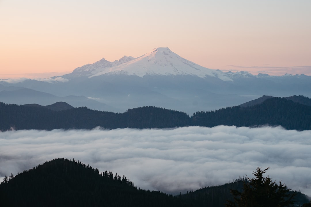
When height works in your favor: Pacific marine clouds frequently settle over the Puget Sound lowlands at 1,500 to 3,000 feet in autumn and winter, creating gray overcast skies at street level. Rainier's summit often sits entirely above this cloud layer. From elevated viewpoints in Seattle, such as Kerry Park or the Columbia Center observation deck, you can sometimes see the upper snowfields glowing above a solid deck of clouds. This is among the most dramatic sights the Pacific Northwest offers and one reason local photographers plan their outings specifically for post-storm clearing windows.
When height works against you: Rainier's mass also creates its own weather. Moist Pacific air rising against the mountain's slopes cools and condenses, forming lenticular clouds that cap the summit even when the surrounding sky is clear. A perfect blue day in Seattle does not guarantee the mountain will be visible — the summit may be wrapped in its own cloud system entirely independent of lowland conditions. Wildfire smoke in late summer adds another variable, with Rainier disappearing behind haze on days when Seattle seems perfectly clear.
The result is that Rainier is visible from Seattle on roughly 83 days per year, about 23 percent of the time. Understanding this variability is exactly why the mountain out became a phrase locals use to mark special days. For planning the best odds of a clear sighting, the best time to see Mt. Rainier is July through September, when dry Pacific air produces the most reliably clear conditions. Our Mt. Rainier webcam guide explains how to cross-reference live camera feeds with forecasts to confirm actual summit visibility before committing to a drive.
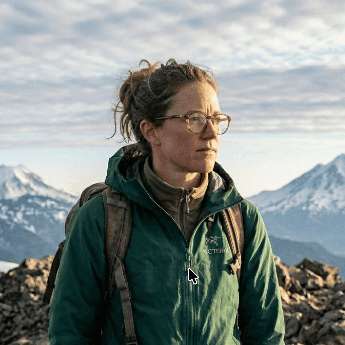
Climbing Mt. Rainier: The Height Challenge
Reaching Rainier's 14,411-foot summit is a serious mountaineering objective, not a hike. The most popular route, the Disappointment Cleaver route from Camp Muir, involves roughly 9,000 feet of total elevation gain from the Paradise trailhead and typically takes two days.
Vertical Gain by Starting Point
| Starting Point | Elevation | Gain to Summit |
|---|---|---|
| Paradise | 5,400 ft (1,646 m) | ~9,011 ft |
| Camp Muir | 10,080 ft (3,073 m) | ~4,331 ft |
| White River | 4,400 ft (1,341 m) | ~10,011 ft |
The total elevation gain from Paradise to the summit is roughly equivalent to climbing from sea level to the top of Mt. Fuji and then continuing another 1,600 feet higher. Most guided climbs follow a two-day structure: the first day ascends to Camp Muir, and the second begins around midnight to reach the summit by late morning before afternoon convective clouds build against the upper slopes.
Altitude-related symptoms become common above 10,000 feet for climbers ascending quickly. At the summit crater rim near 14,400 feet, the thin air delivers roughly 40 percent less oxygen than at sea level. The rapid elevation gain over a single overnight push is why many climbers experience headaches, nausea, and fatigue before reaching the top.
Weather at summit elevation operates on its own schedule, entirely separate from conditions at Paradise. A sunny morning at the trailhead offers no guarantee of clear skies by the time a climber reaches Camp Muir eight to ten hours later. Checking Mt. Rainier weather in the days before a summit attempt, and specifically tracking forecasts at elevation rather than just at valley level, is essential preparation. The National Park Service requires all summit climbers to register and recommends prior experience with glacier travel, crevasse rescue, and self-arrest as prerequisites.
Frequently Asked Questions
How tall is Mt. Rainier in feet and meters?
Mt. Rainier stands 14,411 feet (4,392 meters) above sea level, based on the official 1956 NPS/USGS survey. This remains the figure on federal maps and in official park literature. Recent GPS surveys suggest the actual highest point may now be approximately 11 to 12 feet lower due to glacial melting, but no official re-measurement has been adopted.
Is Mt. Rainier the tallest mountain in the United States?
No. Mt. Rainier is the tallest mountain in Washington State and the Cascade Range, but Denali in Alaska reaches 20,310 feet, making it the tallest in the United States and in North America. In the contiguous 48 states, Mt. Whitney in California (14,505 feet) and multiple Colorado peaks also exceed Rainier's height.
Why is Mt. Rainier so visible from Seattle?
Mt. Rainier's topographic prominence of 13,210 feet is the highest of any mountain in the contiguous United States. It rises from relatively flat lowland terrain with no intervening mountain range to obscure the view. From Seattle, about 60 miles away, Rainier's summit at 14,411 feet sits well above both the visual horizon and the marine cloud layer that frequently covers the Puget Sound lowlands, making it visible above the clouds on many overcast days.
Is Mt. Rainier taller than Mt. Fuji?
Yes. Mt. Rainier at 14,411 feet (4,392 m) is taller than Mt. Fuji by approximately 2,022 feet (616 meters). Fuji stands 12,389 feet (3,776 m) as Japan's highest peak. Both mountains are active stratovolcanoes, both are visible from major cities on clear days, and both are tall enough to create their own cloud systems. You can check live conditions for both on this site.
Is Mt. Rainier's official height going to change?
Possibly, but no timeline has been announced. The 2024 survey found the actual highest point is now a rocky feature on the southwest crater rim at approximately 14,399.6 feet, after the traditional ice-capped summit, Columbia Crest, melted down roughly 22 feet since 1998. The 2025 follow-up confirmed continued melting. Mt. Rainier National Park has received the survey data, and whether to conduct an official re-survey or formally update the elevation remains an open question.
Mt. Rainier's 14,411-foot height is the reason it appears on the Seattle horizon on clear days, and the same reason it creates its own weather and disappears without warning when atmospheric conditions shift. Before heading to a viewpoint or planning any time on the mountain, check the Mt. Rainier visibility forecast to see current conditions. The height is fixed, but choosing the right day makes all the difference.
More Articles
Lake Yamanaka Hotel Guide: Where to Stay for the Best Mt. Fuji Views
Find the best lake Yamanaka hotel for Mt. Fuji views, from luxury resorts and ryokans to glamping and budget pensions.
Kawaguchiko Onsen: Hot Springs with Mt. Fuji Views You Can Time
Kawaguchiko onsen guide with day-use baths, ryokan picks, prices, and the visibility timing most visitors miss.
Aokigahara: Complete Guide to Mt. Fuji's Sea of Trees
Explore Aokigahara, the ancient forest born from Mt. Fuji's lava. Trails, caves, Fuji views, and practical tips.