Mt. Rainier Visibility Today Live: How to Check Right Now
Check Mt. Rainier visibility today with live tools, webcams, and real-time forecasts. Every resource you need in one place.
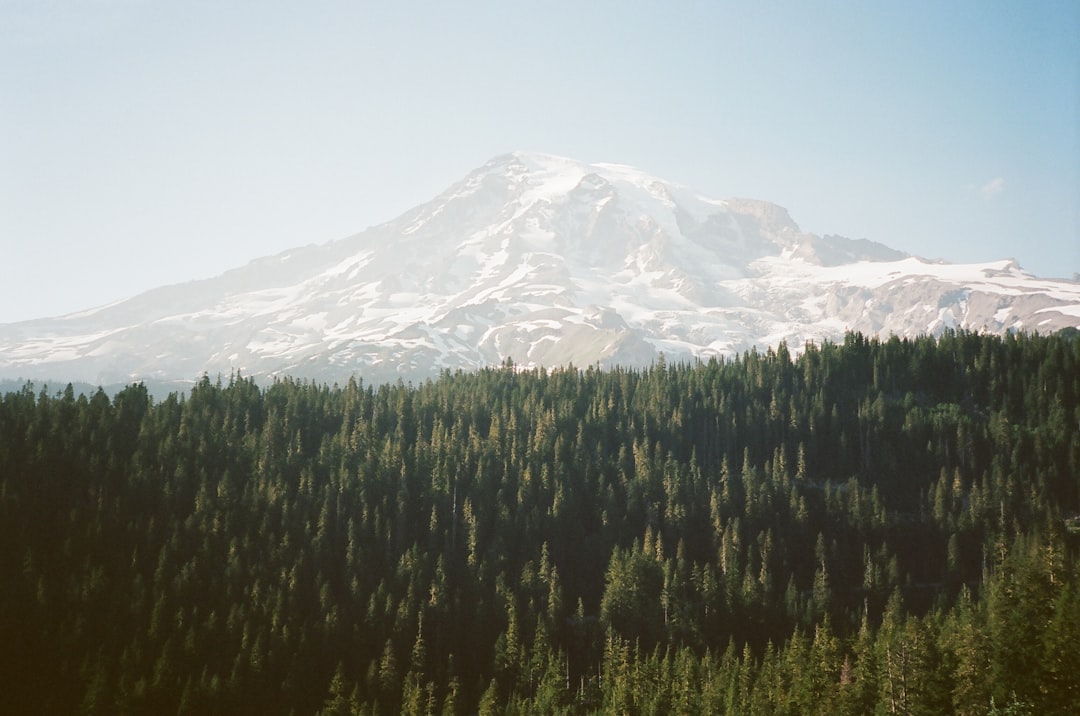
You want to know if Mt. Rainier is visible right now. Maybe you are planning a drive to the park, picking a spot for photos, or just wondering whether today is the day the mountain finally shows itself. Mt. Rainier visibility today, live, is something you can check in under 60 seconds if you know where to look.
The problem is that no single source gives you the full picture. Webcams show one angle. Weather forecasts predict temperature and rain, not whether a 14,411-foot volcano will be hiding behind clouds. Crowd reports depend on someone nearby actually filing one.
This guide pulls every useful live resource together and explains how to read each one so you can answer the question fast: is the mountain out?
Table of Contents
- The Fastest Way to Check
- Live Webcams: See the Mountain Right Now
- Reading Visibility Like a Local
- Beyond Webcams: Other Live Checking Tools
- A Practical Visibility-Checking Routine
- Why Forecasts Beat Webcams (and Vice Versa)
- Frequently Asked Questions
Mt. Rainier Visibility Today Live: The Fastest Way to Check
The fastest way to check Mt. Rainier visibility today live is our real-time visibility score, which updates every 15 minutes and rates conditions from 0 to 100. A score above 70 means excellent chances of seeing the full mountain. Below 40, it is probably hidden.
The score combines cloud cover, humidity, wind direction, precipitation, and atmospheric clarity using a weighted atmospheric model. Standard weather forecasts do not calculate this. They tell you if it will rain, not whether the mountain will be visible on a dry, hazy afternoon when the dew point creeps above 55 degrees.
Here is how to use the score in practice:
| Score | What It Means | What to Do |
|---|---|---|
| 80-100 | Exceptional clarity | Drop everything. Go see it. |
| 60-79 | Good visibility | Summit likely visible, some haze possible |
| 40-59 | Partial views | Lower slopes may show, summit obscured |
| 20-39 | Poor conditions | Unlikely to see the mountain |
| 0-19 | Socked in | Not visible from any direction |
Bookmark the Mt. Rainier visibility page and check it the morning of any outing. That single habit will save you more disappointment than any amount of seasonal planning.
Live Webcams: See the Mountain Right Now
Webcams provide visual confirmation that no forecast can match. If the visibility score says 75 but you want proof before driving 90 minutes, pull up a live feed.
National Park Service Webcams
The NPS operates six active cameras at Paradise, the most useful being the "Mountain View" cam that points directly at the summit. It answers the core question with a single glance. Additional cameras cover the Jackson Visitor Center (east and west views), the Tatoosh Range, and an air quality monitor that updates every 15 minutes with ozone and visibility readings.
The Longmire camera shows conditions at lower elevation (2,762 feet). If Longmire is fogged in but the Paradise mountain cam shows blue sky, a temperature inversion is likely trapping clouds in the valley while higher elevations sit clear.
Seasonal cameras at Camp Muir (10,080 feet) and Sunrise (6,400 feet) go offline for winter and typically return by summer. When operational, the Camp Muir cam updates every 5 minutes and gives a rare above-treeline perspective.
Other Live Camera Resources
Several other sources provide live or near-live views:
ismtrainierout.com captures timelapse imagery from a fixed Seattle viewpoint, loading a new photo roughly every 10 minutes from 4 AM to 5 PM. It is the best tool for seeing how visibility has changed throughout the current day. If the mountain was out at 7 AM but clouds rolled in by noon, the timelapse slider shows exactly when.
mora-webcams.com aggregates views from Carbon River, Longmire, Paradise, Sunrise, and surrounding areas into a single dashboard. Useful for comparing conditions at different sides of the mountain simultaneously.
Crystal Mountain Resort operates webcams at the ski area on Rainier's northeast side. These sit above 6,000 feet and often show the mountain clearly even when lowland webcams are fogged in.
For a complete breakdown of every available feed, our Mt. Rainier webcam guide covers each camera's location, angle, and best use case.
Reading Visibility Like a Local
Knowing where to look is half the problem. Knowing what you are looking at is the other half. Locals who have spent years watching the mountain read conditions instinctively. Here is how to develop that skill faster.
The Haze Test
On warm summer days, the sky overhead can look perfectly blue while the mountain is invisible. This is haze, not clouds. Moisture in the lower atmosphere scatters light and washes out anything more than 30 miles away. If you check a webcam and Rainier looks like a faint ghost rather than a crisp white peak, haze is the culprit.
The fix: check earlier. Haze builds through the morning as the sun heats the ground. Pre-dawn and early morning (before 10 AM) consistently deliver the sharpest views. Our Mt. Rainier visibility guide shows how morning scores from the atmospheric model regularly beat afternoon readings by 12 or more points.
Lenticular Clouds vs. Full Cloud Cover
A lenticular cloud is the flying-saucer shape that hovers over the summit. It means the peak is obscured, but the lower mountain and flanks may still be visible. Full cloud cover, by contrast, blankets everything. On a webcam, lenticular clouds look dramatic and photogenic. If you are a photographer, lenticular days can actually be ideal for shots of the mountain's lower half with a dramatic cap.
Post-Storm Windows
The 24 to 48 hours after a rain system clears produce some of the best visibility of the year. Storms scrub particulates from the air, and cold, dry air trailing behind the front creates razor-sharp clarity. If you see rain in the forecast for today, set an alarm for tomorrow morning. Then check the live visibility score at first light.
Our Mt. Rainier weather guide explains the full mechanics of how storm patterns create these clearing windows.
Beyond Webcams: Other Live Checking Tools
Crowd-Sourced Reports
isthemountainout.com lets people across Western Washington report whether they can see Rainier from their location. Reports appear on an interactive map, so you can check visibility from specific neighborhoods or towns. It is in beta, and coverage depends on people actually filing reports, but on busy days it paints a useful geographic picture. You might see reports confirming the mountain is visible from Tacoma but not from Olympia, which helps narrow down where the cloud line sits.
The UW Recreational Forecast
The University of Washington Atmospheric Sciences department publishes a Mt. Rainier recreational forecast combining regional weather models with mountain-specific knowledge. It does not update as frequently as our visibility score, but it adds context about wind speed at elevation, freezing levels, and precipitation timing that matters if you are heading into the park, not just viewing from afar. Our recreational forecast guide explains how to read it.
Air Quality and Smoke Checks
During August and September, wildfire smoke can erase visibility even under cloudless skies. The NPS air quality webcam at Paradise includes ozone and visibility readings. The Washington Smoke Blog tracks smoke plumes across the state. If AQI tops 100, expect the mountain to fade significantly. Above 150, it will likely vanish entirely even from close-range viewpoints.
A Practical Visibility-Checking Routine
Here is the approach that works best, distilled from years of chasing clear views of the mountain.
The night before: Check the 10-day forecast on the Mt. Rainier visibility page. Look for days with scores above 60. If tomorrow looks promising, set your alarm early.
Morning of (6-7 AM): Check the live visibility score. If it is above 70, pull up the NPS Paradise mountain cam and the ismtrainierout.com timelapse to visually confirm. If both align, you have your window.
Before you leave: Check road conditions on the NPS road status page. A clear-sky day means nothing if the road to Paradise is closed for construction or ice.
En route: Conditions can shift. If you are driving from Seattle (about 2 hours to the Nisqually entrance), check the webcam one more time at your last stop with cell service. Paradise has limited connectivity.
This sequence takes about 3 minutes total and dramatically improves your odds of actually seeing the mountain when you arrive.
Why Forecasts Beat Webcams (and Vice Versa)
Forecasts and webcams answer different questions. The visibility forecast tells you what conditions will likely be in 6, 12, or 24 hours. A webcam tells you what conditions are right now, at one specific location.
Neither alone is sufficient.
A webcam showing clear skies at 8 AM does not mean the mountain will still be visible at noon. Afternoon clouds build reliably in spring and summer. The forecast accounts for this. Conversely, a forecast predicting "partly cloudy" does not tell you whether clouds will sit at 3,000 feet (obscuring everything) or 18,000 feet (irrelevant to visibility). The webcam shows you exactly where the cloud deck sits.
The combination is what gives you confidence. Use the visibility score to plan. Use webcams to confirm. Then go.
Frequently Asked Questions
Is Mt. Rainier visible today?
Check our live Mt. Rainier visibility page for a real-time score updated every 15 minutes. A score above 70 means excellent visibility. You can also pull up the NPS webcam at Paradise for a direct visual confirmation.
What is the best time of day to see Mt. Rainier?
Early morning before 10 AM. Visibility scores from our weighted atmospheric model consistently peak in early morning hours before haze and convective clouds build through the afternoon. If you can check at sunrise, even better.
Can you see Mt. Rainier from Seattle right now?
The mountain sits about 60 miles southeast of downtown Seattle and is visible on clear days from spots like Kerry Park, the Columbia Center, and along the I-5 corridor. Check the visibility score first to confirm today is a good day.
More Articles
Wonder Lake Denali: Iconic Reflection Views and 2026 Access Guide
Wonder Lake Denali has the park's most iconic mountain reflection, but the road is closed past Mile 43. What to know before visiting in 2026-2027.
Mt Rainier Sunset: Best Spots, Alpenglow, and Timing Guide
Where and when to catch a Mt Rainier sunset, from in-park alpenglow at Reflection Lakes to the mountain silhouette from Seattle.
The Kp Index, Explained: Why the Aurora Number Is Not a Promise
The kp index is a 0 to 9 scale of geomagnetic activity. Here is what the aurora number really means, and why a high value is no promise.