Aokigahara: Complete Guide to Mt. Fuji's Sea of Trees
Explore Aokigahara, the ancient forest born from Mt. Fuji's lava. Trails, caves, Fuji views, and practical tips.

What is Aokigahara?
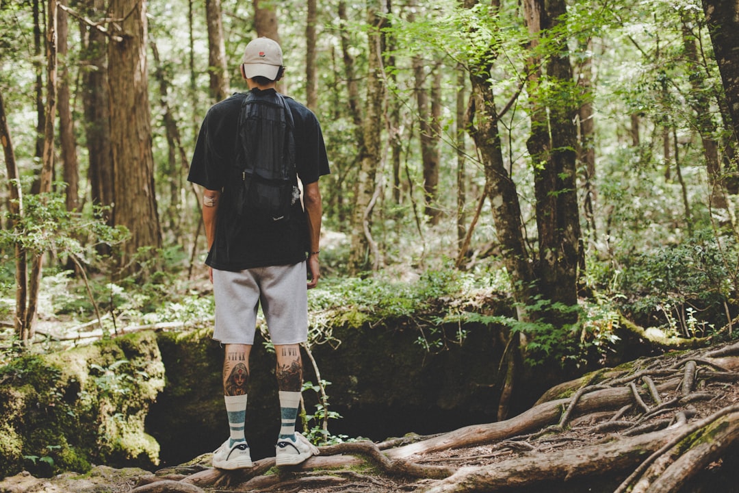
Aokigahara is a 30-square-kilometer ancient forest at the base of Mt. Fuji, grown on hardened lava from the Jogan eruption of 864 CE. Known as Jukai ("Sea of Trees"), it contains lava caves, unique root systems on volcanic rock, and the Koyo-dai viewpoint with panoramic Fuji views. The forest is located in the Fuji Five Lakes area, about 2 hours from Tokyo. Check our live Mt. Fuji visibility tracker before visiting to ensure clear views.
Aokigahara is a 30-square-kilometer forest at the northwestern base of Mt. Fuji, grown entirely on hardened lava from one of the volcano's most violent eruptions. Known in Japanese as Jukai, or "Sea of Trees," this ancient woodland is one of the most geologically and ecologically unusual places in Japan. It is also one of the best starting points for experiencing Mt. Fuji up close, with lava caves, elevated viewpoints, and hiking trails that put you right at the mountain's feet.
Whether you are planning a day trip from Tokyo or spending time around the Fuji Five Lakes, Aokigahara deserves a full day. This guide covers the forest's volcanic origins, its best trails and caves, how to reach it, and why the Koyo-dai viewpoint inside the forest offers one of the most underrated Mt. Fuji views in the region.
Table of Contents
- How Aokigahara Formed
- What Makes the Forest Unique
- Hiking Trails in Aokigahara
- The Lava Caves
- Koyo-dai: The Best Mt. Fuji View from Aokigahara
- Sample Itineraries
- What to Bring
- How to Get to Aokigahara
- Best Time to Visit
- Frequently Asked Questions
How Aokigahara Formed
Aokigahara exists because of a single catastrophic event: the Jogan eruption of 864 CE. This was one of Mt. Fuji's largest recorded eruptions, and it sent massive lava flows pouring down the mountain's northwestern flank. The Yamanashi Prefecture tourism board describes the forest as growing upon lava from this 9th-century eruption. The lava buried forests, villages, and a large portion of an ancient lake called Senoumi.
The scale of destruction reshaped the entire landscape. Lava dammed waterways and divided Senoumi into smaller bodies of water, creating what we now know as three of the Fuji Five Lakes: Saiko, Shojiko, and Motosuko. The flow eventually hardened into a vast basaltic plateau, roughly 30 square kilometers of bare rock with almost zero soil.
For centuries after the eruption, this plateau was barren. Then, slowly, ecological succession began. Lichens colonized the rock surface first, breaking it down into thin layers of organic material. Mosses followed. Over roughly 1,100 years, pioneer species gave way to the dense mixed forest that stands today, with roots spreading horizontally across the lava rather than digging into soil that barely exists.
This geological history is what makes Aokigahara fundamentally different from every other forest in Japan. It did not grow on soil. It grew on a volcano.
What Makes the Forest Unique
Aokigahara's ecosystem is unlike any typical Japanese woodland. The forest sits between 900 and 1,300 meters elevation, and roughly 80% of its canopy consists of two species: hinoki cypress (Chamaecyparis obtusa) and southern Japanese hemlock (Tsuga sieboldii). Mixed in are Japanese red pine, cedar, maple, Fuji cherry, and broadleaf species like longstalk holly and Japanese andromeda.
The root systems are the first thing you notice. Because the lava substrate is only centimeters deep in places, tree roots cannot penetrate downward. Instead, they sprawl across the surface in tangled, exposed networks, wrapping over boulders and lava ridges. Thick moss carpets everything, giving the forest floor an almost luminous green color, especially after rain.
The porous lava bedrock also absorbs sound. Walk 100 meters into the forest and the outside world goes quiet. Wind barely penetrates the dense canopy. This acoustic dampening, combined with the low light levels beneath the trees, creates the atmosphere that earned Aokigahara its reputation in Japanese folklore as a dwelling place for yurei (restless spirits).
The Compass Myth
You may have read that compasses go haywire in Aokigahara due to magnetic iron in the lava. This is partially true, but widely exaggerated. If you place a compass directly on the basaltic rock, the needle can deflect due to naturally occurring magnetite in the lava flow. At normal handheld height, however, compasses function perfectly well. GPS devices also work throughout the forest. The real navigation challenge is not magnetic interference; it is the density of the forest itself, where every direction looks identical once you leave a marked trail.
Wildlife
Because Aokigahara remains largely undisturbed, it supports species that are rare elsewhere in populated Japan. The Japan National Tourism Organization notes sightings of Japanese mink, wild boar, and the small Japanese mole. Asian black bears inhabit the forest, so bear bells are a sensible precaution. Birdwatchers may spot oriental turtledoves and various cuckoo species in the canopy.
Hiking Trails in Aokigahara
Aokigahara has several marked trails ranging from easy nature walks to half-day hikes. All trailheads are well-signed, and the main paths are maintained by Yamanashi Prefecture. Staying on marked trails is essential; the forest floor is uneven lava covered in moss, and off-trail travel is both dangerous and ecologically damaging.
Aokigahara Jukai Nature Trail (Easy)
This is the most accessible trail, starting from the Saiko Nature Center on the southwestern shore of Lake Saiko. The loop covers about 2 kilometers through old-growth sections of the forest and takes roughly 45 minutes to an hour. Interpretive signs explain the volcanic geology and forest ecology along the way. It is flat, well-maintained, and suitable for families.
Fugaku Wind Cave to Narusawa Ice Cave Trail (Moderate)
This popular connecting trail links the two most famous lava caves. The walk between them takes about 20 minutes through dense forest. Combined with cave visits, allow 2 to 2.5 hours for the full experience. The trail is mostly level but has some uneven lava surfaces.
Aokigahara Caves Loop (Moderate)
A 9.3-kilometer loop trail rated moderate on AllTrails, this route covers about 5.8 miles with 718 feet of elevation gain. It takes 2 to 2.5 hours and passes through the densest sections of the forest. The trail connects the ice cave and wind cave areas with longer stretches of uninterrupted woodland.
Koyo-dai to Mt. Ashiwada (Challenging)
The most rewarding hike in the area follows the Tokai Nature Trail from the Koyo-dai parking area up to the Mt. Ashiwada ridge. This trail climbs through the upper edge of Aokigahara and breaks above the treeline to offer panoramic views of Mt. Fuji, the Fuji Five Lakes, and the Southern Alps. The full loop is roughly 13 kilometers and takes 5 to 6 hours, making it a full-day commitment.
| Trail | Distance | Difficulty | Time | Highlights |
|---|---|---|---|---|
| Jukai Nature Trail | 2 km | Easy | 45 min | Old-growth forest, interpretive signs |
| Wind Cave to Ice Cave | 1.5 km | Easy-Moderate | 20 min (trail only) | Both caves, dense forest |
| Caves Loop | 9.3 km | Moderate | 2-2.5 hrs | Deep forest immersion |
| Koyo-dai to Ashiwada | 13 km | Challenging | 5-6 hrs | Mt. Fuji panorama, alpine views |
The Lava Caves
Three lava caves sit within or adjacent to Aokigahara, all formed by the same 864 CE eruption that created the forest. These are not limestone caves carved by water over millions of years. They are hollow tubes left behind when the outer surface of a lava flow cooled and hardened while molten rock continued flowing underneath and eventually drained out.
Narusawa Ice Cave (Narusawa Hyoketsu)
The Narusawa Ice Cave is a 153-meter-long lava tube that stays frozen year-round. The cave maintains a temperature around 0 degrees Celsius regardless of the season outside, and its main attraction is a collection of ice pillars formed by water seeping through the ceiling and freezing on contact. The pillars are largest around April, before summer warmth begins slowly reducing them.
The cave descends about 21 meters below ground level via metal staircases. The ceiling gets low in places, so expect to duck. A visit takes about 15 minutes. The official Yamanashi tourism site has current operating hours and seasonal closures.
Admission: 350 yen per person. A combination ticket covering both the Ice Cave and Wind Cave is available.
Fugaku Wind Cave (Fugaku Fuketsu)
The Wind Cave is a horizontal tube stretching 201 meters with a ceiling height of up to 8.7 meters. The interior averages 3 degrees Celsius year-round. Historically, locals used the natural refrigeration for silkworm egg storage and seed preservation before modern cooling existed. A walkthrough takes about 15 minutes.
Admission: 350 yen per person.
Lake Saiko Bat Cave (Saiko Komori-ana)
At over 350 meters, this is the largest lava cave at the base of Mt. Fuji. It sits on the southwestern shore of Lake Saiko and is home to several bat species. The cave is narrower and rougher than the tourist-oriented ice and wind caves, with some sections requiring stooping. It is the least visited of the three, which makes it the most atmospheric.
Admission: 300 yen per person.
| Cave | Length | Temperature | Time | Admission |
|---|---|---|---|---|
| Narusawa Ice Cave | 153 m | ~0°C | 15 min | 350 yen |
| Fugaku Wind Cave | 201 m | ~3°C | 15 min | 350 yen |
| Saiko Bat Cave | 350+ m | varies | 20 min | 300 yen |
Visiting Tips for the Caves
All three caves are open from roughly 9:00 AM to 5:00 PM in peak season (April through November), with shorter hours in winter. Check the Yamanashi tourism site for exact dates, as closures happen after heavy rain or snow.
Buy the combination ticket at whichever cave you visit first. It covers both the Ice Cave and Wind Cave and saves about 100 yen.
Peak crowds arrive between 11:00 AM and 2:00 PM, especially on weekends and during Golden Week. If you arrive by 9:30 AM, you will have the caves nearly to yourself. The Ice Cave in particular gets congested because the staircases are narrow and single-file in places.
The temperature drop is sudden. You walk from a 25 to 30 degree forest into a 0 degree cave within seconds. If you are visiting in summer, carry your jacket in your bag and put it on at the cave entrance. Children and visitors sensitive to cold should layer up before descending.
The Bat Cave at Lake Saiko is the least polished of the three but the most rewarding for visitors who want to feel like they are actually exploring a lava tube rather than walking through a tourist attraction. Bring a light source.
Restrooms and Facilities
Restrooms are available at the Wind Cave parking area, the Ice Cave parking area, and the Saiko Nature Center. There are no restrooms on the forest trails themselves. The cave parking lots also have small souvenir shops and vending machines. The Saiko Nature Center has a small exhibition about the forest ecology (free entry) and a rest area where you can eat packed lunch.
Koyo-dai: The Best Mt. Fuji View from Aokigahara
Koyo-dai is a viewpoint plateau at 1,165 meters elevation on the northern edge of Aokigahara, and it offers one of the most striking perspectives of Mt. Fuji anywhere in the region. From here, you look across the entire canopy of the Sea of Trees with Fuji rising directly behind it. The composition is unique because you see both the forest and the volcano that created it in a single frame.
The name Koyo-dai means "Autumn Leaves Plateau," and the views are especially dramatic from late October through mid-November when the maples mixed into the forest turn red and orange against the dark evergreen canopy. But the viewpoint works year-round. Winter brings snow-capped Fuji above bare branches. Spring and summer show the forest at its densest green.
A small observation building, the Koyo-dai Tenbo Resthouse, has a second-floor deck offering a 360-degree panorama. Admission is 200 yen. On clear days you can see the Southern Alps to the west.
The catch, as always with Mt. Fuji, is weather. Clouds can obscure the mountain even when the sky looks clear at ground level. Before making the trip, check our live Mt. Fuji visibility tracker to see current conditions scored by our weighted atmospheric model. A score above 60 means you will likely see the full profile from Koyo-dai.
Photography Tips for Koyo-dai
If you are interested in Mt. Fuji photography, Koyo-dai is worth prioritizing over the more crowded lakeside viewpoints. The elevated angle and foreground depth create a composition you cannot get anywhere else in the region.
Best light is early morning. Koyo-dai faces east toward Fuji, so the mountain catches the first warm light of sunrise while the forest canopy below remains in cool shadow. This contrast is what makes the shot. The observation deck's second-floor windows can cause reflections, so shoot from the outdoor railing or step outside the building entirely.
On autumn mornings, temperature inversions sometimes produce a layer of fog that fills the forest basin below Koyo-dai while Fuji rises above it. This "sea of clouds" effect turns the Sea of Trees into a literal sea, and it is one of the most dramatic compositions in the Fuji Five Lakes region. It happens most frequently in late October and November when overnight temperatures drop sharply but morning sun warms the air above. Arrive by 6:00 AM to catch it.
Sample Itineraries
The Half-Day Cave Circuit (3 hours)
This is the most popular way to visit Aokigahara if your time is limited.
| Time | Activity | Cost |
|---|---|---|
| 9:25 AM | Saiko/Green Line bus from Kawaguchiko Station | 590 yen |
| 9:50 AM | Arrive Fuketsu Iriguchi. Visit Fugaku Wind Cave (15 min) | 350 yen |
| 10:15 AM | Walk forest trail to Narusawa Ice Cave (20 min) | free |
| 10:40 AM | Visit Narusawa Ice Cave (15 min) | 350 yen |
| 11:00 AM | Walk the Jukai Nature Trail loop at Saiko Nature Center (45 min) | free |
| 11:50 AM | Lunch at the Nature Center rest area | ~800 yen |
| 12:30 PM | Green Line bus back to Kawaguchiko Station | 700 yen |
Total: approximately 2,790 yen (~$19). Buy the combination ticket at the Wind Cave to save on cave admission. Visit the Ice Cave first if ice pillars are your priority, since the Wind Cave does not have them, and you want the spectacle fresh rather than anticlimactic.
The Full-Day Aokigahara Immersion (7-8 hours)
For visitors who want to see both the forest floor and the Fuji viewpoint in a single day.
| Time | Activity | Cost |
|---|---|---|
| 7:50 AM | Early Saiko/Blue Line bus from Kawaguchiko Station | 700 yen |
| 8:20 AM | Arrive Koyo-dai Iriguchi. Hike to viewpoint (15 min) | free |
| 8:40 AM | Koyo-dai Tenbo Resthouse observation deck | 200 yen |
| 9:15 AM | Hike Tokai Nature Trail from Koyo-dai toward Route 139 (90 min) | free |
| 10:45 AM | Arrive Wind Cave area. Visit Fugaku Wind Cave | 350 yen |
| 11:15 AM | Forest trail to Narusawa Ice Cave. Visit Ice Cave | 350 yen |
| 12:00 PM | Lunch at cave area rest house | ~1,000 yen |
| 12:45 PM | Green Line bus to Komori-ana Iriguchi | 300 yen |
| 1:10 PM | Visit Saiko Bat Cave (20 min) | 300 yen |
| 1:40 PM | Walk along Lake Saiko shoreline to Nature Center (30 min) | free |
| 2:15 PM | Jukai Nature Trail loop (45 min) | free |
| 3:10 PM | Green Line bus back to Kawaguchiko Station | 700 yen |
Total: approximately 3,900 yen (~$26). This itinerary front-loads the Koyo-dai viewpoint when morning visibility is highest. Check our visibility tracker the night before; if the score is below 40, swap the morning order and start with the caves instead, saving Koyo-dai for an afternoon clearing.
What to Bring
Aokigahara's lava caves sit at 0 to 3 degrees Celsius year-round, the volcanic terrain is uneven, and facilities inside the forest are limited. Pack accordingly.
- Extra layer or light jacket. Even in July, the Ice Cave is freezing. You will go from 30 degrees outside to 0 degrees inside within minutes. A packable down jacket or fleece works.
- Shoes with grip. Moss on lava rock becomes slippery after rain. Hiking shoes or trail runners with rubber soles are ideal. Avoid sandals and smooth-soled sneakers.
- Headlamp or phone light. The caves are lit, but dimly. A light helps in the narrower sections of the Bat Cave especially.
- Water (at least 1 liter). There are no vending machines on forest trails. The cave parking areas and Saiko Nature Center have vending machines and rest areas, but once you enter the forest, you are on your own.
- Bear bell. Asian black bears live in Aokigahara. Sightings on marked trails are rare, but a bell on your pack is a cheap precaution, especially on the longer Koyo-dai to Ashiwada route.
- Insect repellent (summer). The forest floor is damp year-round, and mosquitoes are persistent from June through September.
- Cash. Cave admissions, the Koyo-dai Resthouse, and local buses accept cash only. Bring at least 3,000 yen in coins and small bills.
How to Get to Aokigahara
Aokigahara is located in the Fuji Five Lakes area of Yamanashi Prefecture, about 2 to 2.5 hours from central Tokyo. The forest has no single main entrance; instead, different trailheads and caves serve as access points along Route 139 and Route 71.
From Tokyo by Train
Take the JR Chuo Line from Shinjuku to Otsuki Station (about 70 minutes by limited express, around 2,500 yen). Transfer to the Fuji Kyuko Line to Kawaguchiko Station (about 55 minutes, 1,170 yen). From Kawaguchiko, take the Saiko/Green Line retro bus to your destination. The bus runs every 1 to 2 hours and costs 590 to 700 yen depending on the stop.
For a more detailed breakdown of train and bus options, see our Kawaguchiko from Tokyo guide.
From Tokyo by Highway Bus
The most direct option. Highway buses from Shinjuku Expressway Bus Terminal reach Kawaguchiko Station in about 2 hours. One-way fares range from 2,200 to 2,500 yen. From Kawaguchiko, transfer to the local Saiko Line bus.
By Car
From Tokyo, take the Chuo Expressway to the Kawaguchiko IC exit. The drive takes about 90 minutes without traffic. Free parking is available at the Wind Cave, Ice Cave, and Saiko Nature Center. Driving gives you the most flexibility since bus schedules to the forest are limited.
Key Bus Stops
| Destination | Bus Stop | Line | Time from Kawaguchiko |
|---|---|---|---|
| Fugaku Wind Cave | Fuketsu Iriguchi | Saiko/Green Line | ~25 min |
| Narusawa Ice Cave | Hyoketsu Iriguchi | Saiko/Green Line | ~30 min |
| Saiko Bat Cave | Komori-ana Iriguchi | Saiko/Green Line | ~20 min |
| Koyo-dai | Koyo-dai Iriguchi | Saiko/Blue Line | ~30 min |
Best Time to Visit
The best months to visit Aokigahara are April through May and October through November. Spring brings mild temperatures, blooming Fuji cherry trees within the forest, and the ice pillars at Narusawa Cave at their largest. Autumn delivers the famous koyo (fall foliage) at Koyo-dai and comfortable hiking weather.
Summer (June through August) is warm and humid under the canopy, but the caves provide natural air conditioning at 0 to 3 degrees Celsius. The forest is also a cool escape from the heat of lower elevations. However, July and August coincide with Mt. Fuji's climbing season, so the area sees more visitors than usual.
Winter visits are possible but come with caveats. Snow covers the trails above 1,000 meters, and bus service to the forest is reduced. The caves remain open, and the frozen forest has an austere beauty, but you need proper footwear and should check conditions before heading out. For winter Mt. Fuji viewing conditions, see our guide to Mt. Fuji in winter.
Regardless of season, check the Mt. Fuji visibility forecast before you go if Fuji views matter to your trip. Mornings tend to offer clearer conditions, especially from the Koyo-dai viewpoint. Our data shows that early hours consistently score higher for visibility across all seasons.
Frequently Asked Questions
Is Aokigahara safe to visit?
Yes. The marked trails are well-maintained and clearly signed. The forest is a popular hiking and nature tourism destination visited by thousands of people each year. Stay on designated paths, bring water, and carry a charged phone. If hiking alone, tell someone your plans and expected return time.
Do I need a guide for Aokigahara?
Not for the main trails or cave visits. The Jukai Nature Trail and cave routes are straightforward. However, a guided tour adds ecological and geological context that signs alone do not provide. Several operators run English-language tours from Kawaguchiko. If you plan to hike the longer Koyo-dai to Ashiwada route, local knowledge of trail conditions is helpful.
Can I see Mt. Fuji from inside Aokigahara?
Not from the forest floor. The canopy is too dense. But the Koyo-dai viewpoint at the forest's edge offers a panoramic view of Mt. Fuji rising above the Sea of Trees. For the best chance of clear conditions, check our live visibility tracker before heading to the viewpoint.
How long should I plan for a visit?
A half-day (3 to 4 hours) is enough to see both lava caves and walk the connecting trail. A full day allows you to add the Koyo-dai viewpoint or the longer caves loop. If you are combining Aokigahara with other Fuji Five Lakes attractions like the Shibazakura Festival or Lake Yamanaka, plan for two days in the area.
Where can I eat near Aokigahara?
There are no restaurants inside the forest. The cave parking areas have small rest houses selling snacks and light meals. For a proper meal, your best options are back in the Kawaguchiko town area, where you will find hoto noodle restaurants (the local specialty, a thick miso-based noodle soup) and general Japanese restaurants near the station. If you are spending the full day, bring a packed lunch or bento from a convenience store in Kawaguchiko before taking the bus.
More Articles
Best Mt. Fuji Viewing Locations: Kawaguchiko vs Tokyo vs Hakone Compared
Compare the best places to see Mt. Fuji with real visibility data. Find out which location offers the best views for your trip.
Fuji Hakone Pass: What It Covers, the Cost Math, and the Leg It Misses
The Fuji Hakone Pass costs 11,100 yen for three days across both regions. Here is the break-even math and the return leg it quietly leaves out.
Hakone Ropeway: Fares, Route, Mt. Fuji Views and When It Closes
The Hakone Ropeway now charges one flat fare. Real 2026 prices, exactly where Mt. Fuji appears, and the closures nobody warns you about.