Camp Muir: Hike Guide, Whiteout Odds and Route Bearings
Camp Muir hike guide: the 9-mile route from Paradise, how often the Muir Snowfield fogs in by month, updated compass bearings and overnight rules.

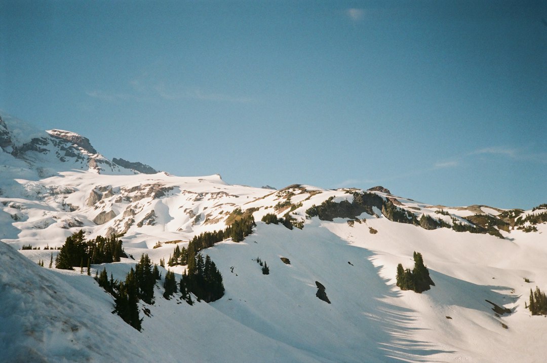
Camp Muir is the stone-hut high camp at about 10,080 feet on the south side of Mount Rainier, and the highest point you can reach on the mountain without a climbing permit. The hike from Paradise is about 9 miles round trip with roughly 4,700 feet of gain. Most of that gain is on the Muir Snowfield, an unmarked slope of snow between two crevassed glaciers. The National Park Service budgets 6 to 8 hours.
The hike is not technical. The danger is weather. Fog can swallow the snowfield in minutes, and the NPS route map says navigation mistakes in storms and whiteouts "have resulted in lost climbers and hikers and fatalities." So this guide starts from one question: how often does the snowfield fog in, and when? To answer it, we analyzed five seasons of hourly model data for the snowfield. It also converts the NPS compass bearings to this year's magnetic declination and covers the rules for a night at camp.
Camp Muir at a Glance
Camp Muir sits at the top of the Muir Snowfield between the Cowlitz and Nisqually glaciers, 4.5 miles and about 4,700 vertical feet above the Paradise parking lot.
| Elevation | About 10,080 ft at the huts; Muir Rock above camp is 10,188 ft |
| Distance | 8 to 9 miles round trip (WTA says 8.0, NPS says 9) |
| Elevation gain | 4,640 to 4,680 ft |
| Time | 6 to 8 hours round trip (NPS) |
| Trailhead | Upper parking lot at Paradise, 5,400 ft |
| Best season | Mid-July to early September |
| Permit for a day hike | None beyond park entry |
| Permit to stay overnight | Wilderness permit, $12 per person per night |
| Climbing fee | Not needed to reach Camp Muir; $82 to go higher |
| Dogs | Not allowed |
Sources quote Camp Muir's elevation as anything from 10,080 to 10,188 feet. The NPS uses 10,188, the height its bearing map gives for Muir Rock just above the huts. WTA and most guidebooks use 10,080.
Camp Muir was first known as Cloud Camp. It took the name of John Muir, who joined the sixth recorded ascent of Rainier in 1888. The NPS history page dates the stone guide shelter to 1916, designed by Mountaineers architect Carl Gould, and the public shelter to 1921. The camp was listed on the National Register of Historic Places in 1991, and the old guide shelter now serves as the ranger station.
The Camp Muir Route, Landmark by Landmark
The Camp Muir route follows the Skyline Trail for 2.3 miles to Pebble Creek. From there it climbs 2,900 feet in 2.2 miles of unmarked snow. The NPS bearing map publishes coordinates for each landmark, and the distances below are measured between those points.
| Leg | Elevation | What to know |
|---|---|---|
| Paradise to Pebble Creek | 5,400 to about 7,200 ft | Paved, then the Skyline Trail past Glacier Vista and Panorama Point. Pebble Creek is the last running water; treat it |
| Pebble Creek to Sugar Rock | About 7,200 to 7,500 ft | The snowfield starts. McClure Rock (7,385 ft) has cliffs on its east side |
| Sugar Rock to Moon Rocks | To roughly 9,200 ft | The longest leg: 1.1 miles and about 1,700 feet of climbing. Most people slow down here |
| Moon Rocks to Camp Muir | To 10,080 ft | The last 0.6 miles and roughly 900 feet. Anvil Rock (9,584 ft) is off to the right |
The first two miles are the Skyline Trail, crowded and easy to follow. The route climbs past Panorama Point, which the NPS flags as a dangerous avalanche area. Above Pebble Creek the trail ends, and in a typical summer the snowfield runs all the way to camp. WTA notes the route is typically under snow its entire length until August.
The upper snowfield is a long, steady slog, not a scramble. The NPS warns that holes open around rock islands as the snow melts, and that hidden crevasses sometimes appear near Anvil Rock in late summer.
The descent is often worse than the ascent. The snow is slushy, legs are tired, and in poor visibility it's easy to drift. WTA warns that the natural fall line leads toward the heavily crevassed Nisqually Glacier.
How Often the Muir Snowfield Fogs In
In July and August, the Muir Snowfield stays fog-free through the whole hiking day on about two of every three days. In October that falls to fewer than half. For each day we checked whether the snowfield was in cloud at any hour between 7 AM and 5 PM. The data is five seasons (2021 to 2025) of hourly visibility from the Open-Meteo historical forecast archive. We used the archive's default best-match model and the grid cell over the middle of the snowfield, whose model terrain sits at about 8,500 feet, with hours in Pacific time. "In cloud" means modeled visibility under 1 kilometer, so these are odds of the model putting the snowfield in cloud, not counts of observed whiteouts.
| Month | Days fog-free 7 AM to 5 PM | Days already fogged in at 7 AM | Clear 7 AM starts that fog in by 4 PM |
|---|---|---|---|
| June | 52% | 13% | 39% |
| July | 66% | 3% | 30% |
| August | 66% | 7% | 28% |
| September | 58% | 6% | 38% |
| October | 43% | 15% | 48% |
The best half-month in the sample was August 1 to 15, at 73% fog-free days. Late October was the worst, at 32%. Years vary a lot. In 2022, 84% of July and August days stayed fog-free; in 2024 it was 58%.
These are model numbers, not observations. A grid cell several kilometers wide can't resolve a cloud sitting on one ridge, and a real whiteout can form inside an hour the model calls clear. Read the table as relative odds by month, not as a forecast for your day.
The morning is clear. The afternoon is the problem.
The last column matters most. In midsummer the model rarely has the snowfield in cloud at dawn: 3% of July mornings and 7% of August mornings started socked in. But about three in ten clear 7 AM starts had the snowfield in cloud at some point before 4 PM.
The timing is consistent. From July to September, the share of hours with the snowfield in cloud was 5 to 7% between 7 and 9 AM. It climbed to 13 to 15% from 11 AM to 4 PM. On days when fog rolled in after a clear start, the median first foggy hour was 11 AM, with half arriving between 10 AM and 1 PM.
So on a summer day, the bigger risk is not starting in bad weather. It is reaching camp at 1 PM on a bluebird day and walking down into cloud. Start at dawn, plan to leave Camp Muir by about noon, and turn around at a fixed time even if you haven't arrived. Your descent is then mostly finished before the afternoon fog peaks.
Fog at Paradise doesn't mean fog at Camp Muir
Paradise can sit inside a cloud layer while the snowfield above is in sunshine. In the same dataset, the model had Paradise fogged in at 7 AM on 74 mornings between June and October across the five seasons. On 57% of them the snowfield was clear at both 9 and 10 AM, so a hiker would have climbed up through the cloud into sun.
That is a real upside and a trap at the same time. If you climb out of a cloud deck, you have to come back down through it, usually in the afternoon when it is thickest. Mark the point where you broke out of the fog on your GPS, and know your bearing from there before you leave camp.
The Mt. Rainier visibility forecast tells you whether the summit is out. Its score comes from a weighted atmospheric model of cloud layers, humidity and haze at the mountain. A high score at dawn is a good sign for the upper mountain. The Skyline Trail analysis found, in ten summers of modeled cloud cover, that when the summit area was clear at 8 AM it was still clear at noon on 78% of those days. Before driving up, check the live Rainier webcams to see whether Paradise is in fog, and the NWS recreational forecast, which gives free-air wind and temperature at Camp Muir's elevation.
The Muir Snowfield Compass Bearings, Updated for 2026
The NPS bearing map gives true bearings between landmarks, plus magnetic bearings worked out with a 16.5° east declination. NOAA's World Magnetic Model puts the 2026 declination at Camp Muir at about 14.6° east. The printed magnetic bearings are now about 2° off.
| Leg (going down) | True bearing | Printed magnetic (16.5°) | 2026 magnetic (14.6°) | Leg length |
|---|---|---|---|---|
| Camp Muir to Moon Rocks | 158° | 141.5° | 143° | 0.6 mi |
| Moon Rocks to Sugar Rock | 167° | 150.5° | 152° | 1.1 mi |
| Sugar Rock to Panorama Point | 209° | 192.5° | 194° | 0.7 mi |
Going up, add 180° to each true bearing: Panorama Point to Sugar Rock is 29°, Sugar Rock to Moon Rocks 347° and Moon Rocks to Camp Muir 338°.
Two degrees sounds trivial. Over the 1.7 miles from Camp Muir to Sugar Rock, though, it moves you about 300 feet sideways, and the error never averages out. The printed magnetic bearings now point about 2° counterclockwise of the true line. On the way down, that means slightly east, toward the side with the cliffs east of Anvil Rock and McClure Rock. The fix is simple. Set your compass's declination adjustment to 14.6° east and follow the true bearings, or load the NPS coordinates into a GPS app as waypoints.
Wind adds its own error. The NPS notes that strong winds on the snowfield usually blow from the west or southwest and can push walkers off line, so you may need to aim slightly into the wind. It also warns that a bearing alone does not make a trip safe. In a real whiteout, the park's advice is to stop and wait for it to clear rather than guess.
When Things Go Wrong on the Snowfield
When the snowfield turns dangerous, it is usually because a party keeps moving in poor visibility and loses the line. The snowfield is nearly surrounded by glaciers: the Nisqually to the west, the Cowlitz to the north and east, and the Paradise Glacier to the south and east. A small navigation error can put you on crevassed ice.
On September 23, 2020, two hikers who had spent the night in a tent at Camp Muir lost their way at about 9,300 feet in high wind, heavy rain and whiteout. One was found alive near the top of the Skyline Trail. The other, a 27-year-old man, was found dead at about 7,700 feet on the snowfield, according to the NPS news release.
The NPS safety handout, Reading This Could Save Your Life, boils it down to this. Get the bearings before you start up the snowfield. Carry an altimeter and emergency shelter. Don't go alone; the park says your risk "increases significantly" when you travel solo. And don't travel in poor visibility at all.
The public shelter at Camp Muir has an emergency radio that reaches park dispatch, for real emergencies when no ranger is present. Don't count on your phone as the backup.
When to Hike to Camp Muir
The best time to hike to Camp Muir is from mid-July through early September, when fog-free days are most common, the Skyline Trail section has melted out, and storms are rarest. Within that window, early August had the best odds in our data.
Snow decides the start of the season. In the Paradise snow-station records since 2011, the ground at Paradise is snow-free around July 9 in a median year. Melt-out came as late as August 21 in 2011, while the station was bare by May 31 in 2015 and June 7 in 2026. Before Paradise melts out, the whole route is on snow, the avalanche slope below Panorama Point is still loaded, and route-finding is harder. The Paradise guide covers the area's seasons in more detail.
Snow texture changes through the day. In July and August, the model's freezing level stayed above camp height from midnight to 6 AM on more than 80% of nights in 2021 to 2025, so the snow can be soft even at dawn after a warm, cloudy night. After a clear night the surface usually firms up, and early starters get the best footing. By early afternoon the lower snowfield is deep slush, which is one more reason to finish early.
October storms bring new snow and much more fog. Winter trips to Camp Muir are ski and snowshoe outings for experienced, well-equipped parties. In winter the road from Longmire to Paradise opens only by day, typically opening at 9 AM with a 3 PM uphill cutoff and a 4 PM downhill closure, conditions permitting, per the NPS winter travel page. That leaves little margin for a 6-to-8-hour round trip, and every vehicle must carry tire chains in the park from November 1 to May 1.
What to Bring to Camp Muir
The gear list for Camp Muir is a normal day-hike kit plus three additions for the snowfield: navigation, traction and warmth.
- Navigation: map, compass with the declination set, GPS with the NPS waypoints loaded, altimeter
- Traction: microspikes or crampons and poles; before mid-August, an ice axe if you know how to self-arrest
- Warmth and sun: shell, insulated jacket, gloves, glacier glasses. At a typical lapse rate, altitude alone makes camp roughly 15°F colder than Paradise, before wind chill
- Water: 3 liters or a filter for Pebble Creek; there is no running water at camp
Glissading saves time on the way down, but only on soft snow with a clear runout, and never with crampons on.
Staying Overnight at Camp Muir
You need a wilderness permit to stay overnight at Camp Muir, even if you're not climbing higher. It costs $12 per person per night plus a $6 Recreation.gov fee for reservations, per the NPS wilderness permit page. The climbing fee FAQ is explicit that there is "no need to pay the fee to travel only as far as Camp Muir." The $82 climbing fee applies only if you go higher or onto a glacier.
The climbing rangers' Camp Muir page describes how the camp works:
- Camp Muir holds just over 100 people a night.
- The public stone shelter fits 15 to 20 people, first come, first served. Bring a tent anyway.
- Most tent sites are on the Cowlitz Glacier next to camp. Camping on exposed rock isn't allowed, and tents need solid anchors.
- There is no water. Bring a stove and fuel to melt snow.
- Outhouses have no toilet paper. Used blue bags go in the labeled barrels, never in the toilets.
- There is no trash service. Pack everything out.
The guide companies have their own huts at camp, and climbers on the Disappointment Cleaver route stay here before a midnight start. For the climb itself, success rates and permits, see our Mount Rainier summit guide.
The View From Camp Muir
On a clear day, Camp Muir looks south over a sea of peaks to Mount Adams, Mount St. Helens and, on the clearest days, Mount Hood. Up close you see Little Tahoma, the Cowlitz Glacier and Gibraltar Rock.
What you don't see is Rainier's true summit. The terrain analysis in our summit post found that the mountain's own upper slopes hide all three summit points from camp. The top you see from Camp Muir is a false one.
The NPS webcam page includes a Camp Muir camera. When it is online, it's the best way to check conditions at camp before you commit. For a full-day hike that skips the snowfield, the rest of the park's trails are in our guide to hikes in Mount Rainier National Park.
Camp Muir FAQ
Do you need a permit to hike to Camp Muir? Not for a day hike; you only need park entry ($30 per vehicle for seven days, or an annual pass). Staying overnight needs a wilderness permit, and going above Camp Muir or onto a glacier needs the $82 climbing registration as well.
Can beginners hike to Camp Muir? Not alone, and not without navigation skills and a fixed turnaround time. The NPS calls it a route only experienced hikers should attempt. A first-timer is better off going in midsummer with someone who has done it, or with a guide service.
How cold is it at Camp Muir? In our model data for 2021 to 2025, 6 AM temperatures adjusted to camp height averaged about 35°F in July and August and dropped below freezing in June, September and October. Wind makes it feel much colder, so pack a warm jacket even on a hot day at Paradise.
A Go or No-Go Plan for Camp Muir
Camp Muir is not a fitness test so much as a weather decision made three times. Make it the night before, with the 10-day Rainier visibility forecast and the NWS recreational forecast for wind at 10,000 feet. Make it again at dawn on the Paradise webcams. Then make it on the snowfield, against a fixed turnaround time and a compass already set to 14.6° east.
If the mountain is out, the morning is calm and you are moving by 7 AM, a summer day at Camp Muir is one of the best in the Cascades. If any of those is missing, Panorama Point is a fine place to turn around.
More Articles
Skyline Trail Mount Rainier: Loop Guide, Snow and Cloud Odds
Skyline Trail Mount Rainier guide: the 5.5-mile Paradise loop, which way to hike it, when the snow melts and the odds the summit stays clear.
Mount Rainier Summit: Climbing Routes, Odds and the Crater
Mount Rainier summit guide: the three summit points, why Paradise never sees the top, NPS success rates since 1950 and the clearest summit-morning months.
Hikes in Mount Rainier National Park: Best Trails by Area
Hikes in Mount Rainier National Park by area, with 2026 closures, snow-free timing and the odds of a clear summit by month and hour.