Skyline Trail Mount Rainier: Loop Guide, Snow and Cloud Odds
Skyline Trail Mount Rainier guide: the 5.5-mile Paradise loop, which way to hike it, when the snow melts and the odds the summit stays clear.

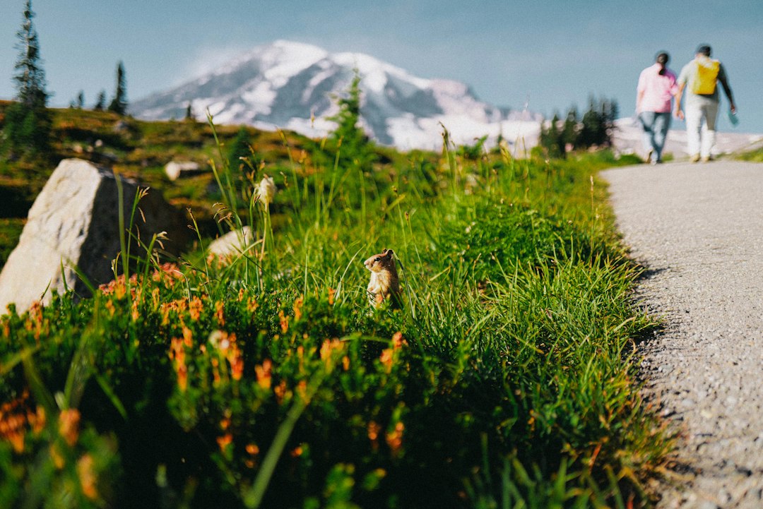
The Skyline Trail, the signature day hike at Mount Rainier's Paradise area, is a 5.5-mile loop from Paradise that climbs about 1,450 to 1,700 feet to Panorama Point at 6,800 feet, then circles back through the meadows past Myrtle Falls. Allow three to five hours.
The route itself is easy to follow. Signs sit at every junction. What decides whether the day is great or grey is timing: whether the upper trail has melted out, and whether the summit is still visible when you reach Panorama Point. This guide covers the route landmark by landmark, then adds two datasets built for this post. One is 16 years of snow records from the Paradise weather station. The other is ten years of modeled hourly cloud cover for the summit area, which answers the question every Skyline hiker asks at the trailhead: if the mountain is out now, will it still be out when I get up there?
Skyline Trail, Mount Rainier: Stats at a Glance
The Skyline Trail is a moderate-to-strenuous loop with one steep climb, one snow hazard and no permit requirement. Published numbers vary a little depending on which variant of the loop a source measured.
| Detail | Figure | Source |
|---|---|---|
| Distance | 5.5 miles (loop) | NPS, WTA |
| Elevation gain | 1,450 ft (WTA) to 1,700 ft (NPS) | Taking High Skyline adds a little |
| Start | Paradise, about 5,400 ft | Muir Steps, upper Paradise parking area |
| Panorama Point | 6,800 ft | Seasonal pit toilet (NPS, WTA) |
| Time | 3 to 5 hours | Add an hour for photo stops |
| Mostly snow-free | Usually late July to early or mid-October | See the snow data below |
| Permit | None for day hiking | Park entry is $30 per private vehicle (NPS) |
| Dogs | Not allowed on trails | NPS |
If you only want a taste, the first half mile to Myrtle Falls is paved and gentle. The full loop is a real hike with loose rock, stone stairs and, early in the season, snow.
The Route, Landmark by Landmark
The classic way to hike the Skyline Trail is clockwise: straight up the west side to Glacier Vista and Panorama Point, then down the east side past Golden Gate, the Stevens-Van Trump Memorial and Myrtle Falls. Here is what you pass, in that order.
Muir Steps. The loop starts on stone steps inscribed with a quote from John Muir, who passed through Paradise on his 1888 summit climb.
The meadow climb. The first mile goes up through subalpine meadow on paved and then stone-stepped trail. In late July and early August, peak bloom per the NPS, this stretch is lupine, magenta paintbrush and avalanche lilies at the snow edge. Staying on the trail is not a courtesy here. The NPS asks hikers to stay on the trail at all times to protect the fragile subalpine plants.
Glacier Vista (about 6,300 ft). A short spur looks out over the Nisqually Glacier toward the summit. Many people turn around here, and WTA notes that foot traffic thins above it.
Panorama Point (6,800 ft). The payoff. On a clear day the view runs south along the Tatoosh Range to Mount Adams, Mount St. Helens and, on the clearest days, Mount Hood. A seasonal pit toilet sits here; WTA notes it is normally closed from mid-October to mid-June.
High Skyline or the lower route. Just past Panorama Point the trail splits. The lower route crosses a steep slope that holds snow and ice most of the year. The NPS is blunt about it: the High Skyline Trail "avoids a dangerous icy slope that does not melt." Take High Skyline. It adds a few minutes and a little extra climbing.
Golden Gate junction. The Golden Gate Trail drops steeply down Edith Creek Basin, a shortcut back to Paradise that WTA says shaves about a mile off the loop. Stay on Skyline to continue the full loop.
Stevens-Van Trump Memorial. A stone bench marks the camp from which Hazard Stevens and P.B. Van Trump made the first documented ascent of Rainier on August 17, 1870. One stone notes that their guide, Sluiskin, "waited here for the climbers to return." The Mountaineers and the Mazamas placed it in 1924, per the NPS. The Paradise Glacier Trail branches off here, about 1.74 miles from Paradise if you hike counterclockwise.
Sluiskin Falls and the descent. Sluiskin Falls, which shares the guide's name, spills down right beside the memorial. From there the trail drops through Paradise Valley meadows.
Myrtle Falls. The last landmark, a short spur down to a small waterfall with the summit framed above it. From here it is half a mile of paved trail back to the lot.
Clockwise or Counterclockwise?
Hike the Skyline Trail clockwise if you want the best odds of a clear summit at Panorama Point; hike it counterclockwise if you want a gentler grade and the mountain in front of you on the way up. Both are reasonable. The difference is where the steep part falls and when you arrive at the top.
Clockwise, you reach Panorama Point after roughly 2 miles and most of the climb, which takes a typical hiker 1.5 to 2 hours. Counterclockwise, the climb is spread over the longer east side, and you usually top out 2.5 to 3 hours in. The descent is the other factor. Clockwise sends you down the east side's long, gradual grade. Counterclockwise sends you down the steep stone steps below Glacier Vista, which some knees dislike.
So clockwise buys you about an hour. The next section shows what that hour is worth.
Will the Mountain Stay Out? Hour-by-Hour Odds
In ten summers of modeled cloud data, when Rainier's summit area was clear at 8 AM it was still clear two hours later about 9 times in 10. When it was cloudy at 8 AM, it was clear by late morning only about 1 time in 5. That is the practical rule for the Skyline Trail: the view at the trailhead is a strong forecast for the view at Panorama Point, and a late start costs more than the direction you pick.
These figures come from ten years (2016 to 2025) of Open-Meteo hourly modeled total cloud cover (the archive's default best-match model) for the grid cell containing the summit, July through September, 920 days in all. "Clear" here means 30% cloud cover or less. A model grid cell covers kilometers of terrain and total cloud cover includes high cloud above the peak, so this is not a camera looking at the summit. Treat the numbers as rough odds for summer mornings in those years, not guarantees.
| Time of day | Any day, Jul to Sep | If clear at 8 AM | If cloudy at 8 AM |
|---|---|---|---|
| 8 AM | 55% | 100% | 0% |
| 9 AM | 56% | 93% | 11% |
| 10 AM | 56% | 89% | 17% |
| 11 AM | 54% | 84% | 19% |
| Noon | 52% | 78% | 20% |
| 1 PM | 48% | 74% | 18% |
| 2 PM | 47% | 71% | 19% |
| 3 PM | 47% | 70% | 20% |
Three things stand out.
The morning is the window. Modeled clear odds slide from 56% at 10 AM to 47% by 2 PM. Most of that loss happens after noon.
Direction matters less than start time. Leave the lot at 8 on a clear morning and, at a typical pace, you reach Panorama Point around 10 clockwise (89%) or 11 counterclockwise (84%). Five points. Leave at 11 and you top out around 1 PM, when even a morning that was clear at 8 is still clear only about 74% of the time.
A cloudy morning rarely rescues itself. From a cloudy 8 AM, the modeled share of clear hours later in the day stays around 11 to 20%. You can still hike the loop for the meadows and the glacier. Just don't do it expecting the curtain to lift.
September is less forgiving. The summit was clear at 8 AM on only 43% of September days, and a clear start was still clear at 2 PM on 80 of 128 such days (about 62%), against 71% for the whole summer. For a late-season Skyline hike, start earlier than you would in August.
The simplest way to use this: check the live Mt. Rainier visibility score the night before and again when you wake up, then glance at the Paradise webcams before you drive. The score comes from our weighted atmospheric model, which blends cloud layers, humidity and haze rather than a single cloud number. If the summit is out at dawn, go clockwise and go early. If it's socked in, consider a waterfall stop such as Narada Falls and save Skyline for a clearer morning.
When Is the Skyline Trail Snow-Free?
In the median year, snow at Paradise is gone by about July 9, and the upper Skyline Trail near Panorama Point holds snow for weeks longer. That median date comes from the NRCS Paradise SNOTEL station at 5,150 feet, just below the trailhead, which records snow depth every day. Below is the first date each spring when its snow depth hit zero and stayed there for a week.
| Year | Apr 1 snow depth | Snow gone at Paradise |
|---|---|---|
| 2011 | 175 in | Aug 21 |
| 2012 | 197 in | Jul 25 |
| 2013 | 146 in | Jul 14 |
| 2014 | 166 in | Jul 17 |
| 2015 | 50 in | May 31 |
| 2016 | 153 in | Jun 28 |
| 2017 | 149 in | Jul 12 |
| 2018 | 151 in | Jul 6 |
| 2019 | 117 in | Jun 19 |
| 2020 | 193 in | Jul 13 |
| 2021 | 203 in | Jul 14 |
| 2022 | 122 in | Jul 21 |
| 2023 | 148 in | Jun 25 |
| 2024 | 121 in | Jul 5 |
| 2025 | 141 in | Jun 29 |
| 2026 | 79 in | Jun 7 |
The spread is almost three months, from May 31 in the low-snow year of 2015 to August 21 in 2011. Nine of the 16 years melted out in July. April snow depth is a useful guide but not a reliable one. 2022 started April with less snow than most years, yet did not melt out until July 21.
The station sits near the bottom of the loop, and the trail climbs another 1,600 feet or more. Glacier Vista and Panorama Point hold snow patches well after the meadows are bare, and the NPS describes the slope on the lower route east of Panorama Point as one that does not melt. In a typical year, plan on a mostly snow-free loop from late July. Before that, carry microspikes and poles, expect to follow flagged routes across snow, and consider the out-and-back to Glacier Vista instead of the full loop. The Mt. Rainier recreational forecast gives the freezing level, which tells you when fresh snow is likely on the upper trail.
The wildflowers track the snow. Peak bloom is usually late July to early August, and it shifts with the melt. In an early year like 2026, when the station went bare on June 7, the meadows are likely to bloom earlier than the usual window.
When does the snow come back?
At the same station, the first fall day with 2 inches or more of snow on the ground came between September 20 and October 30 across 2011 to 2025, with a median of October 15. The start of the lasting winter snowpack had a median of November 6. Between those dates, early-season snow often melts off the lower loop between storms while icing the upper trail.
Hiking the Skyline Trail in Fall 2026
The Skyline Trail is still open heading into October 2026, but the season is closing fast and the facilities around it are winding down. Here is where things stand as of late September, per the NPS operating hours and road status pages.
- Paradise Inn closed for the season on September 28.
- The Jackson Visitor Center is open 9:30 AM to 4 PM daily through October 12. After that its schedule shrinks.
- Stevens Canyon Road, the route east from Paradise toward Ohanapecosh, is scheduled to close October 26.
- Tire chains must be carried in every vehicle in the park from November 1, four-wheel drive included.
- The gate between Longmire and Paradise closes nightly during winter, per the NPS winter travel page. Check the road status page the morning you go.
- Sunrise Road is closed to vehicles until further notice because of the Grand Park 2 and Wonderland Complex fires, so Paradise is the main high-meadow trailhead you can drive to.
The park is not using timed-entry reservations in 2026, per the NPS announcement; you need only the $30 vehicle fee or a valid pass. On a clear October weekday, the Skyline Trail is at its quietest of the snow-free season, with huckleberry leaves turning red across the meadows. The trade-offs are shorter days, a chance of ice on the stone steps first thing in the morning, and lower odds of a clear summit than in August. Pack a warm layer; Panorama Point sits 1,400 feet above the lot, fully exposed to the wind. The Mt. Rainier weather guide covers how conditions shift with elevation.
Parking, Permits and Trail Rules
You do not need a permit to hike the Skyline Trail; you only need to get into the park and find a parking spot. The NPS says the Paradise lots are often full by late morning on weekends, so arrive early or come on a weekday. The early arrival also lines up with the cloud odds above.
A few rules and practical notes:
- Stay on the trail. Subalpine meadows recover from trampling very slowly.
- No dogs. Pets are not allowed on park trails here.
- Bring your own water. Carry what you need from the visitor center.
- Carry the Ten Essentials. Weather at 7,000 feet can go from sun to whiteout in an hour, and the upper trail is open, rocky and easy to lose in fog or snow.
- Don't feed the wildlife. Hoary marmots are common along the upper trail.
For how the Skyline loop fits with the rest of a day at Paradise, including lodging, parking strategy and winter visits, see the complete Paradise guide.
Shorter and Longer Versions of the Loop
The Skyline Trail is easy to shorten or extend because several side trails cross it. The best options:
| Option | Distance | What you get |
|---|---|---|
| Myrtle Falls | 1 mile round trip | Paved, gentle, waterfall with the summit behind it |
| Glacier Vista out-and-back | Roughly 3 miles round trip | Nisqually Glacier views without the snowy upper loop |
| Skyline and Golden Gate loop | About 4.5 miles | Panorama Point, then the steep Golden Gate shortcut down |
| Full Skyline loop | 5.5 miles | Everything, including the memorial and Sluiskin Falls |
| Camp Muir | 8 miles round trip, 4,640 ft gain | Leaves Skyline just before Panorama Point for the climbers' camp at 10,080 ft |
Camp Muir deserves a warning. Above Pebble Creek the route climbs the Muir Snowfield, which WTA notes is snow-covered even in late summer, and where the NPS warns that finding your way back in a whiteout is extremely difficult without a map, compass and altimeter. It is a separate, serious objective, not an add-on for a tired afternoon.
For other trails nearby, including Pinnacle Saddle near Reflection Lakes and Comet Falls near Longmire, see the park-wide guide to hikes in Mount Rainier National Park. If you're staying for the evening, Reflection Lakes is ten minutes down Stevens Canyon Road and the classic spot for sunset on Rainier.
Skyline Trail FAQ
How hard is the Skyline Trail? It is moderate to strenuous. The distance is modest, but most of the 1,450 to 1,700 feet of gain comes in about two miles, at altitude, on stairs and loose rock. Fit hikers without altitude issues do it comfortably in three to four hours.
Is the Skyline Trail worth it if the mountain is in the clouds? The meadows, waterfalls and glacier edge are still worth it, but Panorama Point loses most of its point. With a cloudy start, the modeled odds of the summit being clear later in the day are only about one in five, so a shorter hike to Myrtle Falls or a forest trail may be a better use of the day.
Can you hike the Skyline Trail in October? Yes, often until mid-October, but expect ice on the upper trail after the first storms. At Paradise, the median date for the first 2 inches of snow on the ground is October 15. Check the NPS trail conditions and road status before going.
Do you need microspikes? Before about late July in a typical year, usually, for the snow near Glacier Vista and Panorama Point. After a fall storm, yes again. In August and most of September, good boots are enough.
Pick the Morning, Then the Direction
The Skyline Trail rewards one decision more than any other: when you start. In ten summers of modeled data, a clear 8 AM summit usually stayed clear through late morning, and a cloudy one usually didn't lift. So look before you drive. Check the Rainier visibility forecast the evening before, confirm on the webcams at dawn, and be walking up the Muir Steps by 8:30. Go clockwise if the mountain is out. Save the full loop for another day if it isn't.
More Articles
Paradise Mt Rainier: The Complete Visitor Guide for Every Season
Plan your trip to Paradise at Mt Rainier with trail details, parking tips, wildflower timing, and visibility forecasts.
Hikes in Mount Rainier National Park: Best Trails by Area
Hikes in Mount Rainier National Park by area, with 2026 closures, snow-free timing and the odds of a clear summit by month and hour.
Mt. Rainier Weather: Complete Guide to Conditions and Visibility
Plan your visit with our complete Mt. Rainier weather guide covering monthly conditions, precipitation, snowfall records, and how weather affects mountain visibility.