Comet Falls Trail at Mount Rainier: Height, Hike and Views
Comet Falls drops 301 feet in one plunge, 1.9 miles up a steep Mount Rainier trail. Trail stats, parking, the real height, and when to go higher.

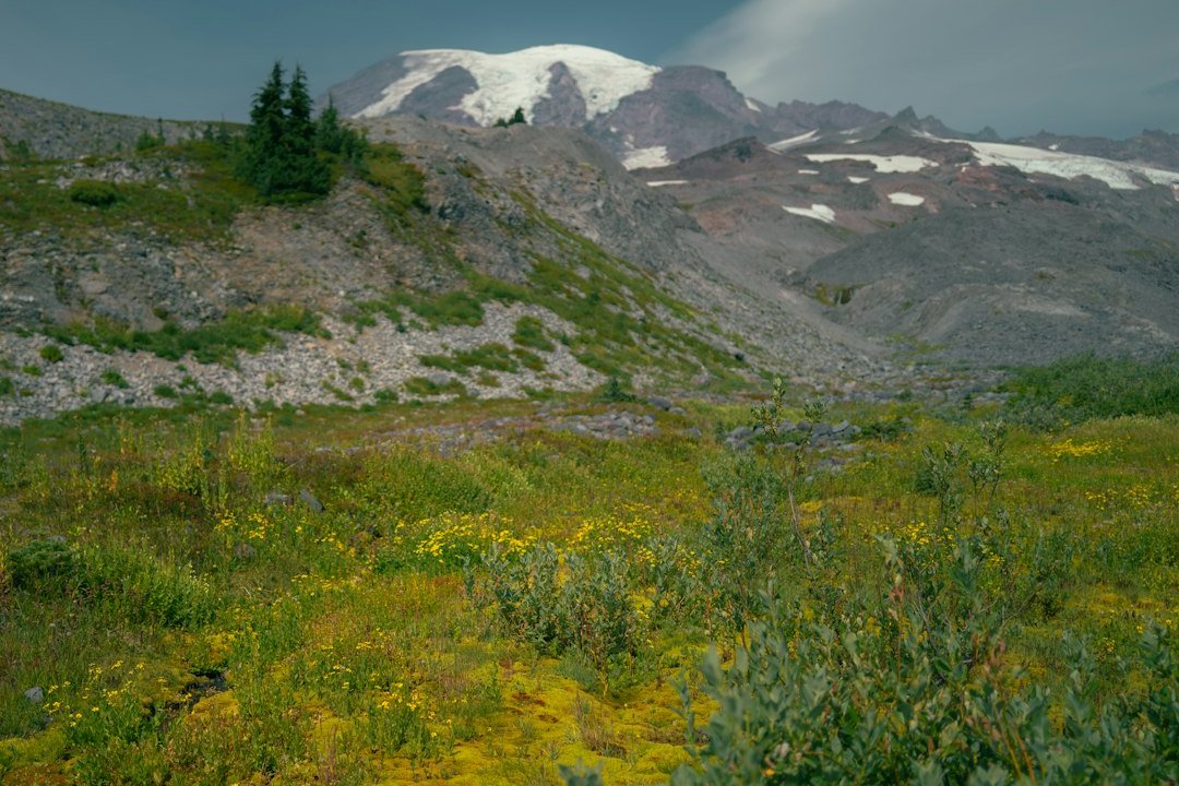
Comet Falls is a waterfall on Van Trump Creek in Mount Rainier National Park, with a single free-falling plunge of about 301 feet. You reach it on a 3.8-mile round-trip hike that climbs roughly 1,250 feet from a small trailhead between Longmire and Paradise. The National Park Service calls it one of the highest waterfalls in the park, and the trail keeps going above it into Van Trump Park, a meadow that sits closer to the summit than the Paradise visitor center does.
That split is the useful thing to know before you go. The falls are worth the hike in most weather. The meadows above are only worth the extra climb when the mountain is out, and the live Mount Rainier visibility score tells you which kind of day you have.
Comet Falls at a Glance
Comet Falls is a strenuous half-day hike for its length: 3.8 miles round trip, about three hours, with almost all of the climbing done in the 1.9 miles to the falls.
| Comet Falls | |
|---|---|
| Main plunge | About 301 ft (often listed as 300 or 320 ft) |
| Total height, all tiers | 462 ft (World Waterfall Database, surveyed 2009) |
| Round trip to the falls | 3.8 mi |
| Elevation gain | About 1,250 ft (WTA); NPS figures range from 900 to 1,200 ft |
| Trailhead elevation | About 3,650 ft |
| High point at the falls | About 4,875 ft |
| Parking | About 16 cars, no trailhead amenities |
| Dogs | Not allowed |
| Usually snow-free | Roughly mid-July to mid-October |
The elevation-gain figures disagree. The NPS trail page says 900 feet, the park's Comet Falls place page says 1,200, and WTA says 1,250. WTA's trailhead (3,650 ft) and high point (4,875 ft) alone are about 1,225 feet apart, and a terrain-model profile of the OpenStreetMap trail line gives a similar net climb of about 1,290 feet. Plan for 1,250.
How Tall Is Comet Falls?
Comet Falls is about 301 feet tall if you count only the main plunge, and 462 feet if you count every tier. The 300 and 320-foot figures you will also see come from counting the falls differently.
The World Waterfall Database measured the falls in 2009 and verified the figures in 2014. It breaks them into four drops:
| Tier, top to bottom | Height |
|---|---|
| Upper tier | 78 ft |
| Main plunge | 301 ft |
| Third tier | 52 ft |
| Bottom tier | 19 ft |
| Cascading stream between the second and third tiers | 12 ft |
The 78-foot upper tier can't be seen from the viewpoints below the falls. It shows up when you climb the switchbacks toward Van Trump Park. The database describes the common 320-foot figure as inaccurate and suggests it counts only the two most prominent tiers. The bottom tier also changed: floods in October 2003 uncovered it and nearly doubled its height, which is one reason older sources disagree.
The NPS says the falls were named because they resemble the tail of a comet. The water comes from glaciers, and the database notes that as the Van Trump Glacier has receded, the creek carries less water and takes on the comet shape less often than it used to.
The Comet Falls Trail, Mile by Mile
The Comet Falls trail climbs steadily for 1.9 miles to the falls, with only short easy stretches.
Trailhead to the bridge. The trail leaves the Longmire-Paradise road a quarter mile west of the Christine Falls bridge. Christine Falls is on the same creek. At 0.3 mile a sturdy bridge crosses Van Trump Creek, with a view down toward the road below Christine Falls and up at whitewater churning through a rock channel.
Through the forest (to about 1.2 mi). The trail follows the creek, alternating between forest and openings below talus slopes. At 1.2 miles it climbs a rock face on a crib ladder, built by WTA and other trail crews after a slide closed the trail in 2012. Use your hands if you need to.
Bloucher Falls. About 0.4 mile past the ladder, the East Fork of Van Trump Creek comes in from the right in a three-tier plunge that WTA puts at 124 feet. The NPS calls it Van Trump Falls, also known as Bloucher Falls, and gives about 65 feet for its tallest step. It is easy to mistake for Comet Falls, but the main event is still ahead. You cross the East Fork on a footlog.
The final stretch. The last 0.2 mile passes snapped-off trees from avalanche and wind damage, then climbs a few steep switchbacks. Comet Falls pours off the lip of a hanging valley ahead. A boot path leads closer to the plunge pool, where swirling wind can drench you in spray.
Rockfall is the main hazard near the falls. WTA calls it "a very real hazard," so don't climb onto the debris below the plunge. The rocks in the spray zone also stay wet and slick. Bring a rain shell even on a sunny day.
Many hikers turn around at the falls. Above it, the trail switchbacks another 0.8 mile to a junction, where Van Trump Park lies to the right and the trail toward Mildred Point and Rampart Ridge continues.
| Destination | Round trip | Gain (NPS) | Time (NPS) |
|---|---|---|---|
| Comet Falls | 3.8 mi | 900 ft (closer to 1,250 in practice) | About 3 hours |
| Van Trump Park (end of maintained trail) | 5.8 mi | 2,000 ft | 4 to 5 hours |
| Mildred Point | 6.6 mi | 2,850 ft | 5 to 6 hours |
Can You See Mount Rainier From Comet Falls?
No. You can't see Mount Rainier from the falls, the trailhead, or most of the lower trail. The summit comes into view once you climb into the meadows of Van Trump Park, about 2.4 miles in.
We checked this by running the OpenStreetMap trail line across a bare-earth elevation model and testing the line of sight to the summit every tenth of a mile. Bare earth means no trees, so real views on the forested lower trail are worse than the model shows.
| Point on the trail | Elevation | Distance to summit | Summit in line of sight? |
|---|---|---|---|
| Trailhead lot | 3,620 ft | 5.2 mi | No, blocked by the slope right above the lot |
| Lower trail (0.1 to 1.8 mi) | 3,700 to 4,900 ft | 4.1 to 5.1 mi | Mostly no; brief gaps in the terrain model (around 1.0 to 1.1 mi) are under forest |
| Comet Falls viewpoint | 4,900 ft | 4.1 mi | No, the hanging-valley cliff blocks it |
| Switchbacks above the falls | 5,100 to 5,500 ft | 4.0 mi | On and off between switchbacks |
| Van Trump Park meadows (2.4 to 2.9 mi) | 5,600 to 6,100 ft | 3.5 to 3.9 mi | Yes, the summit dome is in clear view |
| Mildred Point | 5,900 ft | 3.8 mi | Yes |
Two results stand out. Mildred Point is about 3.8 miles from the summit, closer than the Jackson Visitor Center at Paradise (about 4.8 miles). And from the meadows the summit stands about 25 degrees above the horizon, so you are looking up at the mountain, not across at it. The NPS adds that Mount Adams and Mount St. Helens are visible to the south from Van Trump Park.
The falls work the opposite way. The cliff they pour over blocks everything above, so there is no "falls with Rainier behind it" photo from the viewpoint. That makes Comet Falls a good choice for a cloudy day, alongside roadside stops such as Narada Falls and the Christine Falls viewpoint.
Comet Falls or Van Trump Park: Let the Summit Decide
Hike to Comet Falls on any day the trail is snow-free. Continue to Van Trump Park only when the summit is likely to be clear when you get there. Van Trump Park on a clouded-in day means an extra 750 feet or more of climbing to look into fog.
To put rough numbers on that choice, we pulled ten years (2016 to 2025) of hourly modeled cloud cover for the grid cell containing the summit, and hourly modeled rain for the grid cell nearest the falls, from the Open-Meteo historical archive. Each day from May to October went into one of three groups:
- View day: at least three hours in a row between 7 AM and 7 PM with modeled summit cloud cover at or below 30%.
- Dry, hidden day: no such window, and under 1 mm of modeled rain between 9 AM and 4 PM.
- Wet day: no window, and 1 mm of rain or more over those hours.
| Period | View day (go to Van Trump Park) | Dry, hidden day (falls only) | Wet day |
|---|---|---|---|
| Late June | 53% | 25% | 22% |
| Early July | 64% | 26% | 10% |
| Late July | 83% | 8% | 9% |
| Early August | 73% | 15% | 12% |
| Late August | 65% | 24% | 11% |
| Early September | 55% | 29% | 16% |
| Late September | 47% | 25% | 29% |
| Early October | 48% | 25% | 27% |
| Late October | 29% | 32% | 39% |
In these ten years, late July had the best odds for the full climb: 83% of days had a clear summit window, and 9% were wet. From mid-September the odds swing the other way. By late October, wet days outnumbered view days.
The "dry, hidden" column runs about a quarter of the days in most half-months. Those are days for the falls alone: dry boots, soft overcast light for photos, and no wasted climb.
These are model grid cells, kilometers across, not observations of the summit or the trail. Total cloud cover also counts high cloud above the peak. Treat the table as rough historical odds, not a forecast. The hikes roundup has the same kind of data by month and hour across the whole park.
On the day itself, the morning sky is a useful guide. Our Skyline Trail analysis used the same archive for July to September and found that when the summit cell was clear at 8 AM, it was still clear at 11 AM on 84% of those days. When it was cloudy at 8 AM, the share of clear hours later in the day stayed around 11 to 20%. The meadows are two to three hours up the trail, so an 8 AM start puts you there in that late-morning window.
The quickest check is the Mount Rainier visibility score. It combines cloud cover, humidity, precipitation and visibility distance into one number using our weighted atmospheric model, and the Rainier webcams show you the summit directly. A high score means pack for Van Trump Park. A low score means Comet Falls, then lunch at Longmire.
When to Hike Comet Falls
The best time to hike Comet Falls is mid-July through September. The trail is usually snow-free by then, and the glacier-fed creek is still running.
The NPS advises waiting until the snow has completely melted from the trail, because it can be treacherous until summer. The avalanche paths below the falls hold snow longest. In the winter of 2012, according to the World Waterfall Database, an avalanche over the cliffs buried the valley in snow that lingered all summer, and the trail stayed closed that year.
For a guide to melt-out timing, the NRCS Paradise SNOTEL station at 5,150 feet lost its snow cover on a median date of July 9 across 2011 to 2026, with a range from May 31 to August 21. The falls sit lower, near 4,900 feet, so the lower trail usually clears earlier. The meadows above sit higher than the station, and a heavy-snow year can keep them snowy into August.
At the same station, the first fall day with 2 inches or more of snow on the ground came between September 20 and October 30 in 2011 to 2025, and the lasting winter snowpack started around November 6 in the median year.
Leave winter visits alone. The trailhead lies above the Longmire gate, which can close at any time in winter weather, and the upper trail crosses avalanche terrain.
Parking and Getting There
The Comet Falls trailhead is on the Longmire-Paradise road, about 4 miles east of Longmire and 10.2 miles from the Nisqually Entrance. Driving up from Longmire, it is on the left, about a quarter mile before the Christine Falls bridge.
Parking is the hardest part of the trip. The lot holds about 16 cars, and the NPS says it is often full and there is no other parking nearby, so have a backup hike in mind, such as Carter Falls or the roadside waterfalls. Don't park on the road shoulder. On summer weekends, plan to arrive early.
From Ashford, the trailhead is about 16 miles. Save directions offline before you leave, because data connections are unreliable on the drive in.
The park entrance fee is $30 per private vehicle, valid for seven days. The Mount Rainier entrance fee guide covers passes and payment. The park did not require timed-entry reservations in 2026. Pets aren't allowed on the trail, and there are no toilets or water at the trailhead.
Comet Falls in Late October 2026
As of October 22, 2026, the road from Longmire to Paradise is open, but the park says the Longmire gate may close at any time for weather or road conditions. From November 1 to May 1, every vehicle in the park must carry tire chains, four-wheel drive included. Stevens Canyon Road is scheduled to close for the season on October 26, and Paradise Valley Road is already closed. The NPS road status page has the current status.
SR 706 outside the park closed overnight from 9 PM Friday, October 23, to 6 AM Saturday, October 24, for a culvert replacement, with no access to the Nisqually Entrance during that window. The park directed visitors to the Stevens Canyon Entrance via SR 123 for those hours.
The park has stopped updating trail conditions for the season. Its trail conditions page says reports for the Comet Falls Trail resume in June 2027. Expect icy crossings on cold mornings and early snow on the upper trail. A short trip to the falls may still work on a clear, dry day. Van Trump Park is out of season.
The Creek Is a Glacial Debris-Flow Channel
Van Trump Creek can carry debris flows: fast-moving surges of mud and rock that start near the glaciers above. A well-documented series came down past Comet Falls in August 2001.
According to a USGS study of the event, rapid melting of the upper Kautz Glacier in hot weather set it up. On August 13 a meltwater stream on the glacier's east margin began spilling into the Van Trump basin through a 7 to 10-foot-deep notch in a moraine. On the evening of August 14, slumping loose glacial debris triggered a debris flow down Van Trump Creek. The largest flow stayed coherent past the Wonderland Trail footbridge near Cougar Rock Campground, about 4.4 miles from its source, and became a muddy flood near Longmire. A USGS photo from August 15 shows a debris flow descending Comet Falls. The World Waterfall Database adds that the flows filled the plunge pool at the base of the main tier and left a rocky scar 15 to 20 feet deep in the streambed below.
The USGS notes that these meltwater-driven flows come with little or no warning, are most likely in hot summer weather, and can also happen during intense fall and early-winter rain. If the creek suddenly turns muddy or rises, or you hear a loud roar upstream, move to high ground away from the channel. The Mount Rainier weather guide explains the heat-wave and storm patterns behind both triggers.
Comet Falls FAQ
Is the Comet Falls trail hard?
It is strenuous for its length. You gain about 1,250 feet in 1.9 miles, climb a crib ladder up a rock face, cross a footlog, and finish on rocky ground in avalanche paths. It is not suitable for strollers or for people who struggle on uneven ground.
Is Comet Falls the tallest waterfall at Mount Rainier?
The NPS calls it one of the highest waterfalls in the park, with a single drop of about 301 feet and 462 feet across all tiers. Narada Falls is far easier to reach, right beside the road, but its main drop is 168 feet.
Can you bring a dog to Comet Falls?
No. Pets are not allowed on any trail in Mount Rainier National Park, including the Comet Falls trail. Service animals are the exception.
More Articles
Hikes in Mount Rainier National Park: Best Trails by Area
Hikes in Mount Rainier National Park by area, with 2026 closures, snow-free timing and the odds of a clear summit by month and hour.
Narada Falls: Mount Rainier's Roadside Waterfall Guide
Narada Falls is Mount Rainier's largest drive-up waterfall. Get directions, the trail, the best time to visit, and rainbow-viewing tips.
Skyline Trail Mount Rainier: Loop Guide, Snow and Cloud Odds
Skyline Trail Mount Rainier guide: the 5.5-mile Paradise loop, which way to hike it, when the snow melts and the odds the summit stays clear.