Mt. Rainier Map: Guide to Park Entrances, Trails, and Viewing Spots
Use this Mt. Rainier map guide to navigate park entrances, key visitor areas, top trails, and the best spots to see the mountain from Seattle.
What Does an Mt. Rainier Map Show?
An Mt. Rainier map covers a 236,381-acre national park spanning Pierce and Lewis counties in Washington, roughly 60 to 90 miles southeast of Seattle. The park's five main visitor areas (Longmire, Paradise, Ohanapecosh, Sunrise, and Carbon River) are spread across four separate entrances connected by a network of scenic roads and more than 260 miles of trails. Before you set out, check the Mt. Rainier visibility forecast to confirm the mountain will actually be visible on your visit day.
Table of Contents
- Mt. Rainier Map Overview
- Park Entrances on the Map
- Key Visitor Areas and Distances
- Mt. Rainier Trail Maps
- Viewing Mt. Rainier from Seattle
- Where to Get Official Mt. Rainier Maps
- Frequently Asked Questions
- Planning Your Visit
Mt. Rainier Map Overview
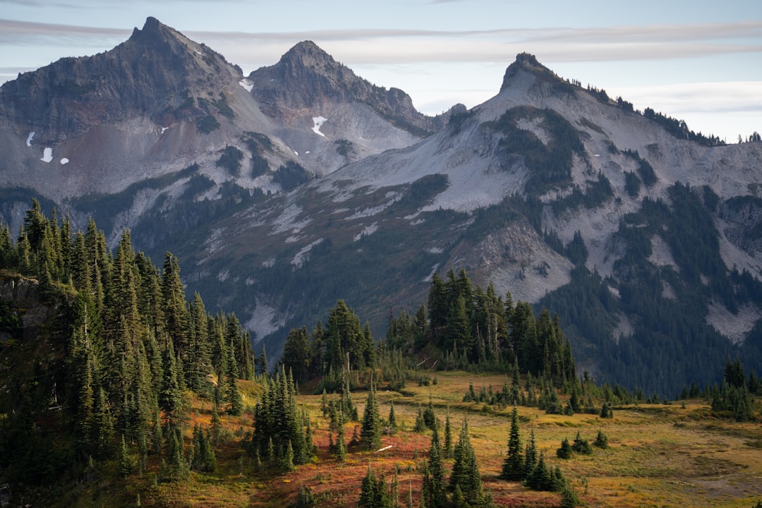
Mt. Rainier is hard to miss on any map. At 14,411 feet, it is the highest peak in the Cascade Range and the most glaciated mountain in the contiguous United States, with more than 25 named glaciers on its slopes. The national park wraps around the peak in a rough oval, stretching about 40 miles north to south and 35 miles east to west.
The park was established on March 2, 1899 as the nation's fourth national park. It preserves 236,381 acres (369 square miles) of old-growth forest, subalpine meadows, river valleys, and glaciated terrain. The summit sits at approximately 46.8523°N, 121.7603°W, about 60 miles southeast of Seattle by air but 90 miles or more by road depending on which entrance you use.
No single road encircles the entire park. The main paved corridors connect the southwest entrance to Paradise and continue east to Ohanapecosh and the Stevens Canyon area. A separate road system accesses Sunrise from the northeast. Carbon River in the northwest and Mowich Lake are accessible by their own spur roads. Keep this in mind when planning: getting from one side of the park to the other can take hours.
Park Entrances on the Map
Mount Rainier National Park has four main vehicle entrances, each serving different sections of the park. The National Park Service directions page covers all four in detail.
Nisqually (Southwest) - Year-Round
The Nisqually Entrance is the most-used entry point and the only one open to vehicles year-round. From Seattle, take I-5 south, exit onto SR 512 east, then SR 7 south through Elbe to SR 706 east. The total drive runs about 90 miles and takes roughly 1.5–2 hours depending on traffic.
This entrance leads directly to Longmire (6.5 miles inside) and Paradise (19 miles inside), the park's two most visited destinations. The mailing address for GPS navigation is 39000 State Route 706 E, Ashford, WA 98304.
White River (Northeast) - Seasonal
The White River Entrance provides access to Sunrise and the Emmons Glacier area on the mountain's east side. From Seattle, take I-5 south to I-405, then SR 167 south to SR 410 east. This route is approximately 85 miles and opens mid-summer when the road clears of snow, typically late June or early July.
Stevens Canyon (Southeast) - Seasonal
The Stevens Canyon Road connects the south and east sides of the park, linking Paradise to Ohanapecosh via a scenic mountain highway. It opens after Nisqually but before Sunrise, usually late May or early June. Use SR 123 south off SR 410 to reach the southeast entrance from the Cascades side.
Carbon River (Northwest) - Road Conditions Vary
The Carbon River Entrance in the northwest corner of the park accesses the park's only inland temperate rainforest. The paved road to the entrance gate is open, but the road inside the park is unpaved and prone to flood damage. Check current road conditions on the NPS road status page before going.
Entrance Summary
| Entrance | Primary Access | Year-Round? | Nearest Area |
|---|---|---|---|
| Nisqually (SW) | SR 706 from Ashford | Yes | Longmire, Paradise |
| White River (NE) | SR 410 east | No (summer only) | Sunrise |
| Stevens Canyon (SE) | SR 123 south | No (seasonal) | Ohanapecosh |
| Carbon River (NW) | SR 165 south | Road conditions vary | Carbon River rainforest |
Key Visitor Areas and Distances
The five developed areas in the park each offer a distinct experience and sit at very different elevations. None of them are connected by a quick drive, so plan accordingly.
Longmire (2,762 feet)
Longmire sits 6.5 miles east of the Nisqually Entrance and serves as the park's historical and administrative hub. The Longmire Museum, Wilderness Information Center, and National Park Inn are all located here. Trail access to the Rampart Ridge Loop and sections of the Wonderland Trail begin at Longmire.
Paradise (5,400 feet)
Paradise, 19 miles from the Nisqually Entrance, is the most visited location in the park and one of the most famous subalpine areas in North America. The Henry M. Jackson Visitor Center offers exhibits, ranger programs, and panoramic views of the Nisqually Glacier. The meadows fill with wildflowers in July and August.
Paradise receives an average of around 500 inches of snowfall per year and set the world record for measured single-season snowfall in 1971–1972 with 1,122 inches. For how weather at this elevation affects visibility, see our Mt. Rainier weather guide.
Sunrise (6,400 feet)
Sunrise is the highest point in the park accessible by paved road. At 6,400 feet, it offers a completely different perspective of the mountain compared to Paradise. Views to the north and east take in the Emmons Glacier (the largest glacier in the lower 48 by area) and the White River drainage. The Sunrise Visitor Center is open from late June through September.
Driving from Paradise to Sunrise takes roughly 40–50 minutes inside the park via the park roads, or about 1.5 hours if you exit and re-enter.
Ohanapecosh (1,600 feet)
Located in the park's southeast corner near the Stevens Canyon Entrance, Ohanapecosh is the lowest and warmest area of the park. The Grove of the Patriarchs (old-growth trees over 1,000 years old) and Silver Falls Trail are the main attractions here. Summer temperatures can reach the low 80s°F.
Carbon River and Mowich Lake
The northwest quadrant of the park feels more remote than the other areas and sees far fewer visitors. Carbon River protects a rare old-growth rainforest. Mowich Lake, the park's largest lake, is reachable via a rough road from SR 165 and serves as a trailhead for routes into Spray Park.
Distances Between Visitor Areas
| From | To | Distance (approx.) | Drive Time (approx.) |
|---|---|---|---|
| Nisqually Entrance | Longmire | 6.5 miles | 15 minutes |
| Longmire | Paradise | 13 miles | 25 minutes |
| Paradise | Ohanapecosh | 21 miles | 45 minutes |
| Paradise | Sunrise (via park road) | ~50 miles | 1.5 hours |
| Seattle | Nisqually Entrance | ~90 miles | 1.5–2 hours |
| Seattle | White River Entrance | ~85 miles | 1.5–2 hours |
Mt. Rainier Trail Maps
The park contains over 260 miles of maintained trails, ranging from short paved interpretive walks to multi-day wilderness routes. Detailed trail maps are available from the Visit Rainier trail map page and the NPMaps free download collection.
The Wonderland Trail
The Wonderland Trail is the park's main long-distance route: a 93-mile loop that goes all the way around Mt. Rainier, passing through every major ecosystem in the park. The trail gains approximately 22,000 feet of cumulative elevation over its full circuit, crossing every significant ridge and river drainage around the mountain.
Most thru-hikers complete the Wonderland Trail in 7–14 days. Sections can be done as day hikes or overnight trips from trailheads at Longmire, Sunrise, White River, and Carbon River. The NPS Wonderland Trail page has permit requirements and permit reservation details.
Top Day Hike Areas
For visitors without days to spare, each visitor area has accessible trails:
- Paradise: Skyline Trail loop (5 miles), Alta Vista, and Panorama Point offer the best meadow and glacier views
- Sunrise: Burroughs Mountain and Sourdough Ridge trail loops reach 7,000+ feet with open views of the summit
- Longmire: Rampart Ridge loop and Trail of the Shadows are accessible from the parking area
- Ohanapecosh: Grove of the Patriarchs and Silver Falls are flat to moderate and excellent for families
For photographers planning trails and viewpoints, the Mt. Fuji photography guide shares composition and timing principles that apply equally well to mountainscapes in the Pacific Northwest.
Viewing Mt. Rainier from Seattle
Looking at a map of the Seattle metro area, Mt. Rainier appears to the southeast, roughly 60 miles from downtown as the crow flies. On a clear day the mountain is visible from dozens of locations across Seattle, the Eastside, and Pierce and King counties.
The phrase "the mountain is out" is a well-known Seattle expression for those days when Rainier emerges from the clouds. For the full story behind it, see our post on what it means when the mountain is out in Seattle.
Best Seattle Viewing Spots
- Kerry Park (Queen Anne): The most iconic Seattle viewpoint combines the city skyline foreground with Rainier in the distance
- Seward Park (South Seattle): Open lake views across Lake Washington toward the mountain
- UW Drumheller Fountain (Rainier Vista): The mountain frames perfectly at the end of the vista, especially beautiful in cherry blossom season
- Discovery Park (Magnolia): Head to the lighthouse area for an unobstructed western perspective
- Columbia Center Observation Deck: Elevated views that see over the city toward Rainier, best on clear winter mornings
Sunset and early morning offer the sharpest contrasts and warmest light on the snowfields. Our Mt. Rainier visibility forecast updates every 15 minutes so you can check conditions before leaving for a viewpoint.
For planning the best times to catch clear views, our guide on the best time to see Mt. Rainier covers seasonal visibility patterns month by month.
Where to Get Official Mt. Rainier Maps
Several sources provide high-quality maps for different needs.
Official NPS Map
The NPS maps page offers a free downloadable PDF of the official park map. This is the standard visitor handout showing all roads, entrances, visitor centers, campgrounds, and major trailheads. It's suitable for road navigation and general orientation.
National Geographic Trails Illustrated Map
The National Geographic Trails Illustrated map (available from REI and outdoor retailers) covers the full park with topographic detail at 1:48,000 scale. It includes all marked trails with distances, wilderness campsites, elevation contours, and GPS coordinates. This is the go-to for hikers doing multi-day trips or wanting detailed off-road navigation.
Digital Maps
For real-time navigation, the NPS app and AllTrails both offer downloadable maps for offline use inside the park, where cell service is often unavailable. Google Maps and Apple Maps show park roads accurately but lack the trail detail needed for backcountry hiking.
Live Webcams
When static maps aren't enough and you want to see actual current conditions, Mt. Rainier webcams provide live feeds from multiple locations in and around the park.
Frequently Asked Questions
How big is Mt. Rainier National Park on the map?
Mount Rainier National Park covers 236,381 acres (about 369 square miles). It measures roughly 40 miles north to south and 35 miles east to west, making it large enough that driving from one entrance to another without passing through the center can take 2 hours or more.
Which Mt. Rainier entrance is closest to Seattle?
The Nisqually (Southwest) Entrance via SR 706 and Ashford is the most direct from Seattle, approximately 90 miles and 1.5–2 hours by car. The White River Entrance via SR 410 is a similar distance but provides access to Sunrise on the east side.
Can I drive all the way around Mt. Rainier?
No continuous road loops the entire park. The main road system connects the Nisqually Entrance through Longmire and Paradise, continuing east to Ohanapecosh. Sunrise is on a separate road off SR 410. Driving the full perimeter requires exiting the park and using state highways between sections.
How do I see Mt. Rainier without entering the park?
Many excellent viewpoints exist outside the park boundary. In Seattle, Kerry Park and Seward Park offer classic views. Along the drive, pull-offs on SR 410, SR 706, and SR 7 provide roadside views. Our Mt. Rainier visibility page can tell you whether the mountain is likely visible before you commit to the drive.
Planning Your Visit
Mt. Rainier rewards visitors who plan with the map in front of them. The biggest mistake is underestimating distances. The park is large, road speeds are slow, and scenic detours add up fast.
Choose Your Area Before Arriving
Decide whether you want the meadows and glaciers of Paradise, the high-elevation views of Sunrise, the old-growth forest of Carbon River, or the history and accessibility of Longmire. Each requires a different entrance and approach route. Trying to visit all four in a single day is rarely satisfying.
Check Seasonal Road Access
The Nisqually Entrance and road to Paradise are open year-round, making them the most reliable option. Sunrise opens in late June or early July when the snowpack melts enough to clear the road. Stevens Canyon typically opens in late May or early June. Always check road status before departing. Storm closures can happen at any time of year.
Verify Visibility Before the Drive
Clouds frequently obscure the summit even when the weather looks fine from Seattle. Our Mt. Rainier visibility forecast combines cloud cover, humidity, and precipitation data to tell you how visible the mountain is right now and what the outlook looks like for the next 10 days. Use it the morning of your trip to avoid a 3-hour round drive through fog.
In Summary
An Mt. Rainier map shows a park organized around one massive peak, with roads and visitor areas branching out in different directions. Four entrances, five main visitor areas, and 260+ miles of trails give you plenty of options. Getting the most from a visit means choosing the right entrance, checking seasonal road conditions, and confirming visibility before you go.
Check Current Visibility
Ready to find out if Mt. Rainier is visible right now?
Check Mt. Rainier Visibility - Real-time visibility score updated every 15 minutes.
Also explore visibility for Mt. Fuji in Japan and Denali in Alaska.
More Articles
Mt Fuji Autumn Leaves: 2026 Peak Dates, Best Spots, and the Snowcap Problem
Mt Fuji autumn leaves peak mid-November at the Five Lakes. Festival timing, nine spots ranked by forecast, and why the snowcap shot keeps failing.
Lake Saiko: The Quiet Fuji Five Lake of Caves, Forest, and Fish
Lake Saiko is the quietest Fuji Five Lake, with Fuji visible only from its western tip. A guide to views, caves, the kunimasu fish, and camping.
Oishi Park, Mt. Fuji: Flower Calendar and When the Mountain Is Out
Oishi Park frames Mt. Fuji behind lavender and kochia on Lake Kawaguchi. Get the flower calendar and learn when the mountain is actually visible.