Mt. Rainier Sunrise: Complete Guide to the Park's Highest Viewpoint
Your complete guide to Mt. Rainier Sunrise: road dates, best hikes, wildflowers, and how to time your visit for clear views of the mountain.
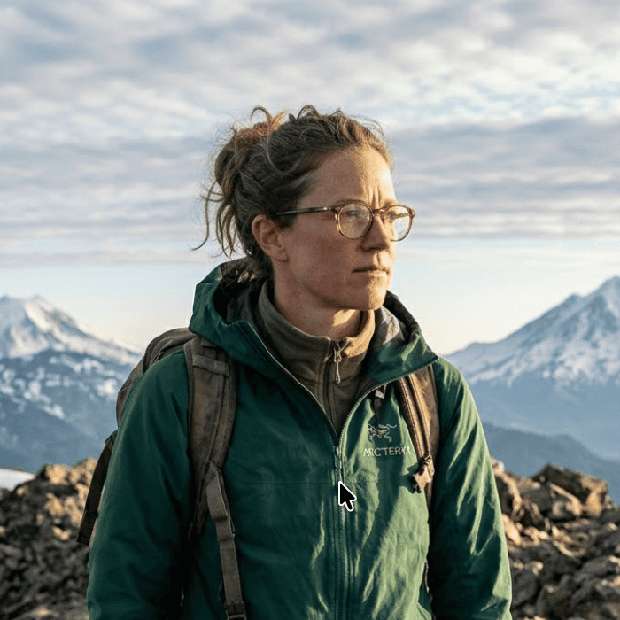
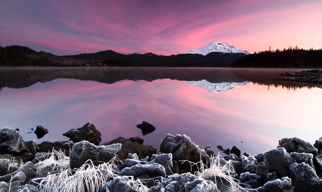
Say "Mt. Rainier Sunrise" to a Washington local and they picture two things at once: the 6,400-foot subalpine wonderland in the park's northeast corner, and the moment first light hits the summit. This guide covers both. Sunrise is the highest point you can reach by car in Mount Rainier National Park, and thanks to its dry, east-facing position, it is often the best place in the park to actually see the mountain. That last part matters more than most guides admit, because on a cloudy day the drive up buys you a parking lot and a wall of fog.
Here is everything you need to plan a Mt. Rainier Sunrise trip, from road dates and hikes to the one thing the other guides skip: how to know whether the mountain will be out before you commit two hours of driving.
Quick facts on Sunrise
- Elevation: 6,400 feet, the highest point reachable by vehicle in the park
- Location: Northeast corner, accessed via the White River Entrance off SR 410
- Road season: Late June or early July through late September or early October
- Drive from Seattle: About 2 to 2.5 hours
- Entrance fee: $30 per vehicle (valid 7 days); no timed-entry reservation required in 2026
Table of Contents
- What Is Sunrise at Mt. Rainier?
- When the Sunrise Road Opens and Closes
- Getting to Sunrise from Seattle
- Will the Mountain Actually Be Out?
- Best Hikes at the Mt. Rainier Sunrise Area
- Shooting Actual Sunrise: Dawn Photography
- Wildflowers and Wildlife
- Sunrise vs. Paradise: Which to Choose
- Frequently Asked Questions
What Is Sunrise at Mt. Rainier?
Sunrise at Mt. Rainier is a developed subalpine area at 6,400 feet on the mountain's northeast flank, and it is the highest point in the park you can drive to. It sits in Yakima Park, a broad shoulder of alpine meadow that historically served as hunting and gathering grounds for Indigenous peoples. The area takes its name from the way it catches the day's first light, and the views from here are the closest road-accessible look you can get at Rainier's enormous Emmons Glacier, the largest glacier in the contiguous United States by area.
Because Sunrise sits in the park's drier northeastern corner, it often stays clear when the wetter southern and western sides are socked in. That rain-shadow effect is the single biggest reason to choose Sunrise over other viewpoints, and it is why the best time to see Mt. Rainier frequently coincides with a trip up here.
The name causes constant confusion. Some visitors search "Mt. Rainier sunrise" wanting the place; others want to photograph dawn. The good news is that Sunrise the location happens to be one of the best places in the park to shoot sunrise the event, so this guide serves both. According to the National Park Service, the area includes a seasonal visitor center, a day lodge with food service, picnic areas, and a network of trails ranging from flat nature loops to strenuous alpine climbs.
When the Sunrise Road Opens and Closes
The Sunrise Road usually opens in late June or early July and closes in late September to early October, making it one of the most weather-dependent roads in the park. Because Sunrise sits so high, deep snowpack lingers well into summer, and plows cannot clear the road until conditions allow. In a heavy snow year the opening can slip past July 4; in a light year it may open in the last days of June.
The seasonal Sunrise Visitor Center typically operates from early July through early September, and the Sunrise Day Lodge, which has grab-and-go food and a gift shop, runs from early July to late September. There is no overnight lodging at Sunrise. The closest campground is White River, about 12 miles down the road from the visitor center.
One important 2026 update: Mount Rainier National Park will not require timed-entry reservations this year. The pilot program that ran at the Sunrise corridor in 2024 and 2025 has been canceled, and the park is instead using parking management to control crowding. You can read the official announcement on the NPS news page. Always confirm current road status before you leave, since the road closes anytime for weather even during the open season.
Getting to Sunrise from Seattle
Sunrise is roughly a 2 to 2.5-hour drive from Seattle, reached through the White River Entrance off State Route 410. From the entrance station, it is another 14 miles and about 40 minutes of climbing switchbacks to the Sunrise parking area. This is the only paved approach; there is no back way in. For the full breakdown of routes and timing, see our guide on getting to Mt. Rainier from Seattle.
The entrance fee is $30 per vehicle and covers seven days. Entrance stations are cashless, so if you only carry cash you must buy a pass in advance at a local business such as the Ashford General Store. An America the Beautiful annual pass also works.
Parking is the real challenge, not reservations. The Sunrise lot fills by mid-to-late morning on clear summer weekends, and once it is full, rangers hold cars at the gate until spaces open. The reliable fix is timing. Enter the park before 7 a.m. or after 4 p.m. to skip the lines entirely. An early arrival does double duty: you beat the crowd and you catch the clearest, most stable air of the day, which is exactly when Mt. Rainier is most likely to be visible.
Will the Mountain Actually Be Out?
The single question that decides whether a Sunrise trip is magic or a bust is whether the summit is visible, and no amount of scenery makes up for a mountain buried in cloud. This is the piece almost every Sunrise guide leaves out. They tell you where to hike; they do not tell you how to avoid driving two hours to see fog.
Start with geography. Sunrise sits on the dry northeast side of the mountain, in Rainier's rain shadow. When Pacific moisture piles against the peak, the wet southwest slopes around Paradise take the brunt while the northeast side often stays clear. That is why Sunrise can deliver a crisp summit view on a day when the mountain is not out over Seattle. It is not a guarantee, but the odds are structurally better here.
Next, watch the pattern. The 24 to 48 hours after a storm front passes tend to bring the cleanest air and the best visibility of any given week, as the system scrubs haze from the sky and drags in cool, dry air behind it. Summer mornings are also your friend: skies are most stable at dawn, and afternoon convection can build cumulus clouds that cap the summit by early afternoon. To understand how cloud cover, humidity, and wind combine into a single viewing forecast, our visibility scores weight each factor rather than treating them separately.
Before you commit to the drive, do two checks. First, pull up the live Mt. Rainier visibility forecast to see the current score and the 10-day outlook, updated every 15 minutes. Second, glance at a Mt. Rainier webcam for a real-time look at the peak. If the forecast and the camera agree the mountain is out, go. If not, the meadows are pretty but the star of the show will be hiding. For a deeper look at how the seasons stack up, our Mt. Rainier weather guide breaks down visibility month by month.
Best Hikes at the Mt. Rainier Sunrise Area
The Mt. Rainier Sunrise area is the best trailhead hub in the park, with routes fanning out across open meadow where the mountain stays in view almost the entire time. Because you start at 6,400 feet, you are already in subalpine terrain the moment you step out of the car, so even short walks pay off. Here are the standout options.
| Trail | Round Trip | Elevation Gain | Time | Payoff |
|---|---|---|---|---|
| Sunrise Nature Trail | 1.5-mi loop | 200 ft | Under 1 hr | Easy meadow loop, big summit views |
| Sourdough Ridge | 1 mi to first views | ~300 ft | 30-45 min | Quick ridge with panoramic Rainier views |
| Dege Peak | 2.8 mi | 850 ft | ~2 hr | 360-degree summit of Cascade peaks |
| Frozen Lake Loop | ~3 mi | 500 ft | 2 hr | Alpine lake and glacier vistas |
| Mount Fremont Lookout | 5.6 mi | 1,100 ft | ~3 hr | Historic fire lookout, expansive views |
| Burroughs Mountain (2nd) | ~9 mi | 2,600 ft | 5-6 hr | Arctic tundra up close to Emmons Glacier |
For a first visit with limited time, walk a few minutes up toward Sourdough Ridge. The mountain snaps into full view almost immediately, and you will understand instantly why photographers haul tripods up here before dawn. The Washington Trails Association maintains current trip reports for the Sunrise Nature area if you want recent conditions.
Two notes on the trails. Snow lingers on the higher routes, especially Burroughs Mountain, well into July and sometimes August, so check conditions before attempting the alpine loops. And dogs are not permitted on any Sunrise trails, a rule the park enforces to protect the fragile meadow ecosystem.
Shooting Actual Sunrise: Dawn Photography
Yes, you can shoot actual sunrise at Sunrise, because during the open season the road is not gated overnight, so photographers can drive up in the dark and be in position before first light. This is the detail that makes the area a photographer's favorite, and it is why the parking lot is often busy well before dawn in July. Nightly gate closures at the White River Campground junction do not begin until late September, so through peak summer the pre-dawn approach is open.
In July, the sun clears the horizon around 5:15 to 5:40 a.m.; by late August it slips closer to 6:00 a.m. Plan to arrive at least 30 to 45 minutes early to set up during the color of civil twilight. Because Sunrise faces east and the mountain sits to the west-southwest, the peak lights up in warm alpenglow while the sun rises behind you. That geometry is ideal: you shoot the pink-and-gold summit without the sun blasting into your lens.
The best dawn spots, in order of effort:
- Sourdough Ridge: A short climb from the parking lot puts the whole summit in frame with meadow foreground. The easiest high-reward option.
- Frozen Lake: A little farther out, offering a reflective foreground when the water is calm.
- Mount Fremont Lookout: A longer pre-dawn hike for those who want the historic lookout and a sweeping vantage, best attempted only if you know the trail in the dark.
- Sunrise Point: A large pullout on the drive up with views in every direction, including south to Mount Adams and Mount Hood. Great if you want to shoot without hiking at all.
For a nearby alternative that requires no hiking, Tipsoo Lake near Chinook Pass delivers a classic reflection of Rainier against the pre-dawn sky and sits right off SR 410. Whatever spot you pick, check the visibility forecast the night before, because a dawn drive is a wasted alarm clock if the summit is buried.
Wildflowers and Wildlife
Sunrise puts on its best show in late July and early August, when the subalpine meadows explode with wildflowers. Lupine, paintbrush, avalanche lily, and aster carpet Yakima Park in a matter of weeks after the snow melts, and the timing shifts year to year depending on snowpack. A late-melting year pushes peak bloom into August; an early one brings it forward into mid-July.
The wildlife is part of the draw too. Hoary marmots whistle from the rocks and are almost guaranteed sightings along Sourdough Ridge. Mountain goats appear on the high slopes, black-tailed deer graze the meadows at dawn and dusk, and black bears occasionally forage in the distance. Early morning is prime wildlife time, which lines up neatly with the best light and the clearest air. According to Visit Rainier, the meadows also draw a steady parade of birds and pollinators through the short alpine summer.
Stay on the trails. The meadows recover painfully slowly at this elevation, and a single boot print off-path can scar the ground for years. The park closes some routes when snow-free meadows are especially vulnerable, so heed posted signs.
Sunrise vs. Paradise: Which to Choose
Sunrise and Paradise are the two marquee areas of Mount Rainier, and most guides describe them in isolation, leaving you to guess which fits your day. Here is the direct comparison. Paradise, at 5,400 feet on the south side, is the busier and more famous destination, open year-round with a large visitor center and the densest wildflower displays. Sunrise, at 6,400 feet on the northeast side, is higher, drier, quieter, and open only in summer.
| Factor | Sunrise | Paradise |
|---|---|---|
| Elevation | 6,400 ft | 5,400 ft |
| Side of mountain | Northeast (drier) | South (wetter) |
| Season | Early July to late Sept | Year-round |
| Crowds | Moderate | Heavy |
| Drive from Seattle | 2 to 2.5 hr | 2 to 2.5 hr |
| Best for | Clearer views, alpine hikes | Wildflowers, facilities, winter |
If your priority is actually seeing the mountain, lean toward Sunrise. The rain-shadow advantage tilts the odds in your favor, and the higher starting elevation means less climbing for alpine views. If you want the biggest wildflower meadows, the fullest facilities, or a winter visit, Paradise wins. For a complete rundown of the south side, see our dedicated guide to Paradise at Mt. Rainier. Many visitors with two days simply do both, and checking the visibility forecast each morning lets you send yourself to whichever side looks clearest that day.
Frequently Asked Questions
What time does Sunrise Road open at Mount Rainier?
The Sunrise Road is open 24 hours a day during its seasonal window (roughly early July to late September), with no nightly gate closure until late September. That means you can drive up before dawn to photograph sunrise. The visitor center itself keeps daytime hours, typically opening around 9 or 10 a.m., but the road and parking lot are accessible around the clock during peak summer.
How long does it take to drive to Sunrise from Seattle?
Plan on about 2 to 2.5 hours from Seattle to the Sunrise parking area, entering through the White River Entrance off SR 410. From the entrance station, the final 14-mile climb to Sunrise takes roughly 40 minutes on winding mountain road, so leave extra buffer beyond raw map estimates.
Is Sunrise or Paradise better for seeing Mt. Rainier?
Sunrise usually offers a better chance of clear summit views because it sits on the drier northeast side of the mountain in Rainier's rain shadow. Paradise, on the wetter south side, has grander wildflower meadows but clouds up more often. Check the live Mt. Rainier visibility forecast the morning of your trip to decide which side looks clearest.
When do the wildflowers peak at Sunrise?
Wildflowers at Sunrise typically peak in late July and early August, though the exact timing depends on how quickly the winter snowpack melts. A heavy snow year can push peak bloom into mid-August, while a light year may bring it forward to mid-July.
Plan Around the Mountain, Not Just the Road
A Mt. Rainier Sunrise trip rewards the visitor who plans around the mountain's mood. The road dates, the parking timing, the wildflower window, and the hikes all matter, but they are backdrop. The mountain being out is the show. Because Sunrise sits high and dry on the northeast flank, it stacks the odds in your favor, yet even here a bad-weather day means fog and a full parking lot with nothing to see.
So before you set that pre-dawn alarm, check the live Mt. Rainier visibility score and 10-day forecast. If the mountain is out, few places on Earth reward an early start like this one. And if you are chasing clear-mountain views elsewhere, we track Mt. Fuji in Japan and Denali in Alaska the same way.
More Articles
Paradise Mt Rainier: The Complete Visitor Guide for Every Season
Plan your trip to Paradise at Mt Rainier with trail details, parking tips, wildflower timing, and visibility forecasts.
Best Time to See Mt. Rainier: Seattle Visibility Guide by Month
Find the best time to see Mt. Rainier from Seattle with monthly visibility data. Learn when "the mountain is out" and how to plan your visit for clear views.