Grove of the Patriarchs: 2029 Reopening and What to Hike Now
Grove of the Patriarchs at Mount Rainier is closed until its new bridge opens, projected for 2029. Status, tree ages, the old trail and what to hike now.

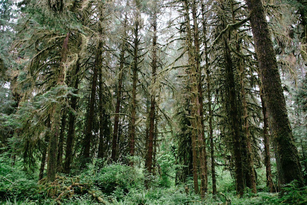
The Grove of the Patriarchs is a short, flat loop on an island in the Ohanapecosh River, in the southeast corner of Mount Rainier National Park, where the old-growth Douglas-firs and western redcedars are typically 250 to more than 1,000 years old. It has been closed to all entry since November 2021, when a flood wrecked the suspension bridge that is the only safe way onto the island. The National Park Service projects it will reopen in 2029.
The 2021 failure was the third time floods had damaged that bridge, so the park is moving the crossing and building a bridge twice as long. This guide covers that history, the year-by-year rebuild schedule from the park's own project documents, why trees this old are rare in a park shaped by fire, and where to find old growth while the island stays closed.
Grove of the Patriarchs Status (October 2026)
The Grove of the Patriarchs is closed to all recreation, and the trail will stay closed until the new bridge is built. The parking lot, restrooms, Eastside Trail and Silver Falls Trail are open until the winter road closure.
| Item | Status as of October 18, 2026 | Source |
|---|---|---|
| Grove loop and island | Closed to all entry since November 2021 | NPS alerts |
| Grove parking lot | Reopened for Silver Falls and Eastside Trail access now that geotechnical drilling and preparation work are complete (it closed in early October) | NPS construction page |
| Silver Falls from the Grove lot | Open, about 1 mile round trip via the Eastside Trail, out and back only | NPS day hiking |
| Stevens Canyon Road | Closes to all visitor traffic at 7 AM on October 26, 2026 (date subject to change) | NPS construction page; NPS road status |
| Ohanapecosh Campground and visitor center | Closed for rebuilding through February 2027 | NPS construction page |
| Bridge construction | Planned for 2028 (the construction page lists the 2027 and 2028 seasons, and some trail pages still say summer 2027) | NPS project FAQ |
| Projected reopening | 2029 | NPS news release, August 19, 2026 |
Don't try to wade across or approach the island from the riverbank. The closure covers the whole island, and the Ohanapecosh runs fast and cold even in late summer.
Why the Grove of the Patriarchs Bridge Keeps Failing
The Grove of the Patriarchs bridge has been damaged by floods three times since 2006, because it sat low over a stretch of the Ohanapecosh River that keeps moving its channel. The park's open-house display boards from August 2026 lay out the full record:
| Year | What happened |
|---|---|
| 1961 | Suspension bridge built during the NPS "Mission 66" building program |
| November 2006 | High water and drift damage the bridge; it closes |
| 2007 | Bridge repaired and reopened, with the deck rebuilt without its steel support frame. From then on it carried one person at a time |
| December 2015 | Minor flood damage from high water and drift |
| November 2021 | Bridge significantly damaged by high water and drift, then closed and removed |
The 2006 flood was the big one for the whole park. Nearly 18 inches of rain fell in about 36 hours, washing out roads and campgrounds and closing Mount Rainier National Park for six months, until May 5, 2007. The park's own flood report says the debris-laden Ohanapecosh River destroyed the suspension bridge to the island, buried the grove in a layer of silt four feet deep and knocked its boardwalk off its foundations (NPS 2006 flood report).
The park did consider simply putting a new bridge back in the same spot. According to the project timeline, it evaluated an in-kind replacement in 2023 and then, in its 2024 design review, recommended relocating. The project page gives the reason directly: the old site is prone to bed scour and erosion as the river migrates (NPS planning page). A fourth bridge at the same crossing would probably have met the same fate.
The New Bridge and Trail: What Changes in 2029
The new Grove of the Patriarchs bridge will be a 215-foot suspension bridge set 30 to 35 feet above the riverbed, about double the 110-foot length of the 1961 bridge. Those figures come from the project FAQ dated August 26, 2026, and match the August news release; the project planning page gives a slightly higher 35 to 40 feet. The changes that matter for visitors:
- No more one-at-a-time crossing. The deck is 5 feet wide and designed for two-way traffic.
- No more bounce. An integrated stiffening truss is meant to stop the sway. Kids who loved the wobble will be disappointed.
- A gentler approach. The bridge grade is under 4.5% to suit a variety of users.
- A new location. The crossing moves about half a mile south of the old one, and roughly half a mile of new trail will link it to the grove.
That last point means the walk you remember will change. The NPS has not published a final round-trip distance for the new route, so treat any "1.1-mile loop" figure as a description of the old trail, not the future one.
The display boards also give a schedule:
| Year | Milestone |
|---|---|
| 2021 | Bridge closed |
| 2022 | Emergency funding approved for replacement |
| 2023 | Same-location replacement evaluated |
| 2024 | Design review recommends relocating the bridge |
| 2025 | Longer, higher bridge approved; siting and geophysics |
| 2026 | 30% design (June), open houses (August), geotechnical drilling (October) |
| 2027 | Final design, environmental compliance, contractor bidding, materials ordered |
| 2028 | Bridge and trail construction, April to October |
| 2029 | Projected opening of the bridge and trail |
Construction will use a highline cable system to fly materials across the river instead of driving heavy equipment through the root zones of the old trees. Work is also timed around nesting surveys for the northern spotted owl and the marbled murrelet, two threatened birds that depend on old-growth forest. The murrelet is a seabird that flies up to 55 miles inland to nest high in mossy old trees, according to the same boards.
A 2029 date depends on funding and weather holding. Before planning a trip around the reopening, check the project page and the park's construction updates.
How Old Are the Trees in the Grove of the Patriarchs?
The trees in the Grove of the Patriarchs are typically 250 to more than 1,000 years old, according to the NPS project boards. The big ones are Douglas-fir and western redcedar, with western hemlock and Pacific silver fir mixed in (NPS trailhead page). The NPS has not published measurements for individual trees in the grove.
What makes that age unusual is fire. The NPS scientific monograph The Forest Communities of Mount Rainier National Park (Franklin and colleagues, 1988) reports that wildfires have occurred on about 90% of the park's existing stands, and estimates the natural fire rotation before European settlement at about 465 years (forest dynamics chapter). Fire, in other words, has reset most of the park's forest at some point in its history.
The Ohanapecosh valley is a clear case. A major fire episode around 1230 AD affected about 25,000 hectares of forest across the park, and stands of that roughly 750-year age class still dominate much of the Ohanapecosh River drainage. The forest around Ohanapecosh Campground, under 2 miles downstream of the grove, is younger still: it grew back after one or more fires around 1703. Trees older than 1,000 years would predate the 1230 episode, so the grove's oldest trees either escaped it or survived it.
A plausible explanation is the island itself. With river channels on both sides and a wet, low valley floor, the grove may have had natural firebreaks that the surrounding slopes lacked. We could not find a published study that tests this for the grove, so treat it as a reasonable hypothesis rather than a finding. The same monograph does note that the park's oldest forests grow in protected valley bottoms, where some stands have survived for more than 1,000 years, and it lists one of those stands farther up the same river, near where Chinook Creek joins the Ohanapecosh.
The Grove of the Patriarchs Trail, Before the Closure
The Grove of the Patriarchs trail was a flat, roughly 1.1 to 1.5-mile walk with almost no climbing, starting just inside the Stevens Canyon Entrance. Published distances differ, partly because of the loop on the island:
| Detail | Figure | Source |
|---|---|---|
| Distance | 1.1 miles round trip | NPS trailhead page |
| Distance | 1.3-mile loop, about 1 hour | NPS day hiking page |
| Distance | 1.5 miles round trip | WTA |
| Elevation gain | About 50 feet | WTA |
| High point | About 2,200 feet | WTA |
| Season | Lot open roughly May through October | NPS trailhead page |
| Dogs | Not allowed (pets are banned on park trails except the Pacific Crest Trail) | NPS pets page |
The self-guided route followed the Ohanapecosh from the parking lot, crossed the short suspension bridge, and finished as a loop among the big trees on the island.
There is no view of Mount Rainier from the grove. You are on a valley floor under a closed canopy, and the summit is hidden behind ridges. That matters for planning, because the same drive that takes you to Ohanapecosh also takes you to some of the park's best mountain views.
Ohanapecosh Weather: The Drier Side of the Park
Ohanapecosh is one of the driest and least snowy developed areas in Mount Rainier National Park. Its long-term average precipitation is about a third lower than at Paradise, and its snowfall is about a fifth of what Paradise gets. That makes the Grove area a good fallback when the high country is socked in.
These are the period-of-record monthly means for the park's three long-running weather stations from the Western Regional Climate Center (Ohanapecosh, Longmire and Paradise precipitation and snowfall tables). The records start between 1909 and 1927, depending on the station, and run to about 2012, and not every year is complete:
| Average (inches) | Ohanapecosh (about 1,950 ft) | Longmire (about 2,760 ft) | Paradise (about 5,400 ft) |
|---|---|---|---|
| Annual precipitation | 77.6 | 81.0 | 115.5 |
| Annual snowfall | 149 | 176 | 680 |
| May precipitation | 3.0 | 4.3 | 5.0 |
| June precipitation | 2.4 | 3.5 | 4.3 |
| July precipitation | 0.9 | 1.4 | 1.7 |
| August precipitation | 1.4 | 1.9 | 2.5 |
| September precipitation | 3.0 | 3.8 | 5.3 |
| October precipitation | 6.3 | 7.8 | 10.1 |
Two patterns stand out. From May through October, Ohanapecosh averages roughly 38 to 47% less precipitation than Paradise each month. And snow there is mostly a December-to-March event, while Paradise has recorded snow in every month of the year.
The practical takeaway: on a showery day when the mountain is wrapped in cloud, the low forest walks around Ohanapecosh and Stevens Canyon are drier and more pleasant than anything at Paradise, and an old-growth forest looks good in soft gray light anyway. On a clear day, do both. Our Mt. Rainier visibility forecast scores whether the summit is likely to be out, using a weighted atmospheric model of cloud, humidity and haze. Check it in the morning to decide whether to drive up Stevens Canyon Road toward Reflection Lakes and Paradise or stay low among the trees. The Mt. Rainier weather guide explains how conditions change with elevation in more detail.
Old-Growth Walks to Do While the Grove Is Closed
The best substitute for the Grove of the Patriarchs right now is Silver Falls via the Eastside Trail, which starts from the same parking lot and runs through the same Ohanapecosh old growth. Here are the short forest walks the NPS lists, with their 2026 status:
| Walk | Area | Distance (NPS) | Status, fall 2026 |
|---|---|---|---|
| Silver Falls via Eastside Trail | Grove of the Patriarchs lot | About 1 mile round trip, 45 min | Open until Stevens Canyon Road closes October 26 |
| Silver Falls from Cowlitz Divide Trailhead | Stevens Canyon Road | Out and back | Open until October 26; no loop this year |
| Box Canyon Loop | Stevens Canyon Road | 0.5-mile loop | Open until October 26 |
| Twin Firs Loop | Nisqually to Longmire road | 0.4-mile loop | Open; this road is normally kept open in winter |
| Trail of the Shadows | Longmire | 0.7-mile loop | Open |
| Hot Springs Nature Trail | Ohanapecosh Campground | 0.5-mile loop | Campground trailhead closed; Ohanapecosh rebuild runs to February 2027 |
| Carbon River Rain Forest Trail | Carbon River | 0.3 mile | No practical access since the Fairfax Bridge on SR 165 closed in 2025 |
Silver Falls is the obvious pick. The NPS describes a forceful 60-foot drop into an amphitheater surrounded by old-growth forest. Stay behind the barriers. The NPS Silver Falls page warns that the rocks along the river are slippery and the water is turbulent and dangerously cold, and asks visitors not to approach the river's edge.
After October 26, the whole Ohanapecosh side is behind the winter gate on Stevens Canyon Road. For a forest walk in winter, use the Nisqually entrance side instead. Twin Firs and Trail of the Shadows are on the road that the park keeps plowed to Longmire. For more trail options by area, see our guide to hikes in Mount Rainier National Park.
Frequently Asked Questions
Is the Grove of the Patriarchs open?
No. The Grove of the Patriarchs has been closed to all entry since November 2021, when floods wrecked the suspension bridge to the island. The parking lot is open for Silver Falls and the Eastside Trail until Stevens Canyon Road closes for winter on October 26, 2026.
When will the Grove of the Patriarchs reopen?
The National Park Service projects a 2029 reopening. Final design and environmental compliance are scheduled for 2027, and construction of the new bridge and trail for April to October 2028.
How long is the Grove of the Patriarchs trail?
The old trail was about 1.1 to 1.5 miles round trip, depending on the source, with roughly 50 feet of elevation gain. The new route crosses the river about half a mile south of the old bridge and adds about half a mile of new trail, but the NPS has not published a final distance.
How old are the trees in the Grove of the Patriarchs?
The Douglas-firs and western redcedars on the island are typically 250 to more than 1,000 years old, according to the NPS.
Can you see Mount Rainier from the Grove of the Patriarchs?
No. The grove sits on the valley floor under a closed canopy, and ridges hide the summit. For a mountain view, drive up Stevens Canyon Road toward Reflection Lakes and Paradise.
Planning an Ohanapecosh Day
The Grove of the Patriarchs trailhead sits just inside the Stevens Canyon Entrance, a short drive off SR 123. From Packwood, the nearest town with lodging and gas, it is about 13 miles and 20 minutes. There's no gas inside the park.
A good day from the southeast entrance goes like this:
- Morning: Check the live Rainier forecast. If the summit looks clear, head up Stevens Canyon Road first, while the mountain is out. Box Canyon, Reflection Lakes and Paradise are all on that road.
- Midday: Drop back down for Silver Falls from the Grove lot. Forest walks don't need clear skies.
- If cloudy all day: Reverse it and spend more time low. Ohanapecosh's lower rainfall makes it the better half of the park on a gray day.
The park entrance fee is $30 per private vehicle, valid for seven days; our Mount Rainier entrance fee guide covers passes and fee-free days. For everything else that is open or closed this season, including Sunrise and the fire closures, the Mount Rainier National Park guide keeps the full list.
When the bridge reopens, the grove will deserve the same plan. Walk the island when the forecast says the mountain is hidden, and save the clear hours for the views above.
More Articles
Hikes in Mount Rainier National Park: Best Trails by Area
Hikes in Mount Rainier National Park by area, with 2026 closures, snow-free timing and the odds of a clear summit by month and hour.
Mount Rainier National Park Guide: Seasons, Areas and Odds
Mount Rainier National Park guide: fall 2026 closures, fees, the five park areas, and 10 years of cloud data on when you will actually see the mountain.
Packwood WA: Mount Rainier's Quiet Gateway Town Guide
Packwood WA guide: drive times to Rainier, where the mountain shows from town, what's open in fall 2026, and what the morning sky says about the summit.