Packwood WA: Mount Rainier's Quiet Gateway Town Guide
Packwood WA guide: drive times to Rainier, where the mountain shows from town, what's open in fall 2026, and what the morning sky says about the summit.
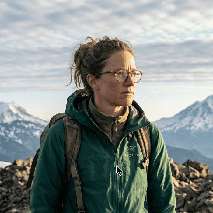
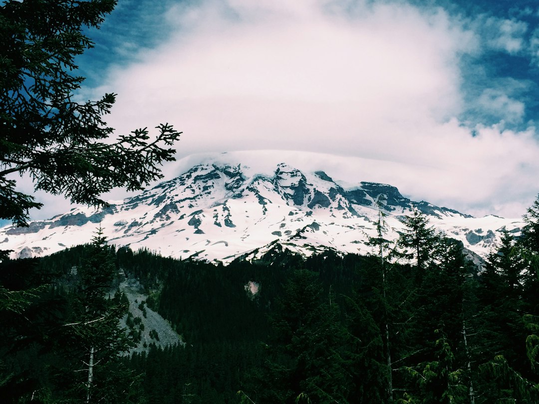
Packwood, WA is a small mountain town on US Highway 12 in eastern Lewis County, about 11 miles south of Mount Rainier National Park's Ohanapecosh area. The 2020 census counted 319 people in the Packwood census-designated place and about 1,000 in its 98361 ZIP code area. It sits at 1,053 feet in the upper Cowlitz River valley, with the Goat Rocks Wilderness to the southeast and White Pass 20 miles up the highway.
Most people know it as the quiet back door to Rainier. That is true for about five months a year. The rest of the time, Packwood's relationship with the mountain changes, and knowing how it changes is the difference between a great base and a long detour.
Where Packwood WA Is, and How Long It Takes to Get Anywhere
Packwood is about 2.5 to 3 hours from Seattle, 3 hours from Portland and under 2 hours from Yakima. It is closer to the park's southeast corner than to anything else, which is the whole point of staying there.
The table below uses routed road distances from the Packwood Visitor Center on US 12. Times are for a car in normal traffic. Mountain roads run slower in practice, and the park's 2026 construction adds its own delays (more on that below).
| Destination | Distance | Typical drive | Open to cars |
|---|---|---|---|
| Ohanapecosh area (SR 123) | 11 mi | 17 min | Road open; campground and visitor center closed in 2026 |
| Stevens Canyon Entrance | 13 mi | 20 min | Until Oct 26, 2026 |
| Box Canyon | 23 mi | 40 min | Until Oct 26, 2026 |
| Reflection Lakes | 31 mi | 1 hr | Until Oct 26, 2026 |
| Paradise, via Stevens Canyon | 34 mi | 1 hr 10 min | Until Oct 26, 2026 |
| Tipsoo Lake / Chinook Pass | 27 mi | 45 min | Until the passes close for winter (estimated mid- to late November 2026) |
| Paradise, via Skate Creek Rd and Ashford | about 45 mi | about 1 hr 45 min | Skate Creek Rd is often gated in winter |
| Paradise in winter, via Morton and Elbe | about 82 mi | about 2 hr 15 min | Longmire to Paradise subject to daily gate |
| White Pass Ski Area | 20 mi | 30 min | Year-round on US 12 |
| Mount St. Helens, Windy Ridge | 52 mi | 1 hr 40 min | Usually late June to early November |
| Seattle | 106 to 112 mi | 2.5 to 3 hr | Year-round via I-5 and US 12 |
| Yakima | 73 mi | 1 hr 50 min | Year-round over White Pass |
Two things stand out. Paradise, the park's main destination, is an hour away in summer, which makes Packwood a reasonable Paradise base, not just an Ohanapecosh base. And the winter row is twice as long, because Stevens Canyon Road, Cayuse Pass and Skate Creek Road all close. If you want Rainier in winter, Ashford is the better town. The Mount Rainier map guide shows how the entrances fit together.
There is no gas inside the park. Packwood has fuel, including the Packwood Chevron on US 12, so fill up in town before heading to Ohanapecosh and Stevens Canyon.
Can You See Mount Rainier From Packwood?
Yes, from most of the town center you can see the top 4,000-plus feet of Mount Rainier, looking north-northwest over a low ridge about three miles away. From the west end of town and from the Timberline neighborhood to the northeast, you mostly can't.
To check this, we ran a line-of-sight test on public terrain tiles (built largely from USGS elevation models) from points across the valley floor to Rainier's 14,411-foot summit, which is 17.5 miles away. It allows for Earth's curvature and normal atmospheric bending. The results:
| Spot in or near Packwood | Summit visible? | Mountain showing above the ridge |
|---|---|---|
| Blue Spruce Saloon area, US 12 | Yes | About 4,400 ft |
| Packwood Visitor Center / Hotel Packwood | Yes | About 4,200 to 4,400 ft |
| Packwood Brewing Co. | Yes | About 4,400 ft |
| Cliff Droppers, south end of US 12 strip | Yes | About 2,900 ft |
| Packwood Airport, west side | No | Hidden by about 1,200 ft |
| Timberline, near Packwood Lodge | No | Hidden by about 2,500 ft |
From the main strip, everything above roughly 10,000 feet clears the ridge. That is the summit dome plus the upper glaciers, and it sits about 8 degrees above the horizon. For comparison, Rainier rises less than 3 degrees above the horizon from Seattle. Seen from Packwood on a clear evening, the mountain looks big.
The view band runs through the commercial center and is lost toward the airport on the west side of town.
There is a catch the terrain data can't see: trees. The model is bare earth. Packwood is full of tall Douglas fir, and in many yards and side streets a single stand of trees blocks the view that the terrain allows. Open stretches of US 12 near the visitor center, the hotel porch and the brewery lot are the reliable places to look. If a cabin listing promises "Rainier views," ask for a photo taken from the deck.
Packwood's Morning Sky Is a Good Summit Forecast
In ten years of modeled cloud data, when Packwood was overcast (80% cloud cover or more) at 8 AM, Rainier's summit got a clear three-hour window that day only 7 to 10% of the time from October to March, rising to about 40% in July and August. When the sky over town was not overcast, the odds rose to between about 60% and 89%.
In that data, the sky over Packwood was a much stronger signal than the sky over Seattle. On overcast Seattle mornings in October, the summit still cleared on 29% of days, against 9% for overcast Packwood mornings. We ran this on ten years (2016 to 2025) of modeled hourly cloud cover from Open-Meteo, using the grid cell nearest Packwood and the grid cell at the summit. A "clear window" means three straight hours at 30% cloud or less between 7 AM and 7 PM. These are modeled grid-cell values, not measured summit visibility.
| Month | Summit clear window, any day | If Packwood is overcast at 8 AM | If Packwood is not overcast at 8 AM |
|---|---|---|---|
| January | 22% | 7% | 63% |
| March | 23% | 8% | 65% |
| May | 35% | 13% | 69% |
| June | 43% | 21% | 67% |
| July | 74% | 42% | 89% |
| August | 69% | 39% | 87% |
| September | 51% | 23% | 76% |
| October | 38% | 9% | 80% |
| November | 23% | 9% | 72% |
| December | 22% | 9% | 69% |
How to use it:
- July and August: a gray morning in Packwood was still followed by a clear summit window on roughly two days in five. On mornings when the gray is low cloud sitting in the valley, the summit cleared on almost half of days. Don't cancel a Paradise trip because of a dull 8 AM sky.
- October: a gray morning is close to a lost day for summit views, at 9%. Use it for Packwood Lake or the river, and save the drive to Paradise for a morning when you can see blue.
- Any month: a clear sky over town is a strong go signal, so leave early rather than waiting for the afternoon.
For a day-by-day call before you leave home, check the live Mt. Rainier visibility forecast. Its score comes from a weighted atmospheric model that combines cloud layers, humidity and precipitation. The best time to see Mt. Rainier guide covers the monthly pattern in more detail.
Packwood as a Mount Rainier Base, Season by Season
Packwood works as a Rainier base from roughly late June to late October, when Stevens Canyon Road links it to Paradise in about an hour. Outside that window it is a White Pass ski town and a Goat Rocks hiking town, and Rainier is a long way around.
Late June to mid-October: the best window. Stevens Canyon Road and SR 123 are open, so Packwood is within an hour of Paradise, Reflection Lakes, Box Canyon and Tipsoo Lake. A sunrise at Reflection Lakes means leaving Packwood about 75 minutes before sunrise to allow for the dark, winding road. September is the value month here. Modeled summit clear odds are still about 50%, and the park counted roughly 30 to 60% fewer visitors in September than in August from 2022 to 2025, according to NPS visitor statistics.
Late October to May: the long way around. Stevens Canyon Road is scheduled to close on October 26, 2026. Cayuse and Chinook passes are estimated to close in mid- to late November 2026, weather permitting, though WSDOT closed them on October 24 in 2025 because of early heavy snow. Skate Creek Road (Forest Road 52), the shortcut to Ashford, is often gated in winter when the snow gets deep; the Forest Service lists its season of use as May to December. That leaves US 12 west to Morton and SR 7 north to Elbe, about 2 hours 15 minutes to Paradise. In winter, a Packwood stay makes more sense for skiing at White Pass, which is 30 minutes away.
May and early June: the in-between. The passes and Stevens Canyon reopen in late spring as the snow is cleared. Modeled summit clear odds are only about 35% in May, so book flexible.
What is open and closed in fall 2026
Packwood's side of the park has more closures than usual this year. Check the NPS road status page on the morning you drive.
- Ohanapecosh Campground is closed for a rehabilitation of its 185 campsites and restrooms, and the visitor center did not open for summer 2026. The park construction page lists the whole Ohanapecosh developed area as closed from October 2026 through February 2027.
- Grove of the Patriarchs has been closed to all entry since flooding in November 2021 damaged its suspension bridge. Preparation work for a new, longer bridge began in October 2026, and its parking lot is closed from October 5 to 31. The NPS expects construction to run through 2028, with the Grove projected to reopen in 2029.
- Silver Falls is still reachable as an out-and-back walk from the Grove of the Patriarchs lot via the Eastside Trail, or from the Cowlitz Divide Trailhead on Stevens Canyon Road while that lot is closed in October. It can't be reached from the closed campground or hiked as a loop.
- Construction delays of up to 30 minutes are posted from 7 AM to 5 PM daily on Stevens Canyon Road near the Grove (including stops for helicopter work) and on SR 123 near the Stevens Canyon junction. That can add an hour to a Packwood to Paradise round trip.
- Sunrise Road is closed to vehicles until further notice because of the Grand Park 2 and Wonderland Complex fires. Walkers and cyclists can still use it.
The park's entrance fee is $30 per car for seven days, and the gates take cards only. The Packwood Visitor Center on US 12 sells the vehicle pass for cash. The Mount Rainier entrance fee guide explains how to make the seven days count. The Mount Rainier National Park guide covers the rest of the park.
Things to Do in Packwood WA Beyond the Park
Packwood has more to do than drive to Rainier: a lake hike into the Goat Rocks Wilderness, a fire lookout with a straight-on Rainier view, a twice-a-year flea market, and an elk herd that walks through town.
Hikes from town
| Hike | Round trip | Gain | Notes |
|---|---|---|---|
| Packwood Lake | 10 mi | about 1,200 ft (WTA) | Old-growth forest to a lake at the Goat Rocks Wilderness edge. Trailhead is on a forest road southeast of town. Snowshoe route in winter |
| High Rock Lookout | 3.2 mi | 1,365 ft | 5,685-ft lookout on a cliff edge, facing Rainier head-on. Reached by forest roads off Skate Creek Rd, which is gated in winter |
| Silver Falls (park) | Out and back from the Grove lot or the Cowlitz Divide Trailhead in 2026 | small | Turquoise falls on the Ohanapecosh River; no loop this year |
| Skate Creek Park | nearly 4 mi of trails | easy | 178-acre state park property on Skate Creek, just outside town |
Published figures for Packwood Lake's elevation gain vary widely, from about 600 feet to WTA's 1,200 feet. The trail rolls in both directions, so plan for the higher number. If you want a Rainier view without paying a park fee, High Rock is the pick. The lookout sits 13.4 miles from the summit and looks straight at it.
For the park itself, the Mount Rainier hikes roundup covers the Paradise and Ohanapecosh trails by difficulty.
Packwood Flea Market
The Packwood Flea Market runs twice a year, over Memorial Day weekend and Labor Day weekend, and dates back to the 1970s. In 2026 the dates were May 22 to 25 and September 4 to 7. Vendors spread along US 12 and the side streets, and the town fills up. If you are coming for Rainier rather than the market, avoid those two weekends, or book months ahead.
White Pass, the elk and the old school
- White Pass Ski Area is about 20 miles east on US 12, with lifts topping out around 6,500 feet. Its new Base Camp Lodge is billed as new for the 2026-27 season. Leech Lake, across the highway, is a summer swim spot and a winter snowshoe loop.
- Elk from the South Rainier herd regularly cross US 12 and graze between businesses. Give them room, and drive slowly at dusk.
- White Pass Country Historical Museum is in Packwood's former elementary school, which closed in 2004 and became a museum in 2007. It covers logging and settlement history from White Pass down to Kosmos.
Where to Eat and Stay in Packwood
Packwood has a handful of restaurants, a brewery, a historic hotel and many cabin rentals, all clustered along US 12.
Food and drink. Packwood Brewing Co. has fire pits and a beer garden. Cliff Droppers is known for its elk burger and the Tatoosh Burger. The Blue Spruce Saloon and Grill is the late-night option. The Mountain Goat is the bakery and coffee stop for an early start. Hours shrink in the off-season, so check before you count on dinner after a long day in the park.
Lodging. The Historic Hotel Packwood dates to around 1912 and reopened in 2022 after a year of remodeling. It has nine rooms and a long covered porch on the main street, one of the spots where the terrain allows a summit view. Packwood Lodge and other motels sit along US 12. Most visitors book cabins and A-frames on rental sites, which fill fast for July, August and the flea market weekends.
Lodging near Paradise itself is limited and books out early, so Packwood and Ashford take most of the overflow. If your plans center on the Nisqually side or a winter visit, stay in Ashford. If they center on Paradise in summer, Stevens Canyon, Chinook Pass or White Pass, Packwood is the quieter choice and often the cheaper one.
Before you book: floods, fire and phone signal
Packwood sits on the Cowlitz River floodplain, and the river can flood. In December 2025 the USGS gauge at Packwood crested at about 12.2 feet, just above major flood stage, and the local fire chief reported more than 60 rescues. Downstream, floodwater covered US 12 in Randle. Riverside rentals with a "river view" are exactly the ones at risk in a winter storm. In summer, the risk is wildfire. The 2022 Goat Rocks Fire put the Timberline, Goat Rocks and High Valley neighborhoods under Level 3 "Go" evacuations and closed US 12 and SR 123 for a time.
Neither is a reason to skip Packwood. Both are reasons to check WSDOT and Lewis County alerts before you drive. Mobile coverage fades fast once you leave town for the park, so download maps and the day's forecast while you still have signal.
The Short Version for Planning a Packwood Trip
- Best months: July to September, while Stevens Canyon Road links town to Paradise in about an hour. September gives the best mix of clear odds and space.
- Fall 2026: go before October 26. After that, Paradise is more than two hours away via Morton and Elbe.
- Look up at 8 AM. A clear sky over Packwood means go now. A gray one in October means pick a valley hike instead.
- For the summit view from town, stand on US 12 near the visitor center, the hotel or the brewery, and look north-northwest.
Before you load the car, check the Mt. Rainier visibility forecast for the next few days and plan your Paradise or Reflection Lakes trip around the clearest morning. Heading north instead? See how far Mt. Rainier is from Seattle for the routes back to the city.
More Articles
Mount Rainier National Park Guide: Seasons, Areas and Odds
Mount Rainier National Park guide: fall 2026 closures, fees, the five park areas, and 10 years of cloud data on when you will actually see the mountain.
Paradise Mt Rainier: The Complete Visitor Guide for Every Season
Plan your trip to Paradise at Mt Rainier with trail details, parking tips, wildflower timing, and visibility forecasts.
Mount Rainier Entrance Fee 2026: Passes, Cash and Free Days
Mount Rainier entrance fee for 2026: $30 per car for 7 days, which pass to buy, paying with cash, and how 7 days lift your odds of a clear view.