Aurora Australis: Where and When to See the Southern Lights
The aurora australis favors Tasmania and southern New Zealand, not Patagonia. Geomagnetic, cloud and storm data show where and how often it appears.

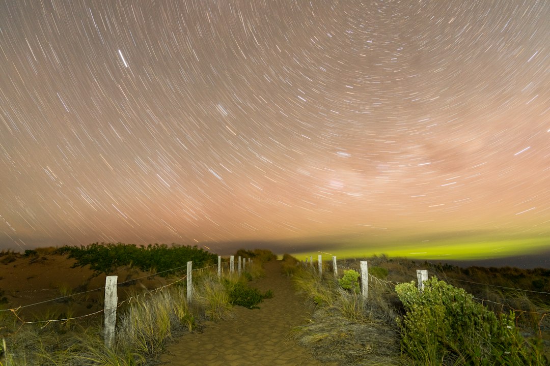
The aurora australis, or southern lights, is the Southern Hemisphere twin of the northern lights: the same solar particles, striking the same oxygen and nitrogen, on the same nights. What differs is the map. The southern auroral zone sits almost entirely over Antarctica and the Southern Ocean, so nearly everyone who sees the aurora australis sees it from far outside that zone, usually as a low glow on the southern horizon.
That raises a practical question. Where on inhabited land do your odds actually look best?
The answer is not "as far south as possible." Ushuaia, often called the southernmost city on Earth, is geomagnetically about level with Dallas. Hobart, 12 degrees of latitude farther north, sits closer to the aurora than Edinburgh does. This guide uses geomagnetic coordinates, a decade of cloud records and the Kp storm record to rank the places people really go, and to show how many nights a year the southern lights are realistically within reach.
What Is the Aurora Australis?
The aurora australis is light emitted by oxygen and nitrogen atoms about 100 to 300 km above the Southern Hemisphere when charged particles from the sun, steered by Earth's magnetic field, collide with them. It is the same process that drives the aurora borealis. Our explainer on what causes the northern lights walks through the full chain from the sun to the sky, and it applies word for word to the south.
Both auroras run on one shared engine. When a storm pushes the northern oval toward Seattle or Scotland, the southern oval swells toward Tasmania and New Zealand at the same moment. They are not always mirror images, though. On 12 May 2001, NASA's IMAGE and Polar spacecraft watched both poles at once and caught bright auroral spots at dawn in the north but at dusk in the south, a single event that University of Bergen researchers described in Nature in 2009.
The colors follow the same rules. Because southern observers usually see the aurora from far away, the high red oxygen layer is often the part that clears their horizon, which is why so many Tasmanian and New Zealand photos glow red and magenta. Our guide to aurora colors explains why distance changes the palette.
Why the Southern Lights Are Seen Less Often
The aurora australis is seen less than the northern lights because there is almost no land under the southern auroral zone. The aurora itself is no rarer in the south. The places to stand are what's missing.
In the north, the auroral zone crosses northern Norway, Sweden, Finland, Iceland, Alaska and Canada. Millions of people live under it. In the south, the matching ring runs over the Antarctic coast and open ocean. The only inhabited spots beneath it are Antarctic research stations and Macquarie Island, a sub-Antarctic part of Tasmania with a small research station.
There is a second twist. Earth's magnetic axis is tilted, and in the south it leans toward Australia. NOAA places the 2025 geomagnetic south pole at 80.85°S, 107.24°E, and the south magnetic dip pole at 63.85°S, 135.08°E, off the Antarctic coast almost due south of Adelaide. That tilt pulls the auroral zone toward Australia and New Zealand and away from South America. It is why Tasmania punches above its latitude and Patagonia punches below it.
Geomagnetic Latitude Decides Where You Can See It
Geomagnetic latitude, your distance from the magnetic pole rather than the geographic one, is the single best predictor of where the aurora australis can appear. The table below gives corrected geomagnetic latitude (AACGM, computed for 2026) for common southern viewing spots, a northern place at the same geomagnetic latitude, and the Kp level each one typically needs.
| Place | Geographic latitude | Geomagnetic latitude | Northern geomagnetic twin | Kp for naked eye, dark site | BOM "northern limit" Kp |
|---|---|---|---|---|---|
| Macquarie Island | 54.5°S | 63.9°S | Reykjavík | 1 to 2 | n/a |
| Stewart Island / Rakiura | 46.9°S | 54.2°S | Vancouver | 5 to 6 | n/a |
| Cockle Creek, Tasmania | 43.6°S | 54.2°S | Vancouver | 5 to 6 | 3 |
| Bruny Island, Tasmania | 43.3°S | 53.9°S | Vancouver | 6 | 3 |
| Invercargill, NZ | 46.4°S | 53.7°S | Washington State | 6 | n/a |
| Hobart, Tasmania | 42.9°S | 53.4°S | Washington State | 6 | 3 |
| Dunedin, NZ | 45.9°S | 52.7°S | Edinburgh, Seattle | 6 | n/a |
| Cradle Mountain, Tasmania | 41.7°S | 52.2°S | Toronto | 6 | 4 |
| Lake Tekapo, NZ | 44.0°S | 50.8°S | Chicago | 6 to 7 | n/a |
| Wilsons Promontory, Victoria | 39.0°S | 49.3°S | Boston | 7 | 5 |
| Melbourne | 37.8°S | 48.1°S | New York, Amsterdam | 7 (8 with city light) | 5 |
| Adelaide | 34.9°S | 45.5°S | Between Paris and London | 8 | n/a |
| Sydney | 33.9°S | 43.2°S | Paris | 8 to 9 | n/a |
| Auckland | 36.9°S | 42.6°S | Paris, Dallas | 8 to 9 | n/a |
| Ushuaia, Argentina | 54.8°S | 41.6°S | Dallas | 8 to 9 | n/a |
| Punta Arenas, Chile | 53.2°S | 40.0°S | Los Angeles, New Orleans | 9 | n/a |
| Brisbane | 27.5°S | 36.2°S | Rome | 9, rarely | 8 |
Geomagnetic latitudes from the AACGM-v2 model at ground level for mid-2026. "Kp for naked eye" follows the latitude-to-Kp pattern of the town thresholds in our live aurora forecast, applied to these southern coordinates; below about 48° geomagnetic the values are an extrapolation, since the tool has no towns that far from the pole. The last column is the Kp at which the Bureau of Meteorology's visibility table places the northern limit of aurora visibility in that region.
Two things stand out.
First, the Australian Bureau of Meteorology's table is far more generous than ours. It lists Kp 3 for southern Tasmania, Kp 5 for the Victorian coast, Kp 7 for southern NSW and Kp 8 for southern Queensland. That is the limit of detection: the farthest north a faint glow can show up low on the horizon, often only to a camera. Our column answers a stricter question, the level at which most people would notice it by eye from a dark site. Both are useful, as long as you know which one you are reading.
Second, Patagonia is badly placed. Ushuaia and Punta Arenas sit farther south than any Australian or New Zealand city, yet the magnetic tilt puts them geomagnetically level with Dallas and Los Angeles. When the extreme storm of 10 May 2024 reached Ushuaia, local media called it a unique natural phenomenon that surprised residents.
Want to compare with a northern location you know? Hobart's geomagnetic latitude falls between our Washington State and Seattle forecast pages. Macquarie Island sits level with Reykjavík, where a quiet night is often enough.
Clouds Decide Most Southern Lights Nights
Cloud cover, not latitude, is the biggest difference between Tasmanian and New Zealand viewing sites. The roaring forties push wet westerly air onto western Tasmania and Fiordland, so the wildest, darkest corners are often the cloudiest ones.
We counted the share of winter evenings (May to August) with at least two consecutive hours of cloud at or below 30 percent between 6 PM and 2 AM, the same cloud cut-off our forecast uses for a naked-eye verdict. The two numbers in each row come from two independent weather models, ERA5 and ECMWF IFS.
| Viewing area | Winter evenings with a clear window | Geomagnetic latitude |
|---|---|---|
| Bicheno, east coast Tasmania | 54% | 52.2°S |
| Melbourne | 42 to 48% | 48.1°S |
| Hobart and eastern shore (South Arm, Goat Bluff) | 39 to 49% | 53.4°S |
| Dunedin | 41 to 44% | 52.7°S |
| Wilsons Promontory | 37 to 41% | 49.3°S |
| kunanyi / Mount Wellington summit | 39% | 53.4°S |
| Lake Tekapo and Mount John | 35 to 46% | 50.8°S |
| Bruny Island (The Neck) | 33 to 34% | 53.9°S |
| Punta Arenas | 31 to 35% | 40.0°S |
| Invercargill | 27 to 29% | 53.7°S |
| Stewart Island (Oban) | 20 to 28% | 54.2°S |
| Cockle Creek, far south Tasmania | 18 to 26% | 54.2°S |
| Strahan, west coast Tasmania | 18 to 21% | 52.8°S |
| Queenstown, NZ | 14 to 23% | 52.2°S |
| Cradle Mountain | 15 to 18% | 52.2°S |
| Ushuaia | 16 to 21% | 41.6°S |
Hourly total cloud cover from Open-Meteo's historical archive (ERA5, 2016 to 2025; ECMWF IFS, 2017 to 2025). Each figure is a single model grid point, so treat differences of a few points as noise. The east-west split across Tasmania holds in both models.
Cradle Mountain and the Tasmanian west coast lose most winter evenings to cloud, despite their dark skies. Hobart's eastern shore and the east coast sit in the rain shadow of the western ranges and clear two to three times as often. Moving from Cockle Creek to Hobart costs you less than one degree of geomagnetic latitude, roughly half a Kp step, and buys you about twice as many clear evenings.
New Zealand shows the same trade-off. Stewart Island has the best geomagnetic position of any town in Australia or New Zealand and an International Dark Sky Sanctuary, but it sits in the path of the westerlies. Dunedin and the Mackenzie Basin around Lake Tekapo give up between one and a half and three and a half degrees of geomagnetic latitude, and both clear far more often. Queenstown, a popular base, scores poorly in winter in both models.
How Many Nights a Year Can You See the Aurora Australis?
Averaged over 2017 to 2025, Hobart got about three nights a year when Kp reached our estimated naked-eye level for the city during a clear, dark hour. In the 2024 to 2025 solar maximum, that rose to six or seven.
To get there, we matched every 3-hour Kp reading in the GFZ Potsdam Kp record against each site's darkness (sun more than 10 degrees below the horizon) and its hourly cloud cover, then counted nights when all three lined up at the site's naked-eye Kp level from the first table. Kp is a global index, so a qualifying night means the odds were good, not that a display was confirmed overhead.
| Site | Naked-eye Kp level | Dark nights reaching it, 2017 to 2025 | Of those, nights also clear | Clear storm nights, 2024 to 2025 |
|---|---|---|---|---|
| Hobart eastern shore | 6- | 7 a year | 2.7 to 3.3 a year | 6 to 7.5 a year |
| Bruny Island | 6- | 7 a year | 2.7 to 2.9 a year | 6 a year |
| Dunedin | 6- | 7 a year | 3.0 to 3.9 a year | 6.5 to 9 a year |
| Invercargill | 6- | 7 a year | 1.9 to 2.6 a year | 3.5 to 5 a year |
| Stewart Island | 6- | 7 a year | 1.4 to 2.4 a year | 2.5 to 6 a year |
| Cradle Mountain | 6- | 7 a year | 1.4 a year | 3.5 to 4 a year |
| Lake Tekapo | 7- | 3 a year | 1.0 to 1.6 a year | 2.5 to 4 a year |
| Wilsons Promontory | 7- | 3 a year | 1.0 to 1.4 a year | 2.5 to 4.5 a year |
Kp from GFZ Potsdam (definitive and preliminary values), counted at the minus-third level (6- equals 5.67). Ranges reflect the two cloud models. Moonlight is not removed, so a share of these nights will be washed out by a bright moon.
That is the honest baseline. If you live in Hobart, Dunedin or Invercargill, you get a handful of naked-eye chances a year. You will miss some of them, because many storms peak during daylight or break up within a single 3-hour block (our post on how long the northern lights last has the numbers for that).
A camera changes the picture. At Kp 5-, the level where a long exposure usually picks up a green or red band from Hobart, the same method finds 10 to 12 clear storm nights a year across 2017 to 2025 and 18 to 21 in 2024 to 2025. Our aurora photography guide covers the settings, and they work identically facing south.
Mainland Australia needs the rare big ones. Kp 7- or higher reached a dark Melbourne sky about three nights a year from 2017 to 2025, and about eight a year in 2024 to 2025. The G5 storm of 10 to 11 May 2024 was the first planetary G5 since October 2003, according to the Bureau of Meteorology, which reported aurora images from as far north as Mackay in Queensland. Mackay sits at about 30°S geomagnetic, roughly where Tokyo sits in the north.
Best Time to See the Aurora Australis
The best time to see the aurora australis is on a dark, moonless night between May and August or near the March and September equinoxes, between about 10 PM and 2 AM. Unlike the far north, Tasmania and southern New Zealand keep several dark hours even at midsummer, so summer storms can still be seen.
Season: darkness and the equinox boost
Winter gives you twice as many dark hours, and the equinoxes give you more storms. Both matter.
| Hours of darkness (sun below -10°) on the 21st | Mar | Jun | Sep | Dec |
|---|---|---|---|---|
| Hobart | 10.2 | 13.1 | 10.2 | 6.5 |
| Stewart Island | 10.1 | 13.4 | 10.1 | 5.6 |
| Ushuaia | 9.8 | 14.2 | 9.8 | 2.6 |
| Antarctic Peninsula (64.8°S) | 8.9 | 15.8 | 8.9 | 0.0 |
Computed with the same solar-position routine our forecast uses to decide whether a sky is dark enough for the naked eye.
Hobart still has six and a half dark hours at the December solstice, while Tromsø has no sky that dark for about four months around its midsummer. The southern lights are a year-round possibility in Tasmania, just a less frequent one in summer.
Geomagnetic storms also cluster around the equinoxes. The Russell-McPherron effect describes how the tilt between Earth's field and the sun's makes the solar wind couple more efficiently in March and September, and it works the same way in both hemispheres. In the GFZ Kp record since 1932, 26 to 28 percent of days in March, April, September and October reach Kp 5-, against 15 to 17 percent in December and January. March and September give you both: an equinox storm boost and roughly ten hours of darkness.
The Antarctica cruise problem
Antarctica cruises are a poor bet for the aurora australis. Most voyages sail to the Antarctic Peninsula between November and March, and at 64.8°S the sun stays less than 10 degrees below the horizon all night from early November to early February. It is also further from the aurora than it looks. Its geomagnetic latitude is about 51°S, a little lower than Hobart's. Late-season departures in March are the exception, with up to nine dark hours and an equinox boost, and they give you a real, if modest, chance. Our guide to northern lights cruises explains the same dark-hours math for Norway.
Time of night: magnetic midnight
Aurora activity tends to peak around magnetic midnight, when your position on Earth's magnetic field points directly away from the sun. Here is when that falls at each site:
- Hobart and Tasmania: about 12:05 AM standard time, or 1:05 AM once daylight saving starts on the first Sunday in October.
- Dunedin, Lake Tekapo, Stewart Island: about 11:50 PM standard time, or 12:50 AM during New Zealand daylight saving.
- Melbourne: about 12:30 AM standard time.
- Ushuaia and Punta Arenas: about 1:40 AM local time.
NOAA's general advice is to watch from 10 PM to 2 AM, and these times sit in the middle of that window. Displays can start right after twilight when a storm is already under way, so don't wait until midnight to go out. Do plan to stay past it.
How to Check Whether the Southern Lights Are Visible Tonight
To check whether the aurora australis is likely tonight, start with the planetary Kp index and the solar wind, then check cloud and the moon at your exact spot. Kp is a global number, so a Kp forecast for the north is also a Kp forecast for Tasmania.
Our northern lights forecast shows the current Kp, NOAA's 3-day Kp outlook and the 27-day outlook. Those panels apply to the Southern Hemisphere unchanged. The town-by-town verdicts on that page cover northern locations only, so for the south, read the Kp panel against the table above. If Kp is forecast at 6 and you are in Hobart or Dunedin, the activity side is there. Our explainer on the Kp index covers what each level means, and the solar storm guide explains why storm timing is so hard to pin down.
Then run the same four-factor check that applies anywhere:
- Activity. Is Kp reaching the level for your geomagnetic latitude? The Bureau of Meteorology's Space Weather Forecasting Centre issues Aurora Outlooks (3 to 7 days ahead), Watches (up to 48 hours ahead) and Alerts (activity in progress). All times there are in UT.
- Clouds. Check satellite imagery and the hourly cloud forecast for your spot. If the west is socked in, head for the east coast in Tasmania, or toward Dunedin or the Mackenzie Basin in the South Island.
- Darkness. At least an hour after sunset, more in summer.
- Moon and light. A bright moon or a town glow to the south can turn a naked-eye display into a camera-only one.
Face south over a low, open horizon such as a beach, headland or lake. At Kp 5 or 6 from Tasmania, the aurora usually sits as a grey-green arc low in the south with pale rays above it. Give your eyes 20 minutes in the dark, and use your phone's night mode to confirm what you are seeing.
Southern Lights Names and History
People in Australia and New Zealand were naming the aurora australis long before it had a Latin name. In New Zealand te reo Māori calls it Tahu-nui-a-rangi. Rakiura, the Māori name for Stewart Island, means "glowing skies", a reference to the southern lights. In Australia, Aboriginal traditions commonly associate the aurora with fire. The Gunditjmara people of coastal western Victoria called it puae buae, meaning "ashes."
One of the best-documented early European records comes from James Cook's second voyage. In February 1773, Lieutenant Richard Pickersgill reported "something like the Aurora Borealis," and William Wales, the astronomer aboard the Resolution, watched and described it over the following nights.
The Bottom Line on the Aurora Australis
The aurora australis is not rarer than the northern lights. It is simply farther from where people live. For the best odds on inhabited land, go to southern Tasmania or the south of New Zealand's South Island, choose the side of the island that sits in the rain shadow, and go near the equinoxes or in the long nights of winter. Skip Patagonia unless a historic storm is forecast. When a storm warning appears, watch the Kp numbers on our live aurora forecast, check your local clouds, face south, and stay out past midnight.
More Articles
What Causes the Northern Lights? The Science Behind the Aurora Borealis
What causes the northern lights? The sun sends charged particles that hit our atmosphere near the poles. The full science, in plain English.
The Kp Index, Explained: Why the Aurora Number Is Not a Promise
The kp index is a 0 to 9 scale of geomagnetic activity. Here is what the aurora number really means, and why a high value is no promise.
How to Photograph Northern Lights: Camera and Phone Settings
How to photograph northern lights: real camera and phone settings, plus why your lens records aurora on nights your eyes see almost nothing.