Mount Rainier Wonderland Trail: Permits, Route and Odds
Mount Rainier Wonderland Trail guide: the 93-mile loop, permits, the 61-mile food carry since Mowich closed, camp melt-out and 10-day cloud odds.
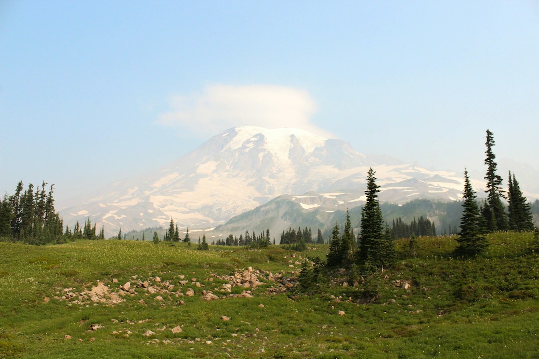
The Mount Rainier Wonderland Trail is a 93-mile backpacking loop that circles the whole mountain, with about 27,000 feet of climbing and the same again in descent, according to the National Park Service. One permit can cover up to 13 nights, and you need a wilderness permit for every night. The NPS says the trail is typically mostly snow-free from mid-July through the end of September.
That is the classic version. The trail you can plan for in 2027 is a little different. The Fairfax Bridge closure in April 2025 cut road access to Mowich Lake, which used to be one of the three main starting points and food cache sites. That one change reshapes the trip: it creates a 61-mile stretch with no resupply. This guide covers the permit system, the current closures, and that food carry, along with camp melt-out timing and ten years of modeled cloud data showing how many days of a 10-day trip you can expect to actually see the summit.
Wonderland Trail Stats at a Glance
The Wonderland Trail is a strenuous loop with 21 camps on the main route and no flat stretch longer than a few miles. These figures come from the NPS segment table, which adds up to 94.1 miles from Longmire.
| Detail | Figure | Source |
|---|---|---|
| Distance | About 93 miles (94.1 by the NPS segment table) | NPS |
| Elevation gain | About 27,000 ft, plus 27,000 ft of loss | NPS |
| High point | Panhandle Gap, about 6,750 ft | Wikipedia |
| Lowest camp | Ipsut Creek, 2,320 ft (2,473 ft on the NPS Wonderland page) | NPS trip planner aid |
| Camps | 18 wilderness camps + 3 non-wilderness campgrounds, plus 2 on the Spray Park alternate | NPS |
| Typical season | Mid-July to late September | NPS permit FAQ |
| Permit fee (2026) | $12 per person per night, plus $6 per trip; age 15 and under free | NPS permit FAQ |
| Full circuits per year | About 600 reserved + about 300 walk-up | NPS permit FAQ |
| Built | 1915; National Recreation Trail since 1981 | Wikipedia |
Pets, campfires and bikes are banned in the backcountry, and full-circuit hikers must use designated camps rather than cross-country zones.
Is the Wonderland Trail Open in 2026?
No. The full Mount Rainier Wonderland Trail is closed until further notice, which in practice likely means the rest of the 2026 season, and the NPS is not issuing full-circuit permits. The cause is a cluster of wildfires in the north and northeast of the park: the Grand Park 2 Fire and the West Fork, Garda Falls and Pigeon fires, which the NPS groups as the Wonderland Complex.
As of the NPS alerts page (updated September 24) and the trail conditions page (updated September 28):
- The northern arc is closed. The Wonderland Trail is closed from the Carbon River Suspension Bridge toward the White River area, along with the Northern Loop and its camps. The NPS pages describe the far end slightly differently (White River Campground, Frozen Lake near Sunrise, or Summerland), so check the trail conditions table before you build any east-side trip.
- Sunrise Road is closed to cars for the rest of the 2026 season. Walkers and cyclists may use it.
- The Fryingpan Creek trailhead and connector are closed for construction, and the upper Fryingpan Creek crossing is out. Summerland is still reachable along the Wonderland from White River Campground.
- Bear poles started coming down on October 4. Late-season backpackers need a bear canister.
- The west and south sides are open. Longmire to Mowich Lake, and White River around the south to Longmire, are listed as snow-free with notes about missing footlogs and water sources.
None of this is permanent, but the Fairfax Bridge problem is a slower fix than the fires. In January 2026, WSDOT narrowed the options to replacing the bridge or removing it and keeping SR 165 closed. The money allocated so far covers design and environmental review, and WSDOT plans about 24 months for the federal environmental review alone, before any construction contract. Plan for 2027 on the assumption that Mowich Lake and the Carbon River entrance still have no road access.
How to Get a Wonderland Trail Permit
A Mount Rainier Wonderland Trail permit comes through three channels: an early-access lottery in February, a general on-sale on April 25, and walk-up permits issued no more than one day before your start date. The NPS states plainly that it is "unlikely" anyone will build a full circuit during or after the general on-sale, so the lottery is the realistic route for a planned trip.
| Channel | When | What you get |
|---|---|---|
| Early-access lottery | Applications mid-February to early March | Up to 1,800 winners get an access window between March and April; one reservation each |
| General on-sale | April 25 | Leftover camps, usually partial circuits only |
| Walk-up | Same day or 1 day before, in person | About one third of summer camps; cards only, no cash |
The rest of the process, per the NPS wilderness permit page and FAQ:
- Reservations must be made at least two days ahead and can cover up to 13 nights.
- Pick-up is the day before or the day of your start. If you have not checked in by noon on your start day and did not warn the park, your reservation is canceled and the camps go to walk-ups.
- Your permit is only good for the camps you booked. A single night at Devil's Dream does not cover the rest of the loop.
- The winners' order matters. Earlier access windows see the most camps. Have two or three itineraries ready in both directions before your window opens.
The demand numbers explain why. The NPS says about 600 full Wonderland trips can be reserved each summer, plus about 300 more issued first come, first served. The NPS expects about half of early-access requests to be for the Wonderland, as in past seasons. If you miss out, the walk-up route works best for flexible hikers with fast legs. Arrive at a wilderness information center early, start on a weekday, and be willing to begin somewhere other than Longmire.
The 61-Mile Food Carry
The Wonderland Trail now has only two places to leave a food cache: the Longmire Wilderness Information Center and White River Campground. The NPS food caching page says that, because of the Fairfax Bridge closure, no caching is allowed at Mowich Lake, and caches mailed to Carbon River cannot be returned.
On the map, Longmire and White River look like they split the loop evenly. They don't. Going by the NPS segment mileages, the gap between them is lopsided:
| Stretch (clockwise) | Miles | Gain | Loss | Drivable trailheads along the way |
|---|---|---|---|---|
| Longmire to White River Campground (west and north side) | 61.1 | 19,054 ft | 17,466 ft | None while Mowich Lake is cut off and Sunrise Road is closed |
| White River Campground to Longmire (east and south side) | 33.0 | 8,100 ft | 9,700 ft | Box Canyon, Reflection Lakes, Narada Falls, Cougar Rock |
Whichever way you go, one leg covers 61 miles and most of the climbing: about 70% of the loop's total gain clockwise, or about 64% counterclockwise. At 9 to 10 miles a day, that is six or seven days of food in your pack in one go. In the years when Mowich Lake had road access, the longest stretch between caches was about 34 miles.
What that means in practice:
- Plan to start at Longmire or White River. Starting either place lets you leave the cache for the far end of the long leg at the other one. Starting at a south-side trailhead like Box Canyon just moves the problem.
- Do the 61-mile leg first. Your legs are fresh and the climbing is front-loaded, so it is better to carry the heavy load early than to face it on day five.
- Budget for bulk, not just weight. Six or seven days of food is a lot to fit in one bear canister, and from October the bear poles are gone. Calorie-dense food matters more here than on most trips.
- Sunrise is the wild card. In normal years Sunrise sits on a road and its day lodge sells basic supplies when open, so a friend meeting you there splits the long leg. It is not an option while Sunrise Road stays closed to cars.
- Fuel is hand-delivered only. It can't be mailed, and it can't be cached at Mowich. Rangers often have leftover white gas and canisters late in the season and hand them out for free.
Caches must be in a labeled plastic container (five-gallon buckets are common), with up to five per group per location. Mail them at least two weeks ahead, or drop them off the day before you start.
Clockwise or Counterclockwise?
Direction does not change the total effort on the Wonderland Trail; clockwise and counterclockwise from Longmire both climb about 27,150 feet by the NPS segment table. What changes is which climbs you face and when.
| Biggest single climbs | Clockwise | Counterclockwise |
|---|---|---|
| 1 | Maple Creek to Paradise River: 2,500 ft over 7.3 mi | Nickel Creek to Indian Bar: 3,200 ft over 6.8 mi |
| 2 | South Mowich to Mowich Lake: 2,400 ft over 4.4 mi | Ipsut Creek to Mowich Lake: 3,000 ft over 5.6 mi |
| 3 | White River to Summerland: 2,300 ft over 7.0 mi | South Puyallup to Devil's Dream: 2,700 ft over 6.5 mi |
| Steepest | Carbon River to Dick Creek: about 770 ft per mile | Klapatche Park from North Puyallup: about 730 ft per mile |
Clockwise spreads the gain into more, shorter climbs. Counterclockwise has fewer but bigger ones, including three climbs of 2,700 feet or more, and swaps them for long, knee-pounding descents. Pick the direction that matches the itinerary you can actually get permits for. Camp availability is a bigger constraint than any difference in difficulty.
Wonderland Trail Camps and Melt-Out Timing
All 18 wilderness camps on the Wonderland Trail sit between about 2,300 and 6,250 feet, and the NPS rates every camp above roughly 4,900 feet as still "melting" in an average July. This table follows the clockwise order from Longmire, with elevations and melt-out ratings from the NPS Wilderness Trip Planner Aid.
| Camp | Miles from Longmire (clockwise) | Elevation | July rating | Notes |
|---|---|---|---|---|
| Pyramid Creek | 3.3 | 3,765 ft | Clear | No group site |
| Devil's Dream | 5.8 | 5,060 ft | Melting | No water at camp in late season |
| South Puyallup River | 12.3 | 4,000 ft | Clear | Below a wall of columnar lava |
| Klapatche Park | 16.4 | 5,515 ft | Melting | No group site; water at St. Andrews Lake |
| North Puyallup River | 19.0 | 3,750 ft | Clear | |
| Golden Lakes | 24.1 | 5,130 ft | Melting | |
| South Mowich River | 29.9 | 2,605 ft | Clear | |
| Mowich Lake* | 34.3 | 4,934 ft | Melting | No road access since 2025 |
| Ipsut Creek | 39.9 | 2,320 ft | Clear | Lowest camp |
| Carbon River | 43.9 | 3,195 ft | Clear | |
| Dick Creek | 45.2 | 4,185 ft | Melting | No group site |
| Mystic | 48.9 | 5,570 ft | Melting | |
| Granite Creek | 53.0 | 5,765 ft | Melting | |
| Sunrise Camp | 57.6 | 6,245 ft | Melting | Highest camp |
| White River* | 61.1 | 4,219 ft | Clear | Food cache |
| Summerland | 68.1 | 5,940 ft | Melting | Below Panhandle Gap |
| Indian Bar | 72.8 | 5,120 ft | Melting | No water between here and Nickel Creek |
| Nickel Creek | 79.6 | 3,385 ft | Melting/clear | |
| Maple Creek | 83.2 | 2,815 ft | Melting/clear | |
| Paradise River | 90.5 | 3,805 ft | Clear |
*Non-wilderness campground. Elevations are from the trip planner aid; the NPS Wonderland page gives slightly different figures for some camps (Ipsut Creek is 2,473 ft there), with gaps of up to about 270 feet between documents (South Puyallup River is 4,266 ft there). Cougar Rock Campground, near the end, is booked separately on Recreation.gov.
The pattern is simple: the camps that stay snowy longest are the ones you most want to sleep in. Klapatche, Golden Lakes, Mystic, Summerland and Indian Bar are the scenic high camps, and all of them are still melting out in an average July. In a heavy snow year, Panhandle Gap above Summerland can hold steep snow late into summer, so check the trail conditions page before you go. For year-to-year variation, the Paradise snow station at 5,150 feet has melted out anywhere from May 31 (2015) to August 21 (2011) since 2011, with a median around July 9, according to the NRCS Paradise SNOTEL station data in our Skyline Trail guide.
Best Time to Hike the Wonderland Trail: Snow, Rain and Summit Odds
The best time to hike the Wonderland Trail is the second half of July through mid-August. In ten years of modeled weather, a 10-day trip in that window averaged seven or eight days with a clear view of the summit, with little rain and no modeled snow. Trips starting in late September averaged about five clear days, and nearly one in five had modeled snow at about 4,000 feet.
To put numbers on that, we ran ten summers of modeled hourly weather (Open-Meteo historical reanalysis, 2016 to 2025) for every possible 10-day trip start. Cloud cover comes from the grid cell covering Rainier's summit area. A "clear day" means at least three straight daylight hours at 30% cloud or less. Rain and snow come from the model grid cell nearest Indian Bar, centered a few miles east of it on the park's southeast side at a modeled elevation of about 4,060 feet, roughly the trail's middle height. These are modeled grid values, not observations at a camp.
| 10-day trip starting | Avg. clear-summit days (of 10) | Trips with 5+ clear days | Trips with a 4+ day stretch of no view | Avg. wet days (≥2.5 mm) | Trips with any snow at ~4,000 ft |
|---|---|---|---|---|---|
| Jul 1-15 | 7.0 | 75% | 25% | 1.1 | 0% |
| Jul 16-31 | 8.3 | 99% | 1% | 0.5 | 0% |
| Aug 1-15 | 7.0 | 95% | 19% | 1.0 | 0% |
| Aug 16-31 | 6.6 | 82% | 21% | 0.7 | 0% |
| Sep 1-15 | 4.9 | 59% | 44% | 1.5 | 4% |
| Sep 16-30 | 4.8 | 56% | 49% | 2.8 | 19% |
| Oct 1-15 | 4.1 | 41% | 66% | 3.8 | 68% |
Three things stand out.
Late July is the sweet spot, and it overlaps the melt-out problem. Trips starting July 16 to 31 almost never went four days without a summit view. But in an average year, that is also when the high camps are only just melting out. Lottery winners who can choose often go in the first half of August, which gives up a little sky in exchange for drier camps and fewer snow patches.
September trades sky for solitude. The average drops to about five clear days, and nearly half of September trips hit a stretch of four or more days with no summit view. On a loop whose whole point is seeing the mountain from every side, that is a real cost. It is still a good month: fewer people, fall color, few bugs. Just go knowing you might walk the Puyallup ridges in fog.
Year-to-year swings beat any calendar rule. Across mid-July to early September starts, the average ranged from 5.8 clear days (2025) to 8.6 (2017), and in 2016 and 2024 some 10-day trips in that window got no clear days at all. Smoke matters too; it is not in this dataset, but fire seasons like 2026 can hide the mountain on days the model calls clear.
On the trail, the most useful habit is a check the night before your big view days: Klapatche Park, Spray Park, Sunrise and Summerland. Our live Mt. Rainier visibility score rates whether the mountain is likely to be out, using a weighted atmospheric model of cloud, humidity and haze. If tomorrow looks bad and your permit has any flexibility, a short day at a low camp can push the high ridge into a clearer morning. Our post on the Mt. Rainier recreational forecast explains how to read the NWS mountain forecast, and Mt. Rainier weather covers how conditions change with elevation.
A Realistic Wonderland Trail Itinerary
A comfortable Wonderland Trail itinerary runs 10 or 11 days at 9 to 10 miles a day, partly because the NPS camps are placed where they are and you can't camp between them. Here is a clockwise 11-day plan from Longmire built only from NPS segment distances. It assumes the northern arc reopens and that Mowich Lake is still cut off by road, so you go past it without picking anything up.
| Day | Route | Miles |
|---|---|---|
| 1 | Longmire to Devil's Dream | 5.8 |
| 2 | Devil's Dream to Klapatche Park | 10.6 |
| 3 | Klapatche Park to Golden Lakes | 7.7 |
| 4 | Golden Lakes to Mowich Lake | 10.2 |
| 5 | Mowich Lake to Carbon River (or Spray Park alternate) | 9.6 |
| 6 | Carbon River to Mystic | 5.0 |
| 7 | Mystic to Sunrise Camp | 8.7 |
| 8 | Sunrise Camp to Summerland (food cache at White River) | 10.5 |
| 9 | Summerland to Nickel Creek | 11.5 |
| 10 | Nickel Creek to Paradise River | 10.9 |
| 11 | Paradise River to Longmire | 3.6 |
That is 94.1 miles, with seven to eight days of food leaving Longmire. The short day 6 is deliberate: Carbon River to Mystic climbs about 3,100 feet in 5 miles, including the steepest mile-for-mile pitch on the loop. The Spray Park alternate swaps the Ipsut Creek descent for a high route through one of the park's best wildflower meadows (Eagle's Roost and Cataract Valley camps). It is shorter, and the scenery is better if the sky cooperates.
Faster hikers compress this to seven or eight days by linking camps, which also eases the food problem. The NPS warns that it often sees hikers go beyond their skill level, which usually ends in injury, illness or an early exit. "Nobody knows your skill level better than you," its Wonderland page says. Three thousand feet of climbing with a full pack, day after day, is a different thing from flat miles at home.
Hiking the Wonderland Trail in Sections
You can hike much of the Mount Rainier Wonderland Trail as day hikes or short overnights from road access points, and the south side is the easiest to reach. Several of the best-known short hikes in the park are really pieces of the Wonderland:
- Longmire to Carter Falls and Paradise River follows the Wonderland up the Paradise River. Carter Falls is 2.8 miles round trip. Our roundup of hikes in Mount Rainier National Park has it with stats.
- Narada Falls and Reflection Lakes are both on the trail. The Narada Falls guide and Reflection Lake guide cover parking and the views.
- White River to Summerland and Panhandle Gap is the best day on the east side: meadows, mountain goats and the trail's high point. With the Fryingpan Creek lot closed, it now starts at White River Campground and runs about 7 miles each way just to Summerland.
- Box Canyon to Indian Bar is a quiet overnight along the Cowlitz Divide.
Section trips use the same wilderness permit system, and partial itineraries are much easier to book than full circuits. If the loop doesn't come through in the lottery, a three-night south-side section from White River to Longmire is a strong consolation. It also happens to be the stretch that is drivable at both ends.
Rules and Hazards Worth Knowing
The Wonderland Trail's main hazards are glacial river crossings, late-season snow on steep slopes, and weather changing fast at elevation. Its rules are strict and enforced by rangers who check permits on the trail.
- Rivers rise in the afternoon. Glacier-fed streams run higher as the day warms, and bridges and footlogs wash out. In 2026 the NPS reported the bridge below Martha Falls out and no handrails on a lower Carbon River crossing.
- Water is not everywhere. Devil's Dream has no water late in the season, and there is none between Indian Bar and Nickel Creek. The trail conditions page lists the gaps.
- No pets, fires or bikes anywhere in the backcountry. Use the bear poles or bring a canister; from early October, the canister is the only option.
- Groups of 6 to 12 need camps with group sites, and several camps (Pyramid Creek, Klapatche, Dick Creek) have none.
- Carry the Ten Essentials and a map. Phone signal is patchy, and the Mt. Rainier map guide shows where the trailheads and visitor centers sit.
What to Do Next
For a 2027 Wonderland Trail trip, the timeline looks like this. Through winter, work out two or three itineraries in each direction around the Longmire and White River caches. Apply for the early-access lottery on Recreation.gov in mid-February. Book the moment your window opens in March or April. Then, in early July, watch the trail conditions page and your high camps' melt-out.
In the week before you start, check whether the mountain is actually going to be out. A trip around Rainier in fog is still a good walk, but you came to see the mountain. The live Rainier visibility forecast shows the next ten days. For the wider park, including fees, roads and the other areas, see our Mount Rainier National Park guide.
More Articles
Hikes in Mount Rainier National Park: Best Trails by Area
Hikes in Mount Rainier National Park by area, with 2026 closures, snow-free timing and the odds of a clear summit by month and hour.
Mount Rainier National Park Guide: Seasons, Areas and Odds
Mount Rainier National Park guide: fall 2026 closures, fees, the five park areas, and 10 years of cloud data on when you will actually see the mountain.
Skyline Trail Mount Rainier: Loop Guide, Snow and Cloud Odds
Skyline Trail Mount Rainier guide: the 5.5-mile Paradise loop, which way to hike it, when the snow melts and the odds the summit stays clear.