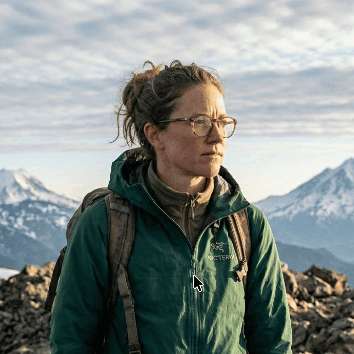
Mt. Rainier News: Latest Updates for Visitors and Locals in 2026
Get the latest Mt. Rainier news including park changes, volcanic activity, road closures, and safety updates for 2026.
Mt. Rainier news heading into spring 2026 covers a wide range of developments. The park dropped its reservation system. A record earthquake swarm rattled the summit last summer. A 104-year-old bridge collapsed, cutting off an entire section of the park through at least 2031. And for the first time since 1998, scientists flew a helicopter through the summit's volcanic gases to check whether magma was rising.
Whether you are planning a summer hike or just checking if the mountain is visible from Seattle today, here is everything worth knowing right now.
No More Timed Entry Reservations
Mount Rainier National Park dropped its timed entry reservation system entirely for 2026. The park first introduced the pilot program in 2024, requiring visitors to book specific two-hour entry windows at both the Paradise and Sunrise corridors. In 2025, officials relaxed restrictions at the Nisqually entrance and kept reservations only for Sunrise during peak months.
The verdict? The system created more problems than it solved. Timed entry produced multi-hour wait times at gates and overfilled parking lots once visitors were inside. Mount Rainier joins Arches and Glacier National Parks in moving away from the model.
The park welcomed roughly 2.4 million visitors in 2025. Without reservations acting as a cap, summer 2026 will be the real test of alternative crowd management strategies. Rangers plan to rely on parking management and traffic flow techniques instead.
The NPS recommends arriving before 7 a.m. or after 4 p.m. to avoid peak congestion. Weekdays are significantly less crowded than weekends. Cell service is spotty throughout the park, so check road conditions and current visibility before you leave home. If you are deciding when to visit, our best time to see Mt. Rainier guide breaks down month-by-month visibility and crowd patterns.
Record Earthquake Swarm Beneath the Summit
The largest earthquake swarm ever recorded at Mount Rainier began on July 8, 2025, at 1:29 a.m. PDT. Over the following weeks, monitoring stations detected more than 1,350 located earthquakes and thousands of additional quakes too small to pinpoint. At its peak, scientists recorded 41 located events per hour on the morning of July 8. The largest individual earthquake was a magnitude 2.4 on July 11, and most of the activity occurred between 1.5 and 4 miles beneath the summit.
By August 25, activity had decayed to fewer than one located event per day.
Should You Be Worried?
No. The USGS Cascades Volcano Observatory kept Mt. Rainier's alert level at GREEN/NORMAL throughout the entire swarm. Scientists at the Pacific Northwest Seismic Network identified 48 repeating earthquake families, with template matching detecting roughly 8,800 distinct events total. The most likely cause: water moving through the hydrothermal system above the magma chamber, creating localized stress changes in the rock.
This is consistent with Mt. Rainier's history as a dormant but monitored volcano. The mountain's last confirmed eruption was roughly 1,000 years ago, and scientists see no indicators of imminent volcanic unrest. For more context on the eruptive timeline, see our Mt. Rainier last eruption deep dive.
Shortly after the swarm made headlines, a viral social media post falsely claimed Mt. Rainier showed signs of "increased seismic tremor activity." Scientists quickly debunked the claim. The erratic signal on one high-altitude station turned out to be radio interference caused by rime ice buildup on the antenna.
First Volcanic Gas Flight Since 1998
On August 4, 2025, USGS gas geochemists conducted the first airborne volcanic gas survey at Mount Rainier in 27 years. An A-Star helicopter carrying specialized sensors circled the 14,411-foot summit, analyzing emissions from the volcanic vents near the crater.
The results were reassuring. Instruments detected water vapor and carbon dioxide, both consistent with low-temperature hydrothermal activity. Sulfur dioxide, the gas most closely associated with rising magma, was not detected. This matches the historical gas profile scientists have observed at Rainier for decades and supports the conclusion that the earthquake swarm was driven by fluid movement in the hydrothermal system, not molten rock pushing toward the surface.
Mount Rainier does not currently have continuous volcanic gas monitoring equipment installed at the summit. The mountain relies on a dense network of seismometers, infrasound sensors, GPS stations, and webcams. The 2025 flight was essentially a targeted checkup, triggered by the swarm, to rule out the possibility that something deeper was happening.
For anyone tracking the volcano's history and risk level, this data point matters. It is the clearest evidence that the swarm was a plumbing event, not a warning sign. More background on Rainier's volcanic hazards is available in our Mt. Rainier eruption guide.
Fairfax Bridge Closure Cuts Off Mowich Lake and Carbon River
The 104-year-old Fairfax Bridge on State Route 165 was permanently closed on April 22, 2025, after inspections revealed a bent and buckling support column along with deteriorated gusset plates across the structure.
This is not a minor inconvenience. The bridge was the only public road access to Mount Rainier's Carbon River area and Mowich Lake, two of the park's quieter and most scenic sections. The closure also blocks access to the nearby Clearwater Wilderness on the Mount Baker-Snoqualmie National Forest.
WSDOT launched a planning study in May 2025, initially evaluating seven alternatives. Two remain under consideration: replacing the bridge on a new alignment just north of the existing structure, or abandoning SR 165 entirely and removing the bridge. The environmental permitting, design, and construction process means access will not be restored until at least 2031.
For hikers who used Mowich Lake as a starting point for the Wonderland Trail or Spray Park, this means rerouting plans entirely. The Carbon River entrance, once the gateway to the park's old-growth rainforest, is effectively off-limits by car for the foreseeable future. Check our Mt. Rainier map guide for alternative access routes.
Lahar Detection System Gets Major Upgrades
While the earthquake swarm grabbed headlines, a quieter but arguably more important development has been underway: significant upgrades to Mt. Rainier's lahar warning system.
Lahars, massive volcanic mudflows, represent a greater threat to surrounding communities than an eruption itself. A large lahar could reach the Puyallup River valley in under an hour. The USGS has been working on a multiyear project to enhance the detection network, creating new Lahar Monitoring Stations with real-time signal transmission and cameras. The current upgrade phase focuses on the Puyallup drainage, the highest-risk corridor.
The upgraded system now sends detection data to two emergency operations centers staffed around the clock: one run by the state of Washington and one by Pierce County. Sirens along the river valleys have been upgraded to include voice warnings in both English and Spanish, flashing lights, and specific verbal instructions based on the type of emergency.
A regional lahar exercise is planned for 2026 to test the new systems and community response procedures. Mt. Rainier at 14,411 feet carries real volcanic hazards, and the monitoring infrastructure is now better than ever.
Road Construction and Closures for 2026
Beyond the Fairfax Bridge situation, three construction projects will affect park access this year.
SR 123 Rehabilitation
A 2.8-mile section of State Route 123, from Laughingwater Creek Bridge to Panther Creek Bridge, will be under construction from April through October 2026. Expect delays of up to 30 minutes. The project replaces substrate to level the road, rehabilitates ditches, and replaces 18 culverts. This route connects the Ohanapecosh area to Stevens Canyon Road.
Ohanapecosh Campground Reopening
The park's popular Ohanapecosh Campground has been closed since 2025 for a full rehabilitation of its 185 campsites and nine bathrooms, plus replacement of the wastewater system and upgrades to electrical and water infrastructure. The improved campground is expected to reopen during the 2026 camping season. Check the NPS website for the latest reopening date.
Fryingpan Creek Bridge Replacement
Construction to replace the Fryingpan Creek Bridge on the Sunrise Road is planned for 2026 through 2029. One lane will remain open during construction, but expect 20 to 30 minute delays for one-way traffic management. This is the primary access road to the Sunrise visitor area, one of the park's best viewpoints for seeing the summit up close.
For a broader view of park access points and routes, our Mt. Rainier map guide covers all the major entrances and road networks.
Entrance Fees and Cashless Policy
Mount Rainier National Park now operates a cashless entrance policy at all entrance stations and campgrounds. Credit and debit cards (Visa, Mastercard, Amex, Discover) are accepted at all kiosks. If you only carry cash, passes can be purchased at partnering community locations before entering the park.
| Pass Type | Cost | Duration |
|---|---|---|
| Private vehicle | $30 | 7 days |
| Motorcycle | $25 | 7 days |
| Per person (walk-up/bicycle) | $15 | 7 days |
| Park annual pass | $55 | 1 year |
| America the Beautiful (resident) | $80 | 1 year |
| America the Beautiful (non-resident) | $250 | 1 year |
The non-resident annual pass price is worth noting. International visitors who previously paid $80 for the standard America the Beautiful pass now face a $250 non-resident fee. If you are visiting from abroad and only planning to see Rainier, the $30 single-park vehicle pass is the better deal.
The park offers eight fee-free days in 2026, including Presidents Day (February 16), Memorial Day (May 25), and Veterans Day (November 11). These days waive the entrance fee for U.S. residents only.
January 2026 Climbing Tragedy
On January 18, 2026, park rangers noticed overdue climbing permits for two climbers who had not been in contact since January 17. Searchers located two non-moving figures near Wilson Glacier the same day. Severe weather prevented helicopter access on January 19, and ground teams reached the site on January 20, confirming the deaths of Ben Watson, 35, and Jiri Richter, 50, at approximately 9,600 feet.
Mt. Rainier has recorded over 425 fatalities since 1897, with roughly 90 being summit climbers. About two mountaineering deaths occur per year from rockfall, icefall, avalanches, falls, and hypothermia.
Winter climbing on Rainier demands serious experience. Weather conditions at elevation bear no resemblance to what you see from Seattle. Summit temperatures rarely rise above freezing even in summer, and winter storms can produce wind chill values below -40 degrees Fahrenheit.
How These Developments Affect Visibility
Several of these news items directly change your ability to see and photograph Mt. Rainier.
The end of the reservation system means more flexibility to chase clear-sky windows. Previously, you needed a reservation for a specific time slot that often did not align with favorable weather conditions. Now you can check the Mt. Rainier visibility forecast, see a high score, and drive straight to the park. Our forecast uses a weighted atmospheric model that combines cloud cover, humidity, wind, and precipitation data, updating every 15 minutes.
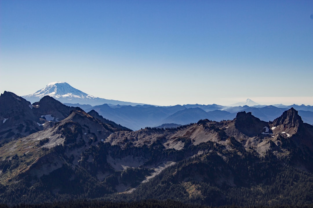
Road construction changes which viewpoints are accessible. With Sunrise Road affected by bridge work and Mowich Lake entirely cut off, your best bets for in-park viewing are Paradise and the Nisqually entrance corridor. But the summit is visible from dozens of locations across the Puget Sound region. Our guide to seeing Mt. Rainier from Seattle covers the best urban and suburban viewpoints that require no park entry at all.
The earthquake swarm has no impact on visibility. But the increased public attention on the volcano has driven more people to check on the mountain, whether out of curiosity or concern. Webcams and live visibility data are the fastest way to confirm the mountain looks the way it should.
Where to Follow Mt. Rainier News
No single outlet covers everything. Here are the sources worth monitoring.
| Source | What It Covers | Update Frequency |
|---|---|---|
| NPS News Releases | Park operations, closures, safety | As needed |
| NPS Alerts & Conditions | Road status, current conditions | Daily in season |
| USGS Volcano News | Seismic activity, volcanic monitoring | As needed |
| PNSN Mt. Rainier | Earthquake data, seismic analysis | Real-time |
| Is It Visible | Visibility forecast, viewing conditions | Every 15 minutes |
For trip planning, pair news updates with real-time conditions. Road closures and construction schedules tell you which routes are open. Visibility scores from our weighted atmospheric model tell you whether the mountain will actually be visible when you get there. The two together save you from driving an hour only to find a closed road or a cloud-wrapped peak.
Frequently Asked Questions
Do I need reservations to visit Mt. Rainier in 2026?
No. Mount Rainier National Park dropped its timed entry reservation system entirely for 2026. You can arrive at any entrance without a reservation. You still need a park entrance pass ($30 per vehicle or a valid America the Beautiful pass). Arrive early on weekends to avoid parking congestion at Paradise and Sunrise.
Is Mt. Rainier going to erupt?
There are no signs of imminent eruption. The July 2025 earthquake swarm was the largest ever recorded at Rainier, but the USGS kept the alert level at GREEN/NORMAL throughout. A volcanic gas flight on August 4, 2025, detected no sulfur dioxide, confirming the swarm was caused by hydrothermal fluid movement rather than rising magma. Scientists continue to monitor the volcano closely.
Can I still access Mowich Lake in 2026?
No. The Fairfax Bridge on SR 165, the only road access to Mowich Lake and the Carbon River area, was permanently closed in April 2025 due to structural failure. WSDOT estimates the replacement process will take until at least 2031.
Is Ohanapecosh Campground open in 2026?
Ohanapecosh has been closed since 2025 for a full rehabilitation of campsites, bathrooms, and infrastructure. It is expected to reopen during the 2026 camping season, but the exact date depends on construction progress. Check the NPS campground page for the latest status.
More Articles
Lake Yamanaka Hotel Guide: Where to Stay for the Best Mt. Fuji Views
Find the best lake Yamanaka hotel for Mt. Fuji views, from luxury resorts and ryokans to glamping and budget pensions.
Kawaguchiko Onsen: Hot Springs with Mt. Fuji Views You Can Time
Kawaguchiko onsen guide with day-use baths, ryokan picks, prices, and the visibility timing most visitors miss.
Aokigahara: Complete Guide to Mt. Fuji's Sea of Trees
Explore Aokigahara, the ancient forest born from Mt. Fuji's lava. Trails, caves, Fuji views, and practical tips.