Myrtle Falls at Mount Rainier: Trail, Views and Best Time
Myrtle Falls is a 0.4-mile walk from Paradise with Mount Rainier right above it. Trail facts, the clearest hours to go, and winter access.

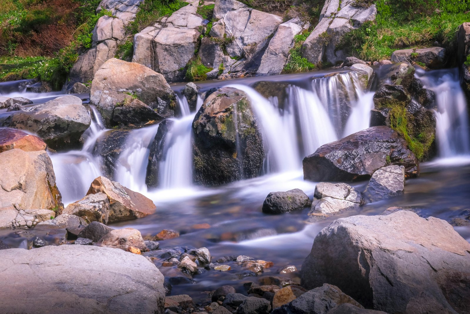
Myrtle Falls is a 60 to 72-foot waterfall on Edith Creek in the Paradise area of Mount Rainier National Park, about 0.4 miles up the paved Skyline Trail from the Paradise Inn. From the viewpoint below the trail, the summit of Mount Rainier rises directly above the falls. That is the shot everyone comes for.
The walk is short. The hard part is the mountain. The summit sits in cloud on a large share of summer days, and when it does, Myrtle Falls is a pleasant cascade in a meadow rather than the postcard. This guide covers the walk itself, then uses ten years of modeled summit cloud data to show which hours and which weeks give you the best chance of the full view. Before you drive up, the live Mount Rainier visibility forecast tells you whether the mountain is out today.
Myrtle Falls Quick Facts
| Detail | Figure | Source |
|---|---|---|
| Height | 60 ft (NPS) or 72 ft (Visit Rainier) | NPS, Visit Rainier |
| Creek | Edith Creek, a tributary of the Paradise River | NPS Nature Notes |
| Distance | 0.8 to 1 mile round trip from Paradise | WTA, NPS |
| Elevation gain | About 130 ft net; WTA says 185 ft, NPS 200 ft | Terrain model; WTA, NPS |
| Elevation at the falls | About 5,550 ft | Terrain model |
| Surface | Paved to the bridge; stairs and dirt to the lower viewpoint | NPS accessibility |
| Summit distance | 4.5 miles, to the north-northwest | Calculated |
| Fee | Park entry, $30 per private vehicle | NPS fees |
| Dogs | Not allowed on trails | NPS pets |
The height figures differ. The National Park Service lists 60 feet, and Visit Rainier lists 72 feet. Either way it is a modest braided cascade, not a giant. It is the setting, not the size, that makes it famous.
How to Walk to Myrtle Falls
The Myrtle Falls trail is the first half mile of the paved Skyline Trail, heading northeast from the Paradise Inn and the Jackson Visitor Center to a footbridge over Edith Creek. It is easy, but it is not flat.
- Park at Paradise. Use the main visitor center lot or the Paradise Inn lot. On sunny summer weekends both fill, so arrive early or late in the day.
- Start at the Muir Steps. The granite stairs behind the visitor center plaza mark the Skyline trailhead. Take the paved path heading east toward Myrtle Falls rather than straight up toward Glacier Vista.
- Climb gently through the meadow. The path rises about 130 feet in total, with a few short, steep pitches. In late July and early August this stretch runs through some of the densest wildflower meadow in the park. Staying on the trail is required by law in the Paradise meadows.
- Take the viewpoint spur. At the footbridge over Edith Creek, a short side path drops down a steep stairway and dirt path to the classic viewpoint. From here the falls are in front of you and the summit is above them.
- Look from the bridge. The small footbridge shows the upper part of the falls. You lose the classic framing, but the mountain is still in view.
Round trip, plan on 30 to 45 minutes with photo time. If you want more, the paved trail keeps going past the bridge toward Golden Gate and the upper Skyline Trail loop.
The NPS describes the stairway to the viewpoint as steep and warns that the area is "treacherous in spring." Take the stairs slowly in wet shoes, and keep children back from the gorge edges. In its September 2025 update, the NPS accessibility page also noted that a section of the trail toward Myrtle Falls was closed for construction, with detours that may include steep slopes and steps. Check current trail status before you go.
Can You See Mount Rainier From Myrtle Falls?
Yes. Myrtle Falls is one of the few waterfalls in the park where the summit is in the same frame as the water. The summit is 4.5 miles away on a bearing of about 343 degrees, which is north-northwest, and it stands roughly 8,850 feet above you.
That geometry matters for the photo. The summit sits about 20 degrees above the horizon from the viewpoint, and the falls drop below eye level in front of you. To fit both, shoot a vertical frame at about 35 mm (full-frame equivalent) or wider, or a horizontal frame at about 24 mm. A phone's main camera held in portrait orientation fits both comfortably. Zoom in and you lose one or the other.
The line of sight is open. In a bare-earth terrain model of the line from the viewpoint to the summit, no ridge between you and the mountain blocks the upper slopes. That is different from many Rainier waterfalls. At Narada Falls the gorge and trees hide most of the mountain, and at Comet Falls you cannot see the summit from the falls at all. At Myrtle Falls, if the sky is clear, you see the whole upper mountain.
If the summit is in cloud, there is no workaround. No nearby angle sees under or around a cloud cap. That is why timing matters more here than at any other short walk at Paradise.
Best Time of Day to Visit Myrtle Falls
The best time of day for the Myrtle Falls view is early morning or the last hour before sunset. In July and August, the summit area is clear about 60 percent of the time at dawn and in the evening, compared with 54 percent in the early afternoon.
The table below comes from ten years (2016 to 2025) of Open-Meteo hourly cloud cover for the model grid cell at Rainier's summit. An hour counts as clear when total modeled cloud cover is 30 percent or less. This is modeled grid-cell data, not a camera at the falls, so read it as relative odds rather than a guarantee. The sunrise and sunset columns use one fixed clock hour per month that falls nearest sunrise or just before sunset, so they are approximate.
| Period | Around sunrise | 9 AM | 1 PM | 4 PM | Before sunset | Either of those two hours |
|---|---|---|---|---|---|---|
| Late June | 42% | 42% | 24% | 33% | 41% | 60% |
| Early July | 52% | 57% | 49% | 53% | 58% | 68% |
| Late July | 68% | 76% | 64% | 71% | 79% | 87% |
| Early August | 60% | 57% | 55% | 56% | 65% | 75% |
| Late August | 54% | 55% | 46% | 44% | 54% | 74% |
| Early September | 46% | 49% | 36% | 41% | 42% | 59% |
| Late September | 35% | 44% | 31% | 32% | 31% | 45% |
| Early October | 38% | 39% | 29% | 37% | 33% | 45% |
Three things stand out.
Midday is the weakest window. The 1 PM column is the lowest or tied for lowest in almost every row; daytime cloud building over the mountain is a likely reason. Unfortunately, 11 AM to 3 PM is also when Paradise is busiest.
Having both ends of the day available raises your odds. In late July, any single hour gives you roughly a two-in-three to four-in-five chance. Being able to go at sunrise or sunset, choosing whichever is clear, raised that to 87 percent in this dataset. Staying in or near the park makes this realistic. Our Mount Rainier lodging guide covers which bases make a dawn start practical.
Late July is the peak. In the same ten years of modeled data, the second half of July was the clearest half-month of the year at the summit, and it overlaps with the start of peak wildflower bloom. If you have one shot at the classic photo, aim for the last two weeks of July.
For hikers who want to know whether a clear morning will last, the Skyline Trail guide breaks the same dataset down by "clear at 8 AM, still clear later." The short version: a clear start usually holds into late morning.
Where the sun sits
The sun never sets behind the summit from Myrtle Falls, so you are never shooting straight into it. Calculated sun positions for the viewpoint:
| Date | Sunrise (PDT) | Sunrise direction | Sunset (PDT) | Sunset direction | Sunset, degrees left of the summit |
|---|---|---|---|---|---|
| June 21 | 5:13 AM | Northeast (53°) | 9:05 PM | West-northwest (307°) | 36° |
| July 15 | 5:29 AM | Northeast (57°) | 8:58 PM | West-northwest (303°) | 39° |
| August 15 | 6:05 AM | East-northeast (68°) | 8:17 PM | West (291°) | 51° |
| September 15 | 6:45 AM | East (85°) | 7:19 PM | West (275°) | 68° |
| October 15 | 7:26 AM | East-southeast (102°) | 6:20 PM | West-southwest (258°) | 85° |
In early summer, morning light comes from your right and rakes across the mountain's eastern flank. Evening light comes from your front left, lighting the western slopes and producing the pink alpenglow most people want. At midday the sun is high behind you, which flattens the glaciers and puts the falls in bright light against a deep-shadowed gorge. Shoot early or late and you trade some shadow in the gorge for far better light on the mountain.
When Is Myrtle Falls Snow-Free?
The Myrtle Falls trail is usually snow-free from early to mid July until mid October. Before that, the paved path and the viewpoint stairs are under snow, and the falls themselves can be buried or partly bridged by snow.
The closest snow record is the Paradise SNOTEL station at 5,150 feet, about 400 feet below the falls. Over 2011 to 2026, the first spring date its snow depth reached zero ranged from May 31 (2015) to August 21 (2011), with a median around July 9. In 2026 the depth sensor read zero from June 7, but the station's snow pillow still held about 10 inches of water then and did not reach zero until June 17, so mid June is the safer reading. The falls sit higher than the station, so the viewpoint can hold snow later.
In fall, the first snow of 2 inches or more at the station usually arrives in mid October, and lasting winter snowpack typically sets in around early November.
Two seasonal trade-offs:
- Flow. Edith Creek is fed by melting snow, so the falls run hardest in early summer while the basin above is still white. By September the falls are noticeably thinner.
- Flowers. The NPS says many flowers are blooming by mid July in most years and the meadows should be very impressive by August 1, which is also when the summit odds are highest. That overlap is why Myrtle Falls is so crowded at the end of July.
If you want strong water and accept lower summit odds, late June through mid July works. If you want the mountain, flowers and clear sky in one frame, late July to mid August is the window.
Myrtle Falls in Winter
In winter, Myrtle Falls is buried under deep snow and the paved trail disappears. The stairs to the viewpoint become a steep snow slope. You can still snowshoe or ski toward the Edith Creek area on a clear day, but you will not see a waterfall, and you should stay well away from the creek gorge, where snow can hide open water and drop-offs.
Status as of November 8, 2026:
- Road. The Longmire-to-Paradise gate closes nightly. Nightly closures began October 29, 2026. Conditions permitting, the gate opens at 9 AM, the uphill gate closes at 3 PM and the downhill gate at 4 PM. Plan to leave Paradise by 3:30 PM (NPS winter travel).
- Chains. Every vehicle, including 4WD and AWD, must carry tire chains in the park from November 1 to May 1.
- Visitor center. The Jackson Visitor Center is open 10 AM to 3:30 PM on weekends and holidays only through January, conditions permitting (NPS hours). Paradise Inn is closed for the season.
- Snow. The Paradise SNOTEL station picked up about 10 inches of snow in a late-October storm, and by November 7 its depth sensor was back to bare ground or close to it, so the trail is patchy rather than fully buried right now. That will change with the next storm.
The gate hours matter for the view. In winter you cannot be at Paradise for sunrise or sunset, so you are stuck with the midday hours. Winter summit odds are also low. In the same modeled data, only about one November-to-March day in six had a three-hour clear stretch at the summit between 9 AM and 4 PM. Check today's Mount Rainier visibility score before committing to the drive and the chains.
Is Myrtle Falls Wheelchair Accessible?
Myrtle Falls is only partly wheelchair accessible. The NPS Paradise page lists the route as "wheelchair accessible with assistance," but its accessibility page describes "several steep sections," says the full view of the falls requires a stairway and steep dirt path, and notes "one stair leading to the bridge" where the upper falls are visible.
For a gentler outing, the NPS suggests turning left at the junction onto the Waterfall Trail, a "relatively flat" 1-mile walk with about 200 feet of gain. Accessible parking and restrooms are at the Jackson Visitor Center and the Paradise Inn lots. The summit is visible from the paved path itself in clear weather, so even without the stairs you get the mountain and the meadow, just not the falls in the same frame.
Who Was Myrtle?
Nobody knows her full name. Myrtle Falls was named in 1907 by Jules Stampfler, a Paradise guide, after Myrtle, a member of one of his climbing parties. According to the place-name record quoted in the park's Nature Notes, "Jules remembered Myrtle but forgot the rest of her name."
Edith Creek, which feeds the falls, has the same story. Stampfler named it in 1907 while putting together a series of stereopticon slides and needing a name for the creek, after a member of one of his climbing parties whose full name he did not remember. He also named Cowlitz Rocks. As the same note's editor points out, despite all the names he handed out, nothing in the park bears his own.
Making More of the Trip
Myrtle Falls takes less than an hour, so most people pair it with something else at Paradise:
- Keep walking. Continue past the bridge toward Golden Gate and back down for a short loop, or commit to the full 5.5-mile Skyline Trail to Panorama Point.
- Add another waterfall. Narada Falls is a short drive down the road toward Longmire and works on cloudy days, when Myrtle Falls loses its backdrop. A few miles farther down, Christine Falls pours through a stone bridge right beside the road, so it is an easy extra stop on the drive out.
- Chase a reflection. Reflection Lakes sits a few minutes east of Paradise on Stevens Canyon Road (closed in winter) and gives the other classic Rainier photo.
- See the rest of Paradise. The Paradise guide covers parking, lodging and the visitor center, and the Mount Rainier hikes roundup lists the longer options.
- Time the light. The Mount Rainier sunrise and sunset guides cover the best golden-hour spots in the park.
If the forecast is cloudy, swap the order. Do Narada Falls and the forest walks first, and keep checking the live summit visibility. Our score comes from a weighted atmospheric model of cloud cover, humidity, precipitation and visibility distance. When it climbs, walk the half mile to Myrtle Falls. The view is only ten minutes from the car, which makes it one of the easiest places in the park to wait out a cloud cap.
More Articles
Paradise Mt Rainier: The Complete Visitor Guide for Every Season
Plan your trip to Paradise at Mt Rainier with trail details, parking tips, wildflower timing, and visibility forecasts.
Skyline Trail Mount Rainier: Loop Guide, Snow and Cloud Odds
Skyline Trail Mount Rainier guide: the 5.5-mile Paradise loop, which way to hike it, when the snow melts and the odds the summit stays clear.
Narada Falls: Mount Rainier's Roadside Waterfall Guide
Narada Falls is Mount Rainier's largest drive-up waterfall. Get directions, the trail, the best time to visit, and rainbow-viewing tips.