Where Is Mount Rainier? Location, Distances and Views
Where is Mount Rainier? In Washington's Cascade Range, 59 miles SSE of Seattle. Coordinates, distances, and which way to look from 13 cities.

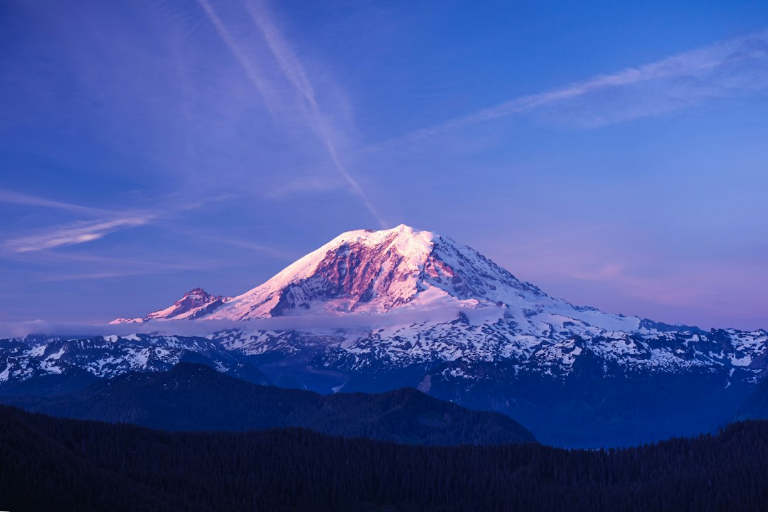
Where is Mount Rainier?
Mount Rainier is in west-central Washington State, in the Cascade Range, about 59 miles (95 km) south-southeast of downtown Seattle and 42 miles southeast of Tacoma. The summit sits in Pierce County at 46.853°N, 121.760°W, near the middle of Mount Rainier National Park. From Seattle you look south-southeast to see it, when the clouds allow; the live Mt. Rainier visibility forecast shows whether it is out right now.
If you want to know where Mount Rainier is, the one-line answer is "southeast of Seattle." The more useful answer depends on why you are asking. Planning a drive, you need the entrance, not the summit. Trying to spot it from a city, you need a compass direction and how high to look. Wondering why it shows up in so many Seattle photos, you need to know how a mountain 60 miles away can look like it is sitting on the edge of town.
This guide covers all three, with distances and sightlines we calculated from the summit coordinates and a terrain model.
Where Is Mount Rainier on the Map?
Mount Rainier stands in the southeast corner of Pierce County, Washington, on the western side of the Cascade Range, about 150 miles south of the Canadian border. It is not in Oregon, and it is not inside any city. The nearest incorporated towns are small: Carbonado and Wilkeson, 21 to 22 miles northwest of the summit, and Eatonville, about 24 miles west, measured in a straight line.
| Fact | Detail |
|---|---|
| State | Washington, USA |
| County | Pierce (the summit); the national park also covers part of Lewis County |
| Range | Cascade Range, west of the Cascade crest |
| Summit coordinates | 46.853°N, 121.760°W (Columbia Crest) |
| Elevation | 14,410 ft (4,392 m), the National Park Service figure |
| Protected area | Mount Rainier National Park, established 1899 |
| Straight-line distance | 59 mi from downtown Seattle, 42 mi from Tacoma, 55 mi from Olympia, 102 mi from Portland |
You will see two different Seattle distances quoted, 54 miles and 59 miles, and neither is wrong. Seattle is long. Measured from the summit, the city's southern edge near Rainier Beach is about 50 miles away and its northern edge at NE 145th Street about 67 miles. Pike Place Market and City Hall both come out at 58 to 59 miles. Driving is a different number again, 70 to 110 miles depending on the entrance, which our guide to how far Mt. Rainier is from Seattle breaks down route by route.
The height is its own small argument. GPS surveys in 1988 and 1999 gave 14,411 feet, and independent GPS surveys in 2024 and 2025, posted as a preprint that has not changed the official figure, found the melting Columbia Crest ice dome has dropped below a rock point on the southwest crater rim. The Mt. Rainier height guide covers why the park still lists 14,410.
Which Way to Look for Mount Rainier From 13 Cities
From Seattle, look south-southeast, at a bearing of about 152° from true north, and roughly 2° above the horizon. That is four full-moon widths. A mountain 60 miles away should look small, and on a hazy day it does, but Rainier rises about 13,000 feet above the lowlands around it, so it fills a surprising slice of the skyline.
We calculated the bearing (from true north) and apparent height of the summit from public viewpoints in 13 cities, then traced each sightline across a terrain elevation model with standard atmospheric refraction to check whether ridges get in the way. The model has no trees or buildings, so a specific street can still be blocked even where the table says "yes."
| Viewpoint | Straight-line distance | Look toward | Summit height in the sky | Hidden by Earth's curve | Terrain verdict |
|---|---|---|---|---|---|
| Tacoma, Wright Park | 43 mi | SE (131°) | 3.3° | ~200 ft | Visible |
| SeaTac Airport | 49 mi | SE (148°) | 2.8° | ~300 ft | Visible |
| Olympia, Capitol Campus | 55 mi | ESE (103°) | 2.4° | ~900 ft | Visible |
| Bellevue, Downtown Park | 57 mi | SSE (158°) | 2.4° | ~1,000 ft | Visible |
| Ellensburg, downtown | 58 mi | W (261°) | 2.0° | ~0 ft | Hidden by ridges, just barely |
| Seattle, Kerry Park | 61 mi | SSE (152°) | 2.1° | ~750 ft | Visible |
| Yakima, downtown | 62 mi | WNW (287°) | 1.9° | ~200 ft | Visible, upper mountain only |
| Everett, Forest Park | 79 mi | SSE (164°) | 1.4° | ~1,600 ft | Visible |
| Portland, Pittock Mansion | 103 mi | NNE (26°) | 0.8° | ~2,200 ft | Visible |
| Victoria BC, Mount Tolmie | 133 mi | SE (146°) | 0.3° | ~6,700 ft | Visible, upper half only |
| Bellingham, Sehome Hill | 134 mi | SSE (165°) | 0.3° | ~7,100 ft | Blocked |
| Vancouver BC, Queen Elizabeth Park | 177 mi | SSE (159°) | Just below eye level (-0.25°) | ~13,000 ft | Blocked |
| Spokane, downtown | 211 mi | WSW (256°) | Below the horizon | ~13,700 ft | Blocked |
A few things stand out:
- Tacoma has the biggest city view. It is the closest large city, and the summit stands about 3.3° high, half again as tall as it looks from Seattle. Low ground beside a hill can still lose it: a test point next to the Tacoma Dome came out blocked by the higher ground to its east. The upper neighborhoods have the cleanest lines.
- Rainier is visible from Portland, Oregon. From the hilltop at Pittock Mansion, more than 900 feet up, it clears the terrain, but it stands only 0.8° high, and Earth's curvature hides the bottom 2,200 feet. Mount St. Helens and Mount Adams sit much closer and are easier to pick out.
- East of the Cascades, the view is narrower. Yakima sees the upper mountain over the ridges to the west. From downtown Ellensburg the model puts the summit about 300 feet below the intervening ridgeline, a margin too small for the model to call with confidence, so higher ground on the edge of town is a better bet than the downtown streets.
- North of Everett, the curve wins, mostly. By Bellingham, half of the mountain is below the horizon before terrain even enters the picture, and nearer hills block the rest. Victoria, at about the same distance, does better: much of its sightline runs across open water, and the upper half of the mountain clears it. From Vancouver, BC, only the top 1,400 feet rises above the curve of the Earth, and terrain hides that. Spokane is far too distant.
Seattle has a whole culture around this view. The phrase for it is "the mountain is out," and the best city viewpoints, from Kerry Park to Jefferson Park, are in our guide to seeing Mt. Rainier from Seattle. Kerry Park is the classic postcard, with the Space Needle about 10° to the left of the summit.
Where Mount Rainier Sits in the Cascade Volcanoes
Mount Rainier is one of five major volcanoes in Washington, all part of the Cascade Volcanic Arc that runs from British Columbia to Northern California. It is the tallest of them and the only one that looms over a metro area the size of Seattle-Tacoma.
| Volcano | Elevation | Straight-line distance from Rainier | Direction from Rainier |
|---|---|---|---|
| Mount Adams | about 12,280 ft | 47 mi | SSE |
| Mount St. Helens | about 8,330 ft | 50 mi | SSW |
| Glacier Peak | about 10,540 ft | 92 mi | NNE |
| Mount Hood (Oregon) | about 11,240 ft | 102 mi | S |
| Mount Baker | about 10,780 ft | 133 mi | N |
The mountain's position, just west of the Cascade crest, explains a lot about it. All five of its major rivers, the White, Carbon, Puyallup, Nisqually and Cowlitz, eventually drain west, according to a USGS field-trip guide. Four of them reach Puget Sound through the valleys east and south of Tacoma; the Cowlitz joins the Columbia.
Those valleys are where the mountain's biggest hazard lies. Volcanic mudflows called lahars follow those river valleys. A 2015 USGS study, summarized by the USGS in 2022, counted more than 90,000 residents and more than 50,000 employees in Rainier's lahar hazard zones, mainly in the Puyallup and Nisqually valleys and towns such as Orting. Our Mt. Rainier eruption guide covers the warning systems.
The same position puts Rainier directly in the path of wet Pacific air, which matters for the next question.
Where the Summit Is Inside the National Park
The summit is close to the middle of Mount Rainier National Park, so every entrance is 10 to 12 miles from the top in a straight line and no road climbs the mountain itself. The closest you can drive is Paradise, about 4.8 miles south of the summit at 5,400 feet, followed by Sunrise (7.0 miles, northeast) and Mowich Lake (7.3 miles, northwest).
| Park area | Side of the mountain | Gateway town | Status, late October 2026 |
|---|---|---|---|
| Nisqually Entrance, Longmire, Paradise | Southwest and south | Ashford, via SR 706 | Open all year; Longmire gate closes nightly in winter |
| Stevens Canyon Entrance, Ohanapecosh | Southeast | Packwood, via US 12 and SR 123 | Stevens Canyon Road closed for the season |
| White River, Sunrise | Northeast | Enumclaw and Greenwater, via SR 410 | Closed for the season |
| Carbon River, Mowich Lake | Northwest | Wilkeson, via SR 165 | No public access since the Fairfax Bridge closed |
Status comes from the park's road status page, updated October 29, 2026. Chinook and Cayuse passes on the east side were still open on that date, with closure expected in mid to late November. For the rest of the park, including what each area offers and when it is worth visiting, see our Mount Rainier National Park guide.
One thing surprises first-time visitors. Being near the mountain does not mean seeing it. In Ashford, 14 miles from the summit, a forested ridge just north of town hides it from the main street. At Paradise the true summit sits just out of sight behind the upper slopes, which is why the Mount Rainier summit guide calls the peak you see from there Point Success.
Why Mount Rainier's Location Makes It Hard to See
Mount Rainier's location between the Pacific Ocean and the Cascade crest means it is hidden by cloud on most days of the year. Moist air off the ocean rises up its west and south slopes, cools and condenses, often into cloud that wraps the mountain while Seattle stays dry.
In 2016 to 2025 modeled hourly cloud cover for the summit grid cell, analyzed in our park guide, about 74% of July days had a three-hour clear window, against roughly 20% to 22% of days from December through February. Those are model estimates for a grid cell, not observations from the ground. The same kind of modeled data puts Rainier clear behind the skyline from Kerry Park in the hour before sunset on about 28% of evenings across a year. Where Rainier is matters less, on any given day, than whether it is hiding.
That is the gap the Mt. Rainier visibility forecast fills. It scores the chance of a clear view from Seattle hour by hour with a weighted atmospheric model that combines visibility distance, cloud cover (weighted toward cloud at the mountain's height), precipitation and humidity. Check it before you drive to a viewpoint or into the park.
Frequently Asked Questions
Is Mount Rainier in Seattle?
No. Mount Rainier is about 59 miles south-southeast of downtown Seattle, inside Mount Rainier National Park. It looks close because it is so tall, but the nearest edge of Seattle is still about 50 miles from the summit.
What city is Mount Rainier closest to?
Of the larger cities, Tacoma is closest, about 42 miles northwest of the summit. The nearest communities are small gateway towns: Ashford at 14 miles and Packwood at 18 miles, measured in a straight line.
Is Mount Rainier in Washington or Oregon?
Washington. It is in Pierce County, about 80 miles north of the Oregon state line on the Columbia River. On clear days it is visible from high points in Portland, which is part of the confusion.
Is there a Mount Rainier in Maryland?
Yes, but it is a small city in Prince George's County just outside Washington, D.C., named after the mountain. It is about 2,300 miles from the volcano. If your map app sends you east, that is why.
Where to Go From Here
If you are trying to see Mount Rainier from the city, Tacoma's hills and Seattle's south-facing viewpoints get the best of it, and evenings in July and August are your best odds. If you are heading into the park in winter, the Nisqually Entrance road to Longmire and Paradise is the only route kept open, on winter gate hours. The Mt. Rainier map guide lays out the full road network.
Either way, start with the Mt. Rainier forecast to find out whether the mountain will be out. The same live scores run for Mt. Fuji in Japan and Denali in Alaska, two more mountains that are easy to locate on a map and hard to catch in the sky.
More Articles
How Far Is Mt. Rainier from Seattle? Distance, Drive Times, and Routes
Mt. Rainier is 59 miles from Seattle. Get drive times, routes to every entrance, and total trip costs.
Mount Rainier National Park Guide: Seasons, Areas and Odds
Mount Rainier National Park guide: fall 2026 closures, fees, the five park areas, and 10 years of cloud data on when you will actually see the mountain.
Mt. Rainier Map: Guide to Park Entrances, Trails, and Viewing Spots
Use this Mt. Rainier map guide to navigate park entrances, key visitor areas, top trails, and the best spots to see the mountain from Seattle.