Hakone: Where Fuji Shows, How the Loop Runs, When to Go
Hakone is a volcanic caldera 80 minutes from Tokyo. Which parts actually see Mt. Fuji, which way to ride the loop, and 2026 prices for each leg.

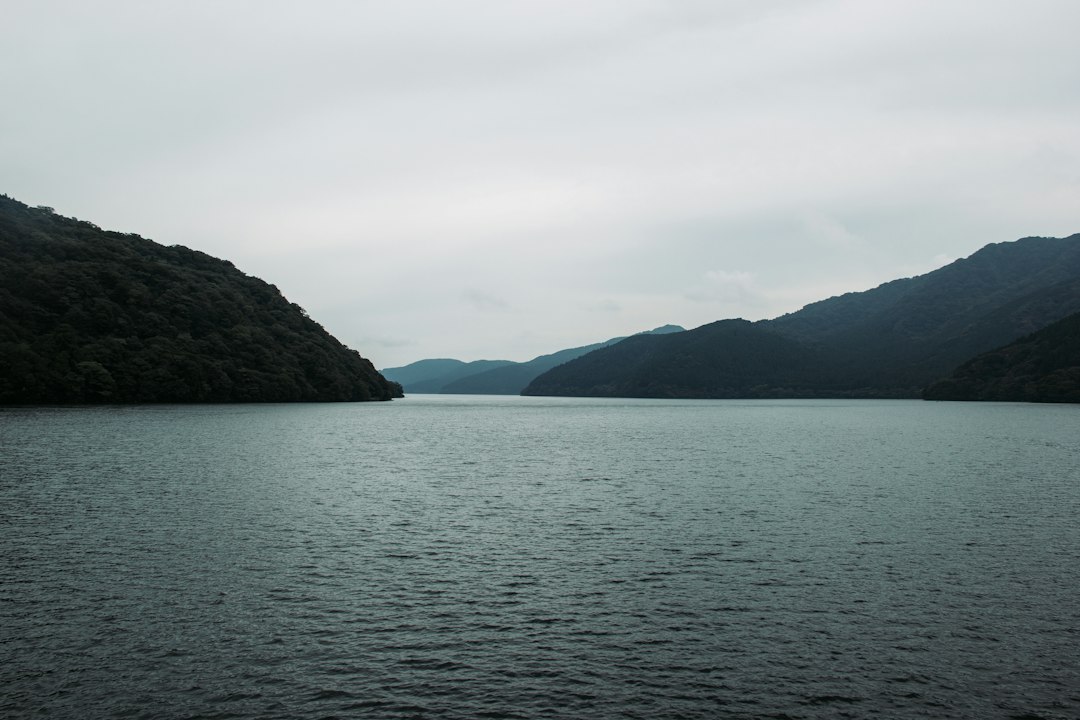
Hakone is a mountain town in Kanagawa Prefecture, about 80 minutes from Shinjuku by Romancecar, built inside the caldera of an active volcano. It is famous for hot springs, a lake with pirate ships, a steaming volcanic valley, and views of Mt. Fuji. According to Hakone town's own count, 21.12 million people visited in 2025. About 17 million of them went home the same day.
That last number matters more than it looks. Hakone is not one place. It is a staircase that climbs from about 100 m at Hakone-Yumoto station to 1,044 m at Owakudani, and the parts that face Mt. Fuji are almost all at the top. A day trip on the standard loop typically reaches that high ground around midday, when Fuji is clear less often than in the early morning.
This guide covers how Hakone is laid out, where Fuji is actually visible, which direction to ride the famous loop, and what each month is really like. For the mountain on a given day, the live Mt. Fuji visibility forecast is the thing to check the night before.
Hakone Is a Caldera, and That Explains Everything
Hakone sits inside the collapsed crater of Mount Hakone, a complex volcano whose caldera measures about 8 km east to west and 12 km north to south, according to the Japan Meteorological Agency. The rim forms a ring of ridges. Inside it are a cluster of younger lava domes, topped by Mt. Kami at 1,438 m, and Lake Ashi (Ashinoko), which fills the southwest corner at 723 m. The Hayakawa River cuts east through the rim, and that gorge is how the railway and Route 1 climb in from Odawara.
Every practical question about Hakone comes back to that shape. The valley towns sit low and closed in. The lake and the ridges sit high and open. About 3,200 years ago the north flank of Mt. Kami collapsed; the debris dammed the valley that now holds Lake Ashi, and steam-driven explosions followed around Owakudani, the steaming valley.
| Area | Approx. elevation | Known for | Mt. Fuji from ground level? |
|---|---|---|---|
| Hakone-Yumoto | 100 m | Gateway station, shops, day baths | No |
| Tonosawa / Miyanoshita | 150-440 m | Old ryokan, Fujiya Hotel (1878) | No |
| Gora | 541 m | Open-Air Museum, Gora Park, cable car | No |
| Sengokuhara | 650-700 m | Pampas grass, Pola and Lalique museums | No, from the village floor |
| Owakudani | 1,044 m (station) | Steam vents, black eggs, ropeway | Yes, on clear days |
| Togendai (north shore) | 741 m | Ropeway and cruise terminal | No, at ground level |
| Moto-Hakone / Hakone-machi | 725-790 m | Hakone Shrine, checkpoint, cruise ports | Yes, upper cone from the waterfront |
| Ubako | 878 m (station) | Ropeway station, Fuji-view hotel | Yes, the widest view of these areas |
The Fuji column comes from a terrain line-of-sight scan built for our Hakone ryokan guide, using Japan's official 10 m elevation model. It checks whether Fuji's summit rises above every ridge between you and the mountain.
Where You Can Actually See Mt. Fuji in Hakone
Mt. Fuji is visible from only part of Hakone, and almost none of it is where most people sleep or eat. In our terrain scan of 2,021 points across the caldera, the sightlines were on the lake, its south and east shores, Ubako and the high ground around Owakudani. The valley floors at Yumoto, Miyanoshita and Gora had none, and Sengokuhara village was blocked by the western rim. The scan uses bare-earth elevation, so trees and buildings can block a view it shows as open.
Three places do most of the work:
- The Hakone Ropeway between Ubako and Owakudani. From Owakudani the summit is 29.4 km away at a bearing of 296 degrees. The Hakone Ropeway guide has the side of the cabin to sit on and the stretches where the cone appears.
- The Moto-Hakone waterfront. This is where the famous torii-plus-Fuji photo is taken. The gate itself faces south, away from the mountain, so the queue at the torii never sees Fuji. The Hakone Shrine guide shows the exact spot on the shore.
- The lake itself, from the cruise. The pirate ships cross the open water, which clears the headlands that block most of the shoreline.
Set expectations on size. From Owakudani, Fuji's summit stands 5.3 degrees above horizontal. From Kawaguchiko's north shore it stands about 9 degrees. The mountain reads roughly half as tall from Hakone, with ridges cutting off the lower slopes. It is still a beautiful view. It is just a framed one, and the full viewpoint list lives in Mt. Fuji from Hakone.
The Hakone Loop, and Why to Ride It Backwards
The Hakone loop is a circuit of five kinds of transport that links the main sights in about 4-5 hours, and riding it in reverse puts the Fuji-facing half in the morning. The standard direction, as printed on the Odakyu map, runs:
- Hakone Tozan Railway, Hakone-Yumoto to Gora. About 40 minutes, three switchbacks, grades up to 8%. Running since 1919.
- Hakone Tozan Cable Car, Gora to Sounzan. About 10 minutes.
- Hakone Ropeway, Sounzan to Owakudani to Togendai. About 30 minutes end to end.
- Hakone Sightseeing Cruise, Togendai to Moto-Hakone or Hakone-machi. 25 to 40 minutes.
- Hakone Tozan Bus, the lake back down to Hakone-Yumoto. About 30 to 40 minutes.
Start that sequence from a 9 AM Romancecar arrival, add an hour for the Open-Air Museum in Gora and a lunch stop, and you reach Owakudani around noon and the lake around 2 PM.
That timing works against you. The longest public record of Fuji visibility comes from Fuji City, whose staff have logged the mountain from the 8th floor of city hall, south of Fuji, at 8 AM, noon and 4 PM since 1990. Across the 35 years from 1991 to 2025, its records show Fuji fully visible at 8 AM on 36.6% of days, at noon on 23.3%, and at 4 PM on 22.5%. That is one viewpoint on the other side of the mountain, not a measured probability for Hakone, but it is the best long-run evidence that mornings are the better bet. Our Fuji visibility trends page tracks the same question with recent data.
So flip the loop:
- Take the bus from Hakone-Yumoto straight up to Moto-Hakone-ko (route H, timetabled at a little over 30 minutes but slower in traffic, ¥1,210 one way).
- Walk the Moto-Hakone waterfront and Hakone Shrine while the light is low.
- Catch one of the first pirate ships of the morning north to Togendai; check the day's timetable, as first sailings vary by port and season.
- Ride the ropeway up to Owakudani. Fuji sits behind you and to the left on the climb, so turn around after Ubako, then look at it head-on from the Earth Valley decks at the top.
- Descend by ropeway and cable car to Gora, then spend the afternoon at the Open-Air Museum or an onsen. Neither needs a clear sky.
- Ride the Tozan Railway down to Yumoto at the end of the day.
The reverse loop costs you two things. First, the cabin angle: riding the ropeway downhill toward the lake keeps Fuji off your right shoulder the whole way, which is why the ropeway guide favours the standard direction. Uphill, you are twisting round in a shared cabin. Second, the bus to the lake can be slow on weekends, when Route 1 traffic backs up; leave Yumoto before 9 AM and it rarely matters.
A clouded cone seen from the ideal seat is still a clouded cone, so for a day trip the hour wins. If you are sleeping in Gora or Sengokuhara, you do not have to choose: ride the standard direction as soon as the ropeway opens and you get the morning and the right-hand seat together.
What Hakone Costs in 2026
The Hakone Ropeway and the pirate ships raised their fares on 1 October 2025. Current adult prices on the loop:
| Leg | Adult fare, one way | Notes |
|---|---|---|
| Romancecar, Shinjuku to Hakone-Yumoto | about ¥2,470 | Base fare plus ¥1,200 limited express ticket; about 80 minutes |
| Tozan Railway, Yumoto to Gora | ¥460 | |
| Tozan Cable Car, Gora to Sounzan | ¥430 | |
| Hakone Ropeway, any section | ¥2,000 | Flat fare, up from ¥1,500 on 1 Oct 2025; return ¥3,000 |
| Sightseeing Cruise, across the lake | ¥1,700 | Up from ¥1,200 before Oct 2025 |
| Tozan Bus, Moto-Hakone-ko to Yumoto | ¥1,210 | Route H |
| Komagatake Ropeway (Hakone-en) | ¥2,200 return | Not covered by the Freepass |
The loop inside Hakone, from Yumoto back to Yumoto, adds up to ¥5,800 paid leg by leg. The Hakone Freepass costs ¥7,100 for two days from Shinjuku and includes the Odakyu train there and back, so the loop alone covers it: the Odakyu base fare is ¥1,270 each way, and ¥2,540 plus the ¥5,800 loop comes to ¥8,340. From Odawara it costs ¥6,000. The Romancecar still needs its own ¥1,200 limited express ticket each way on top of the pass.
Two exceptions catch people out. The Freepass covers Odakyu-group transport only, so the Izuhakone buses and the Komagatake Ropeway are extra. And if you are also heading to Kawaguchiko, the Fuji Hakone Pass bundles both regions for three days.
Hakone Month by Month
The best time to visit Hakone for Mt. Fuji is December through February, and the worst is June through August. The caldera is wet from June through October. Hakone is also far wetter than its lowland neighbours. The JMA rain gauge at Ashinoyu, at 855 m between Moto-Hakone and Kowakudani, averages 3,561 mm a year. Odawara, 12 km away on the coast, averages 1,997 mm (both 1991-2020 normals).
| Month | Fuji fully visible at 8 AM (Fuji City, 1991-2025) | Avg. rain at Ashinoyu (855 m) | What Hakone is like |
|---|---|---|---|
| Jan | 60.0% | 128 mm | Hakone Ekiden relay brings Route 1 traffic restrictions on 2-3 Jan; a ropeway section can close for winter maintenance |
| Feb | 52.6% | 151 mm | Cold, clear and quiet; in 2026 Owakudani to Togendai closed 31 Jan to 20 Feb for maintenance |
| Mar | 40.7% | 285 mm | Rain picks up; cherry blossoms start low in the valley late in the month |
| Apr | 36.3% | 322 mm | Blossoms climb toward the lake; Golden Week crowds begin at month end |
| May | 30.2% | 327 mm | Golden Week (early May) brings the heaviest spring crowds; fresh green slopes |
| Jun | 12.4% | 420 mm | Rainy season; hydrangeas line the Tozan Railway from mid-June |
| Jul | 9.9% | 425 mm | Hydrangeas into early July; worst month for Fuji |
| Aug | 14.6% | 346 mm | Cooler than Tokyo, humid and hazy |
| Sep | 27.2% | 449 mm | Wettest month; typhoon risk; Sengokuhara pampas starts to turn late in the month |
| Oct | 41.1% | 404 mm | Pampas grass at its peak; Fuji odds recover |
| Nov | 53.9% | 197 mm | Autumn leaves and heavy crowds |
| Dec | 61.7% | 108 mm | Best Fuji odds and the driest month |
The two columns broadly move together: the dry months from November to February are the clear ones, and the wet summer is the cloudy one. They are not a perfect match, though. September has the most rain, yet July has the lowest Fuji figure. The two series come from different places, so treat this as a seasonal pattern, not a rule for any given day.
November is the compromise most people choose: good odds, red maples, and the heaviest crowds of the year. December gives slightly better Fuji odds with far fewer people, which makes it the pick if you care more about the mountain than the leaves. For the full seasonal picture, see the best time to see Mt. Fuji.
A final note on rain. Heavy fog and strong wind can suspend the pirate ships and the ropeway, and fog on the lake can sit there on days when Odawara is sunny. A generic sunny forecast does not tell you whether Fuji's summit is in cloud. The Fuji visibility score weighs cloud, haze and humidity with a documented weighted model rather than a single sky icon.
What to Do in Hakone When Fuji Hides
Hakone is one of the few Fuji-area destinations that still works on a grey day, because its best experiences are water, art and history. On the June to August odds above, plan for Fuji to be a bonus, not the point.
- Hot springs. Hakone had 345 hot spring sources as of March 2016. Tenzan and Hakone Yuryo near Yumoto are popular day baths, and the milky sulphur water piped from Owakudani supplies Gora and Sengokuhara. Our ryokan guide maps which areas get which water.
- Hakone Open-Air Museum. Japan's first open-air art museum, opened in 1969 in Gora, with a Picasso pavilion and a foot bath. Rain does not ruin it; mist on the sculptures is its own mood.
- Owakudani. The steam is more dramatic in cool, damp air. Check the operating status first, because the ropeway can suspend sections for volcanic gas even when the volcano's official alert level is low.
- The Old Tokaido Road. A stone-paved stretch of the Edo-era highway runs between Hatajuku and Moto-Hakone, past the Amazake-chaya teahouse. The reconstructed Hakone Checkpoint sits on the lakeshore at the end of it.
- Hakone Shrine. Cedar forest, lanterns and the lake gate look better in mist than in harsh sun.
On volcanic risk: the Japan Meteorological Agency has kept Hakoneyama at alert Level 1, the lowest, since October 2019. A small eruption at Owakudani in 2015 and raised activity in 2019 each closed parts of the area for months, so check the ropeway's operating status on the morning you go.
Day Trip or Overnight in Hakone?
Stay one night if Mt. Fuji matters to you. About 80% of Hakone's 2025 visitors were day-trippers, and a day trip from Tokyo rarely reaches the lake before mid-morning. An overnight stay lets you be on the Moto-Hakone shore or at Ubako at dawn, in the hours when the 35-year record says Fuji is most often clear.
Staying also changes the onsen experience. A ryokan bath at night, dinner in your room, and an early bath before breakfast are what most Japanese visitors come for. Practical points:
- Luggage. Hakone Carry Service takes bags from Hakone-Yumoto to your inn for ¥1,500 (up to 140 cm and 15 kg) if you drop them off by noon, and delivers after 3 PM.
- Taxes. Hakone charges a bathing tax of ¥150 per person per night at onsen inns, usually added to the bill. The town plans a separate lodging tax of ¥350 per person per night from April 2028.
- Where. For a room that faces Fuji, the lake's south and east shores and Ubako are the only areas with terrain clearance. For atmosphere and easy train access, Miyanoshita and Gora win. The trade-off is laid out in the Hakone ryokan guide.
If you only have a day, the reverse loop above is the best use of it. The Mt. Fuji day trip from Tokyo guide compares it against a Kawaguchiko day.
Adding Kawaguchiko to a Hakone Trip
Hakone and Kawaguchiko are the two classic Fuji bases, and they complement each other. Hakone has the onsen, the museums and the lake. Kawaguchiko has the big, unobstructed Fuji views from 18 km away. There is no direct bus between them; you change at Gotemba, and the crossing takes about two to three hours, depending on where in Hakone you start. Our Hakone to Kawaguchiko guide covers the timetable, fares and which bus to take.
The sensible order depends on the forecast. Put Kawaguchiko on whichever day has the best visibility score, since that is where Fuji is the whole show, and give Hakone the cloudier day. The 10-day Fuji forecast is built for exactly that decision.
Hakone FAQ
How far is Hakone from Tokyo? Hakone-Yumoto is about 80 km southwest of central Tokyo. The Romancecar from Shinjuku takes about 80 minutes. The Tokaido Shinkansen to Odawara takes about 35 minutes from Tokyo station, followed by a 15-minute train to Hakone-Yumoto.
Is Hakone worth it if Mt. Fuji is not visible? Yes. The hot springs, Owakudani, the Open-Air Museum and Lake Ashi carry the trip on their own, and Fuji is hidden from most of Hakone even on clear days. If seeing Fuji is the only goal, Kawaguchiko is the better choice.
How many days do you need in Hakone? One full day covers the loop. One night adds an onsen evening and a dawn attempt at Fuji, which is the most useful single upgrade. Two nights lets you add the Old Tokaido Road hike or Mt. Kintoki.
Is Hakone safe from the volcano? Hakoneyama is at Level 1 on the JMA's five-level scale, meaning "be aware it is an active volcano." Areas near Owakudani's vents are restricted and monitored, and the ropeway suspends sections when gas levels rise.
Before You Go
Check the Fuji forecast the evening before, not the morning of. If the next morning scores well, take the early bus to the lake and ride the loop backwards. If it scores badly, ride it the normal way, spend the morning at the museum and the afternoon in a bath, and do not feel short-changed. Either way, the live Mt. Fuji visibility page and its webcam feeds tell you which Hakone you are going to get.
More Articles
Mt. Fuji from Hakone: Best Viewpoints and Visibility Guide
Can you see Mt. Fuji from Hakone? Yes, on about half of all days. Here are the best viewpoints, when to go, and how to check conditions.
Hakone Ropeway: Fares, Route, Mt. Fuji Views and When It Closes
The Hakone Ropeway now charges one flat fare. Real 2026 prices, exactly where Mt. Fuji appears, and the closures nobody warns you about.
Hakone Ryokan: Where to Stay, Fuji Views and Onsen Water
Choosing a Hakone ryokan? Terrain data shows which areas can see Mt. Fuji, where each area's bath water comes from, and how to time the stay.